Property Record
129 Fowler St, Gentry, AR 72734
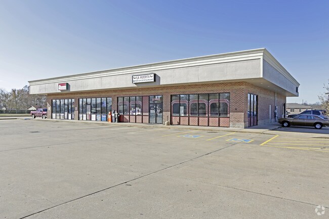

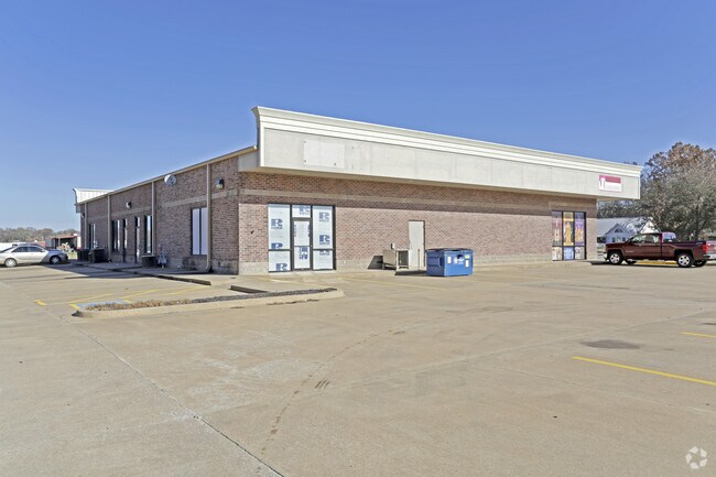
Property Detail
129 Fowler St
Fayetteville-Springdale-Rogers, AR
PLAT 04-1185 10/7/04
10-06053-000
Benton
Regionalshoppingcenterormallwithanchorstore
Arkansas
B and X Area of moderate flood hazard, usually the area between the limits of the 100-year and 500-year floods.
5
2025
1.16 AC
2025
Outlying Benton County
021004
Fayetteville/Springdale/Rogers
8,000 SF
NEARBY LISTINGS FOR SALE OR LEASE
-
-
View all Gentry listings for sale on LoopNet.com
DEMOGRAPHICS near 129 Fowler St
1 mile
3 mile
5 mile
2025 Total Population
2,876
6,827
13,376
2030 Population
3,153
7,549
14,882
Pop Growth 2025-2030
+ 9.63%
+ 10.58%
+ 11.26%
Average Age
38
39
38
2025 Total Households
1,102
2,519
4,809
HH Growth 2025-2030
+ 9.89%
+ 10.84%
+ 11.52%
Median Household Inc
$61,854
$66,257
$69,996
Avg Household Size
2.60
2.70
2.80
2025 Avg HH Vehicles
2.00
2.00
2.00
Median Home Value
$189,618
$246,823
$274,433
Median Year Built
1991
1993
1997
Nearby Places
Map Layers
Map Styles
 Street
 Aerial
Layers
 Traffic
 Biking
Places
Listings with unknown addresses are not visible on the map
- Restaurants
- Banks
- Shops
- Fitness
- Groceries
PUBLIC TRANSPORTATION
AIRPORT
Northwest Arkansas Ntl
Drive
Walk
Distance
Northwest Arkansas Ntl
30 min
14.3 mi
Nearby Properties
Address
Land Use
TOTAL SIZE
Lot Size
Zoning
Address
Land Use
TOTAL SIZE
Lot Size
Zoning
614,704 SF
15.83 AC
Address
Land Use
TOTAL SIZE
Lot Size
Zoning
4,846 SF
Address
Land Use
TOTAL SIZE
Lot Size
Zoning
116,840 SF
12.12 AC
Address
Land Use
TOTAL SIZE
Lot Size
Zoning
42,534 SF
3.42 AC
Address
Land Use
TOTAL SIZE
Lot Size
Zoning
7,499 SF
4.61 AC
Address
Land Use
TOTAL SIZE
Lot Size
Zoning
42,480 SF
7.50 AC
Address
Land Use
TOTAL SIZE
Lot Size
Zoning
27,672 SF
4.60 AC
Address
Land Use
TOTAL SIZE
Lot Size
Zoning
15,004 SF
3.84 AC
Address
Land Use
TOTAL SIZE
Lot Size
Zoning
30,310 SF
17.65 AC
Address
Land Use
TOTAL SIZE
Lot Size
Zoning
39,724 SF
3.25 AC
Address
Land Use
TOTAL SIZE
Lot Size
Zoning
13,788 SF
2.99 AC
Address
Land Use
TOTAL SIZE
Lot Size
Zoning
22,321 SF
4.64 AC
Address
Land Use
TOTAL SIZE
Lot Size
Zoning
3,384 SF
2.56 AC
Address
Land Use
TOTAL SIZE
Lot Size
Zoning
25,309 SF
11.19 AC
Address
Land Use
TOTAL SIZE
Lot Size
Zoning
27,183 SF
11.08 AC
Address
Land Use
TOTAL SIZE
Lot Size
Zoning
36,576 SF
1.11 AC
Address
Land Use
TOTAL SIZE
Lot Size
Zoning
3,751 SF
1.38 AC
Address
Land Use
TOTAL SIZE
Lot Size
Zoning
12,704 SF
2.32 AC
Address
Land Use
TOTAL SIZE
Lot Size
Zoning
23,679 SF
10.41 AC
Address
Land Use
TOTAL SIZE
Lot Size
Zoning
3,129 SF
0.65 AC
Address
Land Use
TOTAL SIZE
Lot Size
Zoning
3,814 SF
1.02 AC
Address
Land Use
TOTAL SIZE
Lot Size
Zoning
5,814 SF
1.95 AC
Address
Land Use
TOTAL SIZE
Lot Size
Zoning
3,120 SF
1.25 AC
Address
Land Use
TOTAL SIZE
Lot Size
Zoning
6,000 SF
1.40 AC
Address
Land Use
TOTAL SIZE
Lot Size
Zoning
14,178 SF
1.15 AC
Address
Land Use
TOTAL SIZE
Lot Size
Zoning
6,161 SF
0.81 AC
Address
Land Use
TOTAL SIZE
Lot Size
Zoning
10,400 SF
0.97 AC
Address
Land Use
TOTAL SIZE
Lot Size
Zoning
5,407 SF
50.74 AC
The World's #1 Commercial Real Estate Marketplace
Connect with us
© 2026 CoStar Group
The information above has been obtained from sources believed reliable. While we do not doubt its accuracy we have not verified it and make no guarantee, warranty or representation about it. It is your responsibility to independently confirm its accuracy and completeness. Any projections, opinions, assumptions, or estimates used are for example only and do not represent the current or future performance of the property. The value of this transaction to you depends on tax and other factors which should be evaluated by your tax, financial, and legal advisors. You and your advisors should conduct a careful, independent investigation of the property to determine to your satisfaction the suitability of the property for your needs.