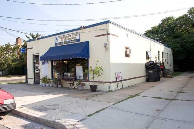
Property Record
129 N Lafayette Ave, Ventnor City, NJ 08406
NEARBY LISTINGS FOR SALE OR LEASE
Property Detail
129 N Lafayette Ave
Atlantic City-Hammonton, NJ
City Ventnor
22-00184-0000-00013-02
FACILITY NAME: ABATEMENT
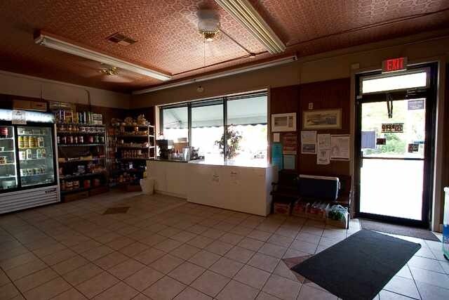
Retailwithmorethanonenonretailuse
Atlantic
ARE
New Jersey
34001C0453F
13.2
2024
0.07 AC
2025
Atlantic City/Hammonton
013301
Philadelphia
1,936 SF
DEMOGRAPHICS near 129 N Lafayette Ave
1 Mile
3 Mile
5 Mile
2024 Total Population
13,591
46,187
96,605
2029 Population
14,518
48,649
98,603
Pop Growth 2024-2029
+ 6.82%
+ 5.33%
+ 2.07%
Average Age
50
45
43
2024 Total Households
6,415
20,179
39,823
HH Growth 2024-2029
+ 6.66%
+ 5.94%
+ 2.39%
Median Household Inc
$86,522
$65,164
$53,264
Avg Household Size
2.00
2.20
2.30
2024 Avg HH Vehicles
2.00
1.00
1.00
Median Home Value
$375,121
$346,346
$282,737
Median Year Built
1960
1961
1963
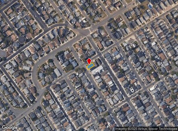
Nearby Places
Map Layers
Map Styles
 Street
 Aerial
- Restaurants
- Banks
- Shops
- Fitness
- Groceries
PUBLIC TRANSPORTATION
COMMUTER RAIL
Atlantic City (Atlantic City Line - NJ Transit Commuter Rail (NJ Transit))
DRIVE
WALK
Distance
Atlantic City (Atlantic City Line - NJ Transit Commuter Rail (NJ Transit))
12 min
4.6 mi
Absecon (Atlantic City Line - NJ Transit Commuter Rail (NJ Transit))
DRIVE
WALK
Distance
Absecon (Atlantic City Line - NJ Transit Commuter Rail (NJ Transit))
18 min
10.0 mi
AIRPORT
Atlantic City International
DRIVE
WALK
Distance
Atlantic City International
41 min
15.3 mi
Freight Ports
Broadway Terminal - Pier 5
DRIVE
WALK
Distance
Broadway Terminal - Pier 5
74 min
56.4 mi
Nearby Properties
Address
Land Use
TOTAL SIZE
Lot Size
Zoning
Address
Land Use
TOTAL SIZE
Lot Size
Zoning
6,552 SF
3.61 AC
RS
Address
Land Use
TOTAL SIZE
Lot Size
Zoning
387,249 SF
49.56 AC
HW-C
Address
Land Use
TOTAL SIZE
Lot Size
Zoning
4.33 AC
RS-C
Address
Land Use
TOTAL SIZE
Lot Size
Zoning
2.44 AC
RS-C
Address
Land Use
TOTAL SIZE
Lot Size
Zoning
3.01 AC
RS-C
Address
Land Use
TOTAL SIZE
Lot Size
Zoning
20.25 AC
06
Address
Land Use
TOTAL SIZE
Lot Size
Zoning
43,980 SF
1.80 AC
R-3
Address
Land Use
TOTAL SIZE
Lot Size
Zoning
Address
Land Use
TOTAL SIZE
Lot Size
Zoning
Address
Land Use
TOTAL SIZE
Lot Size
Zoning
70,780 SF
1.52 AC
NC-2
Address
Land Use
TOTAL SIZE
Lot Size
Zoning
95,102 SF
2.09 AC
R-3
Address
Land Use
TOTAL SIZE
Lot Size
Zoning
8,440 SF
2.70 AC
NC-2
Address
Land Use
TOTAL SIZE
Lot Size
Zoning
4,024 SF
2.93 AC
B
Address
Land Use
TOTAL SIZE
Lot Size
Zoning
1.84 AC
10
Address
Land Use
TOTAL SIZE
Lot Size
Zoning
2.90 AC
GRA
Address
Land Use
TOTAL SIZE
Lot Size
Zoning
64,346 SF
0.92 AC
NC-1
Address
Land Use
TOTAL SIZE
Lot Size
Zoning
2.63 AC
I
Address
Land Use
TOTAL SIZE
Lot Size
Zoning
22.98 AC
Address
Land Use
TOTAL SIZE
Lot Size
Zoning
49,698 SF
15.33 AC
D-C
Address
Land Use
TOTAL SIZE
Lot Size
Zoning
4.54 AC
I
Address
Land Use
TOTAL SIZE
Lot Size
Zoning
4,268 SF
0.45 AC
03
Address
Land Use
TOTAL SIZE
Lot Size
Zoning
12.49 AC
I
Address
Land Use
TOTAL SIZE
Lot Size
Zoning
0.75 AC
CBD
Address
Land Use
TOTAL SIZE
Lot Size
Zoning
136,378 SF
17.41 AC
HW-C
Address
Land Use
TOTAL SIZE
Lot Size
Zoning
7,588 SF
2.93 AC
03
Address
Land Use
TOTAL SIZE
Lot Size
Zoning
0.46 AC
P
Address
Land Use
TOTAL SIZE
Lot Size
Zoning
0.43 AC
RS-C
Address
Land Use
TOTAL SIZE
Lot Size
Zoning
72,549 SF
1.09 AC
RS-C
Address
Land Use
TOTAL SIZE
Lot Size
Zoning
215 SF
2.62 AC
RS-C
Address
Land Use
TOTAL SIZE
Lot Size
Zoning
52,176 SF
0.72 AC
R-2
The World's #1 Commercial Real Estate Marketplace
Connect with us
© 2025 CoStar Group
The information above has been obtained from sources believed reliable. While we do not doubt its accuracy we have not verified it and make no guarantee, warranty or representation about it. It is your responsibility to independently confirm its accuracy and completeness. Any projections, opinions, assumptions, or estimates used are for example only and do not represent the current or future performance of the property. The value of this transaction to you depends on tax and other factors which should be evaluated by your tax, financial, and legal advisors. You and your advisors should conduct a careful, independent investigation of the property to determine to your satisfaction the suitability of the property for your needs.