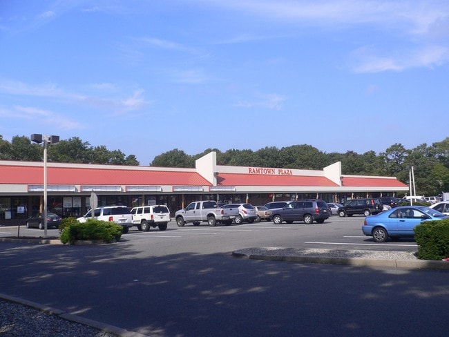
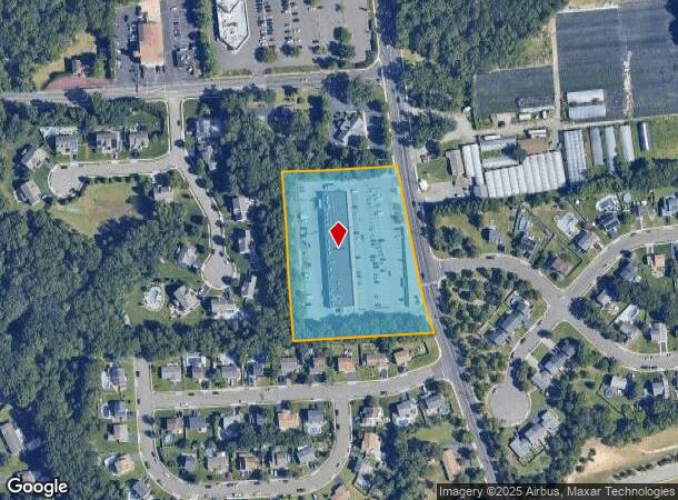
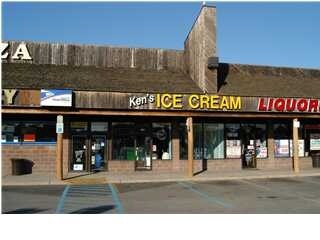
Property Record
129 Newtons Corner Rd, Howell, NJ 07731
NEARBY LISTINGS FOR SALE OR LEASE
Property Detail
129 Newtons Corner Rd
21-00002-0000-00002-01
Monmouth
Regionalshoppingcenterormallwithanchorstore
New Jersey
X
2.1
34025C0435F
3.55 AC
2024
Western Monmouth
2025
Northern New Jersey
811501
Lakewood-New Brunswick, NJ
20,438 SF
DEMOGRAPHICS near 129 Newtons Corner Rd
1 mile
3 mile
5 mile
2024 Total Population
7,651
46,798
167,067
2029 Population
7,589
48,335
171,812
Pop Growth 2024-2029
(0.81%)
+ 3.28%
+ 2.84%
Average Age
39
38
34
2024 Total Households
2,582
15,666
50,309
HH Growth 2024-2029
(0.93%)
+ 2.88%
+ 2.27%
Median Household Inc
$119,957
$82,544
$89,894
Avg Household Size
2.90
2.80
3.00
2024 Avg HH Vehicles
2.00
2.00
2.00
Median Home Value
$402,747
$355,266
$399,175
Median Year Built
1987
1979
1978
Nearby Places
Map Layers
Map Styles
 Street
 Aerial
Transit
 Traffic
 Biking
Places
Listings with unknown addresses are not visible on the map
- Restaurants
- Banks
- Shops
- Fitness
- Groceries
PUBLIC TRANSPORTATION
COMMUTER RAIL
Bay Head (North Jersey Coast Line - NJ Transit Commuter Rail (NJ Transit))
Drive
Walk
Distance
Bay Head (North Jersey Coast Line - NJ Transit Commuter Rail (NJ Transit))
16 min
7.8 mi
Point Pleasant Beach (North Jersey Coast Line - NJ Transit Commuter Rail (NJ Transit))
Drive
Walk
Distance
Point Pleasant Beach (North Jersey Coast Line - NJ Transit Commuter Rail (NJ Transit))
15 min
8.3 mi
Freight Ports
New York Container Terminal
Drive
Walk
Distance
New York Container Terminal
69 min
51.0 mi
Nearby Properties
Address
Land Use
TOTAL SIZE
Lot Size
Zoning
Address
Land Use
TOTAL SIZE
Lot Size
Zoning
105.04 AC
SED
Address
Land Use
TOTAL SIZE
Lot Size
Zoning
2,382 SF
341 AC
OSP
Address
Land Use
TOTAL SIZE
Lot Size
Zoning
36.25 AC
R12
Address
Land Use
TOTAL SIZE
Lot Size
Zoning
49.57 AC
RR1
Address
Land Use
TOTAL SIZE
Lot Size
Zoning
5,826 SF
15.35 AC
RM
Address
Land Use
TOTAL SIZE
Lot Size
Zoning
39.84 AC
OPT
Address
Land Use
TOTAL SIZE
Lot Size
Zoning
162,000 SF
34.35 AC
ARE2
Address
Land Use
TOTAL SIZE
Lot Size
Zoning
360,400 SF
35.98 AC
SED
Address
Land Use
TOTAL SIZE
Lot Size
Zoning
2,736 SF
18.04 AC
R15
Address
Land Use
TOTAL SIZE
Lot Size
Zoning
2,976 SF
336.41 AC
POS
Address
Land Use
TOTAL SIZE
Lot Size
Zoning
2.89 AC
R12
Address
Land Use
TOTAL SIZE
Lot Size
Zoning
13.82 AC
RM
Address
Land Use
TOTAL SIZE
Lot Size
Zoning
145.11 AC
R20
Address
Land Use
TOTAL SIZE
Lot Size
Zoning
296.61 AC
POS
Address
Land Use
TOTAL SIZE
Lot Size
Zoning
5.09 AC
HS
Address
Land Use
TOTAL SIZE
Lot Size
Zoning
9.09 AC
R15
Address
Land Use
TOTAL SIZE
Lot Size
Zoning
1.85 AC
R15
Address
Land Use
TOTAL SIZE
Lot Size
Zoning
13.24 AC
SED
Address
Land Use
TOTAL SIZE
Lot Size
Zoning
65.74 AC
SED
Address
Land Use
TOTAL SIZE
Lot Size
Zoning
24.14 AC
RR1
Address
Land Use
TOTAL SIZE
Lot Size
Zoning
60,315 SF
2.55 AC
R15
Address
Land Use
TOTAL SIZE
Lot Size
Zoning
18,434 SF
7.46 AC
R20
Address
Land Use
TOTAL SIZE
Lot Size
Zoning
2,336 SF
29.02 AC
POS
Address
Land Use
TOTAL SIZE
Lot Size
Zoning
6.50 AC
RR2
Address
Land Use
TOTAL SIZE
Lot Size
Zoning
360 SF
167.72 AC
POS
Address
Land Use
TOTAL SIZE
Lot Size
Zoning
2,540 SF
41 AC
M1
Address
Land Use
TOTAL SIZE
Lot Size
Zoning
17,732 SF
6.75 AC
R20
Address
Land Use
TOTAL SIZE
Lot Size
Zoning
9,840 SF
2.29 AC
R15
Address
Land Use
TOTAL SIZE
Lot Size
Zoning
8,436 SF
1.82 AC
RM
Address
Land Use
TOTAL SIZE
Lot Size
Zoning
34,590 SF
4.88 AC
B4
The World's #1 Commercial Real Estate Marketplace
Connect with us
© 2026 CoStar Group
The information above has been obtained from sources believed reliable. While we do not doubt its accuracy we have not verified it and make no guarantee, warranty or representation about it. It is your responsibility to independently confirm its accuracy and completeness. Any projections, opinions, assumptions, or estimates used are for example only and do not represent the current or future performance of the property. The value of this transaction to you depends on tax and other factors which should be evaluated by your tax, financial, and legal advisors. You and your advisors should conduct a careful, independent investigation of the property to determine to your satisfaction the suitability of the property for your needs.