Property Record
129 Township Road 281A St, Steubenville, OH 43952

Save to a Folder
{{folder.Name}}
{{folder.ListingIds.length}} Properties
{{folder.ListingIds.length}} Property
Create a New Folder
Property Detail
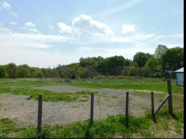
129 Township Road 281A St
09-03164-000
2-7-3 11-H LAND 6.00A MAP-09-3B-20
Religious
JEFFERSON
B and X Area of moderate flood hazard, usually the area between the limits of the 100-year and 500-year floods.
Ohio
0
6 AC
2025
Ohio North Area
011402
Other Market Areas
26,307 SF
Weirton-Steubenville, WV-OH
NEARBY LISTINGS FOR SALE OR LEASE
-
-
View all Steubenville listings for sale on LoopNet.com
DEMOGRAPHICS near 129 Township Road 281A St
1 mile
3 mile
5 mile
2025 Total Population
921
8,362
46,158
2030 Population
896
8,090
45,148
Pop Growth 2025-2030
(2.71%)
(3.25%)
(2.19%)
Average Age
45
44
43
2025 Total Households
412
3,555
19,267
HH Growth 2025-2030
(2.67%)
(3.40%)
(2.39%)
Median Household Inc
$57,499
$62,380
$52,195
Avg Household Size
2.20
2.30
2.20
2025 Avg HH Vehicles
2.00
2.00
2.00
Median Home Value
$164,144
$147,860
$128,331
Median Year Built
1970
1958
1957
Nearby Places
Map Layers
Map Styles
 Street
 Aerial
Layers
 Traffic
 Biking
Places
Listings with unknown addresses are not visible on the map
- Restaurants
- Banks
- Shops
- Fitness
- Groceries
PUBLIC TRANSPORTATION
AIRPORT
Pittsburgh International
Drive
Walk
Distance
Pittsburgh International
53 min
34.1 mi
Freight Ports
Port of Toledo
Drive
Walk
Distance
Port of Toledo
268 min
226.9 mi
SALE & LEASE HISTORY
LISTING DATE
SALE/LEASE

Mar 26, 2020
For Sale
Nearby Properties
Address
Land Use
TOTAL SIZE
Lot Size
Zoning
Address
Land Use
TOTAL SIZE
Lot Size
Zoning
85.37 AC
Address
Land Use
TOTAL SIZE
Lot Size
Zoning
156.89 AC
Address
Land Use
TOTAL SIZE
Lot Size
Zoning
249.36 AC
Address
Land Use
TOTAL SIZE
Lot Size
Zoning
10,488 SF
3.17 AC
Address
Land Use
TOTAL SIZE
Lot Size
Zoning
15.26 AC
Address
Land Use
TOTAL SIZE
Lot Size
Zoning
9.63 AC
Address
Land Use
TOTAL SIZE
Lot Size
Zoning
7.76 AC
Address
Land Use
TOTAL SIZE
Lot Size
Zoning
5.23 AC
Address
Land Use
TOTAL SIZE
Lot Size
Zoning
3.41 AC
Address
Land Use
TOTAL SIZE
Lot Size
Zoning
4.50 AC
Address
Land Use
TOTAL SIZE
Lot Size
Zoning
3.08 AC
Address
Land Use
TOTAL SIZE
Lot Size
Zoning
2.55 AC
Address
Land Use
TOTAL SIZE
Lot Size
Zoning
623.52 AC
Address
Land Use
TOTAL SIZE
Lot Size
Zoning
870.38 AC
Address
Land Use
TOTAL SIZE
Lot Size
Zoning
0.46 AC
Address
Land Use
TOTAL SIZE
Lot Size
Zoning
7,459 SF
15.86 AC
Address
Land Use
TOTAL SIZE
Lot Size
Zoning
18,796 SF
9.10 AC
Address
Land Use
TOTAL SIZE
Lot Size
Zoning
4,961 SF
15 AC
Address
Land Use
TOTAL SIZE
Lot Size
Zoning
3,978 SF
35.53 AC
Address
Land Use
TOTAL SIZE
Lot Size
Zoning
22.63 AC
Address
Land Use
TOTAL SIZE
Lot Size
Zoning
264.97 AC
Address
Land Use
TOTAL SIZE
Lot Size
Zoning
2,446 SF
107.80 AC
Address
Land Use
TOTAL SIZE
Lot Size
Zoning
3,696 SF
87.50 AC
Address
Land Use
TOTAL SIZE
Lot Size
Zoning
16,720 SF
1.72 AC
Address
Land Use
TOTAL SIZE
Lot Size
Zoning
1,914 SF
25.54 AC
Address
Land Use
TOTAL SIZE
Lot Size
Zoning
2,865 SF
13 AC
Address
Land Use
TOTAL SIZE
Lot Size
Zoning
81.16 AC
Address
Land Use
TOTAL SIZE
Lot Size
Zoning
4,284 SF
32.61 AC
Address
Land Use
TOTAL SIZE
Lot Size
Zoning
2,731 SF
12.50 AC
The World's #1 Commercial Real Estate Marketplace
Connect with us
© 2026 CoStar Group
The information above has been obtained from sources believed reliable. While we do not doubt its accuracy we have not verified it and make no guarantee, warranty or representation about it. It is your responsibility to independently confirm its accuracy and completeness. Any projections, opinions, assumptions, or estimates used are for example only and do not represent the current or future performance of the property. The value of this transaction to you depends on tax and other factors which should be evaluated by your tax, financial, and legal advisors. You and your advisors should conduct a careful, independent investigation of the property to determine to your satisfaction the suitability of the property for your needs.