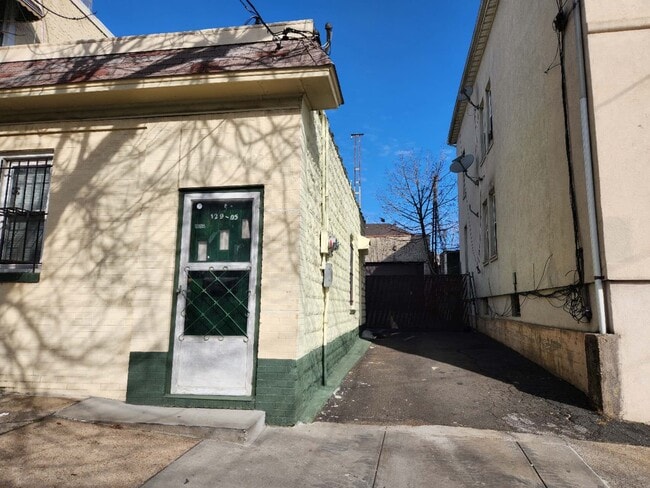
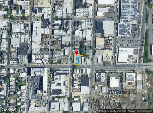
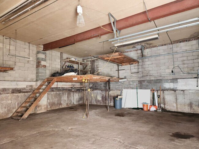
Property Record
12901 20Th Ave, College Point, NY 11356
NEARBY LISTINGS FOR SALE OR LEASE
Property Detail
12901 20Th Ave
04135-0001
W Moffit Realty Co Prop
Commercialofficeresidentialmixeduse
Queens
X
New York
3604970112F
1
2024
0.16 AC
2025
Northeast Queens
094700
Long Island (New York)
3,508 SF
New York-Jersey City-White Plains, NY-NJ
DEMOGRAPHICS near 12901 20Th Ave
1 mile
3 mile
5 mile
2024 Total Population
38,233
445,775
1,659,459
2029 Population
35,020
412,485
1,548,011
Pop Growth 2024-2029
(8.40%)
(7.47%)
(6.72%)
Average Age
43
42
41
2024 Total Households
12,425
145,999
594,309
HH Growth 2024-2029
(8.68%)
(7.71%)
(7.01%)
Median Household Inc
$71,071
$59,638
$61,357
Avg Household Size
2.90
2.90
2.70
2024 Avg HH Vehicles
1.00
1.00
1.00
Median Home Value
$628,380
$700,160
$682,992
Median Year Built
1957
1956
1955
Nearby Places
Map Layers
Map Styles
 Street
 Aerial
Transit
 Traffic
 Biking
Places
Listings with unknown addresses are not visible on the map
- Restaurants
- Banks
- Shops
- Fitness
- Groceries
PUBLIC TRANSPORTATION
COMMUTER RAIL
Murray Hill Station (Port Washington Branch - Long Island Rail Road)
Drive
Walk
Distance
Murray Hill Station (Port Washington Branch - Long Island Rail Road)
7 min
2.8 mi
Flushing-Main Street Station (Port Washington Branch - Long Island Rail Road)
Drive
Walk
Distance
Flushing-Main Street Station (Port Washington Branch - Long Island Rail Road)
7 min
2.9 mi
AIRPORT
LaGuardia
Drive
Walk
Distance
LaGuardia
11 min
4.1 mi
John F Kennedy International
Drive
Walk
Distance
John F Kennedy International
17 min
11.6 mi
Newark Liberty International
Drive
Walk
Distance
Newark Liberty International
38 min
30.1 mi
Freight Ports
NY - Red Hook Container Terminal
Drive
Walk
Distance
NY - Red Hook Container Terminal
26 min
14.6 mi
SALE & LEASE HISTORY
LISTING DATE
SALE/LEASE

Feb 14, 2024
For Lease
Nearby Properties
Address
Land Use
TOTAL SIZE
Lot Size
Zoning
Address
Land Use
TOTAL SIZE
Lot Size
Zoning
5,519,372 SF
409.21 AC
C8-2
Address
Land Use
TOTAL SIZE
Lot Size
Zoning
1,258,350 SF
410.24 AC
PARK
Address
Land Use
TOTAL SIZE
Lot Size
Zoning
1,012,000 SF
7.79 AC
R6
Address
Land Use
TOTAL SIZE
Lot Size
Zoning
703,265 SF
83.45 AC
R4
Address
Land Use
TOTAL SIZE
Lot Size
Zoning
4,050 SF
113.40 AC
PARK
Address
Land Use
TOTAL SIZE
Lot Size
Zoning
480 SF
55.26 AC
R4A
Address
Land Use
TOTAL SIZE
Lot Size
Zoning
480 SF
55.26 AC
R4A
Address
Land Use
TOTAL SIZE
Lot Size
Zoning
480 SF
55.26 AC
R4A
Address
Land Use
TOTAL SIZE
Lot Size
Zoning
480 SF
55.26 AC
R4A
Address
Land Use
TOTAL SIZE
Lot Size
Zoning
480 SF
55.26 AC
R4A
Address
Land Use
TOTAL SIZE
Lot Size
Zoning
480 SF
55.26 AC
R4A
Address
Land Use
TOTAL SIZE
Lot Size
Zoning
480 SF
55.26 AC
R4A
Address
Land Use
TOTAL SIZE
Lot Size
Zoning
480 SF
55.26 AC
R4A
Address
Land Use
TOTAL SIZE
Lot Size
Zoning
480 SF
55.26 AC
R4A
Address
Land Use
TOTAL SIZE
Lot Size
Zoning
480 SF
55.26 AC
R4A
Address
Land Use
TOTAL SIZE
Lot Size
Zoning
480 SF
55.26 AC
R4A
Address
Land Use
TOTAL SIZE
Lot Size
Zoning
480 SF
55.26 AC
R4A
Address
Land Use
TOTAL SIZE
Lot Size
Zoning
480 SF
55.26 AC
R4A
Address
Land Use
TOTAL SIZE
Lot Size
Zoning
480 SF
55.26 AC
R4A
Address
Land Use
TOTAL SIZE
Lot Size
Zoning
480 SF
55.26 AC
R4A
Address
Land Use
TOTAL SIZE
Lot Size
Zoning
480 SF
55.26 AC
R4A
Address
Land Use
TOTAL SIZE
Lot Size
Zoning
480 SF
55.26 AC
R4A
Address
Land Use
TOTAL SIZE
Lot Size
Zoning
480 SF
55.26 AC
R4A
Address
Land Use
TOTAL SIZE
Lot Size
Zoning
480 SF
55.26 AC
R4A
Address
Land Use
TOTAL SIZE
Lot Size
Zoning
480 SF
55.26 AC
R4A
Address
Land Use
TOTAL SIZE
Lot Size
Zoning
480 SF
55.26 AC
R4A
Address
Land Use
TOTAL SIZE
Lot Size
Zoning
480 SF
55.26 AC
R4A
Address
Land Use
TOTAL SIZE
Lot Size
Zoning
480 SF
55.26 AC
R4A
Address
Land Use
TOTAL SIZE
Lot Size
Zoning
480 SF
55.26 AC
R4A
Address
Land Use
TOTAL SIZE
Lot Size
Zoning
480 SF
55.26 AC
R4A
The World's #1 Commercial Real Estate Marketplace
Connect with us
© 2026 CoStar Group
The information above has been obtained from sources believed reliable. While we do not doubt its accuracy we have not verified it and make no guarantee, warranty or representation about it. It is your responsibility to independently confirm its accuracy and completeness. Any projections, opinions, assumptions, or estimates used are for example only and do not represent the current or future performance of the property. The value of this transaction to you depends on tax and other factors which should be evaluated by your tax, financial, and legal advisors. You and your advisors should conduct a careful, independent investigation of the property to determine to your satisfaction the suitability of the property for your needs.