Property Record
12901 N 40 Dr, Saint Louis, MO 63141

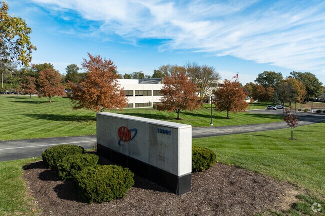
Property Detail
12901 N 40 Dr
19P-24-0098
SURVEY 0000 SEC 17 TWN 45 RANGE 5 AUTO CLUB CENTER/MASON RIDGE OFFICE PARKAMENDED PLAT PT SEC A 19P240043 2 23 82
Officebuilding
Saint Louis
83O
Missouri
B and X Area of moderate flood hazard, usually the area between the limits of the 100-year and 500-year floods.
5.96 AC
2024
Chesterfield/Hwy-40
2025
St. Louis
215201
St. Louis, MO-IL
94,544 SF
NEARBY LISTINGS FOR SALE OR LEASE
DEMOGRAPHICS near 12901 N 40 Dr
1 mile
3 mile
5 mile
2025 Total Population
3,254
43,698
157,393
2030 Population
3,261
43,196
155,300
Pop Growth 2025-2030
+ 0.22%
(1.15%)
(1.33%)
Average Age
44
44
43
2025 Total Households
903
16,769
63,775
HH Growth 2025-2030
+ 0.33%
(1.26%)
(1.36%)
Median Household Inc
$219,600
$144,342
$122,846
Avg Household Size
2.70
2.40
2.40
2025 Avg HH Vehicles
2.00
2.00
2.00
Median Home Value
$834,492
$616,920
$435,801
Median Year Built
1979
1976
1974
Nearby Places
Map Layers
Map Styles
 Street
 Aerial
Layers
 Traffic
 Biking
Places
Listings with unknown addresses are not visible on the map
- Restaurants
- Banks
- Shops
- Fitness
- Groceries
PUBLIC TRANSPORTATION
COMMUTER RAIL
Kirkwood Amtrak Station (Lincoln Service Missouri River Runner - Amtrak, Missouri River Runner - Amtrak)
Drive
Walk
Distance
Kirkwood Amtrak Station (Lincoln Service Missouri River Runner - Amtrak, Missouri River Runner - Amtrak)
15 min
8.2 mi
Richmond Heights (Shrewsbury-Lansdowne I-44 Emerson Park - St. Louis MetroLink (MetroLink))
Drive
Walk
Distance
Richmond Heights (Shrewsbury-Lansdowne I-44 Emerson Park - St. Louis MetroLink (MetroLink))
13 min
8.5 mi
AIRPORT
St Louis Lambert International
Drive
Walk
Distance
St Louis Lambert International
25 min
16.8 mi
Freight Ports
Tulsa Port of Inola
Drive
Walk
Distance
Tulsa Port of Inola
417 min
375.4 mi
Nearby Properties
Address
Land Use
TOTAL SIZE
Lot Size
Zoning
Address
Land Use
TOTAL SIZE
Lot Size
Zoning
20,852 SF
48.33 AC
82PH
Address
Land Use
TOTAL SIZE
Lot Size
Zoning
43,574 SF
55.62 AC
NU
Address
Land Use
TOTAL SIZE
Lot Size
Zoning
389,075 SF
19.85 AC
83H
Address
Land Use
TOTAL SIZE
Lot Size
Zoning
43,617 SF
7.04 AC
83O
Address
Land Use
TOTAL SIZE
Lot Size
Zoning
3,220 SF
31.26 AC
CB
Address
Land Use
TOTAL SIZE
Lot Size
Zoning
442,503 SF
3.52 AC
82PH
Address
Land Use
TOTAL SIZE
Lot Size
Zoning
495,011 SF
33.43 AC
Address
Land Use
TOTAL SIZE
Lot Size
Zoning
4,150 SF
21.42 AC
83H
Address
Land Use
TOTAL SIZE
Lot Size
Zoning
381,211 SF
64.20 AC
Q
Address
Land Use
TOTAL SIZE
Lot Size
Zoning
100,291 SF
569.29 AC
PS
Address
Land Use
TOTAL SIZE
Lot Size
Zoning
31.83 AC
R2
Address
Land Use
TOTAL SIZE
Lot Size
Zoning
12,017 SF
122.40 AC
NU
Address
Land Use
TOTAL SIZE
Lot Size
Zoning
314,640 SF
4.70 AC
83H
Address
Land Use
TOTAL SIZE
Lot Size
Zoning
3.52 AC
82PH
Address
Land Use
TOTAL SIZE
Lot Size
Zoning
247,860 SF
21.11 AC
105MU
Address
Land Use
TOTAL SIZE
Lot Size
Zoning
272,522 SF
8.70 AC
83POP
Address
Land Use
TOTAL SIZE
Lot Size
Zoning
600,516 SF
4.27 AC
17C-3
Address
Land Use
TOTAL SIZE
Lot Size
Zoning
252,737 SF
24.69 AC
R3
Address
Land Use
TOTAL SIZE
Lot Size
Zoning
97,479 SF
21.51 AC
82HE
Address
Land Use
TOTAL SIZE
Lot Size
Zoning
46,849 SF
311.57 AC
NU
Address
Land Use
TOTAL SIZE
Lot Size
Zoning
337,354 SF
7.40 AC
82CB
Address
Land Use
TOTAL SIZE
Lot Size
Zoning
46,752 SF
3.67 AC
82CB
Address
Land Use
TOTAL SIZE
Lot Size
Zoning
68,279 SF
95.59 AC
NU
Address
Land Use
TOTAL SIZE
Lot Size
Zoning
17,371 SF
25.44 AC
SL1
Address
Land Use
TOTAL SIZE
Lot Size
Zoning
228,816 SF
1.70 AC
82CB
Address
Land Use
TOTAL SIZE
Lot Size
Zoning
340,320 SF
55.62 AC
NU
Address
Land Use
TOTAL SIZE
Lot Size
Zoning
302,420 SF
13.97 AC
NU
Address
Land Use
TOTAL SIZE
Lot Size
Zoning
1,635 SF
68.83 AC
83E
Address
Land Use
TOTAL SIZE
Lot Size
Zoning
302,449 SF
11.44 AC
NU
Address
Land Use
TOTAL SIZE
Lot Size
Zoning
297,247 SF
5.40 AC
82CB
The World's #1 Commercial Real Estate Marketplace
Connect with us
© 2026 CoStar Group
The information above has been obtained from sources believed reliable. While we do not doubt its accuracy we have not verified it and make no guarantee, warranty or representation about it. It is your responsibility to independently confirm its accuracy and completeness. Any projections, opinions, assumptions, or estimates used are for example only and do not represent the current or future performance of the property. The value of this transaction to you depends on tax and other factors which should be evaluated by your tax, financial, and legal advisors. You and your advisors should conduct a careful, independent investigation of the property to determine to your satisfaction the suitability of the property for your needs.