Property Record
12901 Se Robert Crain Hwy, Brandywine, MD 20613

Property Detail
12901 Se Robert Crain Hwy
11-1142504
PARCEL A
Commercialnec
PRINCE GEORGE'S
CS
Maryland
B and X Area of moderate flood hazard, usually the area between the limits of the 100-year and 500-year floods.
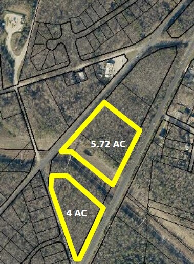
4.63 AC
2024
Outlying PG County South
2025
Washington, DC
801003
Washington-Arlington-Alexandria, DC-VA-MD-WV
NEARBY LISTINGS FOR SALE OR LEASE
DEMOGRAPHICS near 12901 Se Robert Crain Hwy
1 mile
3 mile
5 mile
2025 Total Population
2,786
18,136
62,763
2030 Population
2,887
18,893
64,313
Pop Growth 2025-2030
+ 3.63%
+ 4.17%
+ 2.47%
Average Age
42
43
43
2025 Total Households
910
6,198
21,739
HH Growth 2025-2030
+ 3.74%
+ 4.49%
+ 2.62%
Median Household Inc
$155,603
$143,104
$127,731
Avg Household Size
2.90
2.90
2.80
2025 Avg HH Vehicles
2.00
2.00
2.00
Median Home Value
$592,650
$537,714
$454,685
Median Year Built
2001
2000
1990
Nearby Places
Map Layers
Map Styles
 Street
 Aerial
Layers
 Traffic
 Biking
Places
Listings with unknown addresses are not visible on the map
- Restaurants
- Banks
- Shops
- Fitness
- Groceries
PUBLIC TRANSPORTATION
AIRPORT
Ronald Reagan Washington Ntl
Drive
Walk
Distance
Ronald Reagan Washington Ntl
40 min
24.2 mi
Baltimore/Washington International Thurgood Marshall
Drive
Walk
Distance
Baltimore/Washington International Thurgood Marshall
61 min
41.0 mi
Freight Ports
Port of Baltimore
Drive
Walk
Distance
Port of Baltimore
66 min
46.3 mi
SALE & LEASE HISTORY
LISTING DATE
SALE/LEASE

Sep 24, 2016
For Sale
Sep 24, 2016
For Sale
Nearby Properties
Address
Land Use
TOTAL SIZE
Lot Size
Zoning
Address
Land Use
TOTAL SIZE
Lot Size
Zoning
801,684 SF
34.05 AC
IE
Address
Land Use
TOTAL SIZE
Lot Size
Zoning
7,670 SF
9.78 AC
TACC
Address
Land Use
TOTAL SIZE
Lot Size
Zoning
7,000 SF
354.62 AC
ROS
Address
Land Use
TOTAL SIZE
Lot Size
Zoning
341,372 SF
14.74 AC
RR
Address
Land Use
TOTAL SIZE
Lot Size
Zoning
388,608 SF
28.45 AC
LCD
Address
Land Use
TOTAL SIZE
Lot Size
Zoning
76,906 SF
168.92 AC
AG
Address
Land Use
TOTAL SIZE
Lot Size
Zoning
126,592 SF
58.79 AC
ROS
Address
Land Use
TOTAL SIZE
Lot Size
Zoning
67,608 SF
4.01 AC
TACC
Address
Land Use
TOTAL SIZE
Lot Size
Zoning
98.41 AC
IH
Address
Land Use
TOTAL SIZE
Lot Size
Zoning
939.06 AC
RR
Address
Land Use
TOTAL SIZE
Lot Size
Zoning
78,658 SF
9.13 AC
RR
Address
Land Use
TOTAL SIZE
Lot Size
Zoning
61,836 SF
9.63 AC
IE
Address
Land Use
TOTAL SIZE
Lot Size
Zoning
1,592.32 AC
ROS
Address
Land Use
TOTAL SIZE
Lot Size
Zoning
54,899 SF
5.23 AC
TACE
Address
Land Use
TOTAL SIZE
Lot Size
Zoning
62,442 SF
4.84 AC
TACE
Address
Land Use
TOTAL SIZE
Lot Size
Zoning
28,508 SF
10 AC
TACC
Address
Land Use
TOTAL SIZE
Lot Size
Zoning
61,125 SF
10.10 AC
TACE
Address
Land Use
TOTAL SIZE
Lot Size
Zoning
127,206 SF
2.90 AC
TACE
Address
Land Use
TOTAL SIZE
Lot Size
Zoning
64.47 AC
IH
Address
Land Use
TOTAL SIZE
Lot Size
Zoning
48,146 SF
4.48 AC
RR
Address
Land Use
TOTAL SIZE
Lot Size
Zoning
87 AC
IH
Address
Land Use
TOTAL SIZE
Lot Size
Zoning
137,226 SF
25.66 AC
RR
Address
Land Use
TOTAL SIZE
Lot Size
Zoning
28.84 AC
IH
Address
Land Use
TOTAL SIZE
Lot Size
Zoning
48,100 SF
6.49 AC
TACC
Address
Land Use
TOTAL SIZE
Lot Size
Zoning
24,570 SF
39.87 AC
IE
Address
Land Use
TOTAL SIZE
Lot Size
Zoning
21,720 SF
10 AC
RR
Address
Land Use
TOTAL SIZE
Lot Size
Zoning
152,431 SF
11.12 AC
RR
Address
Land Use
TOTAL SIZE
Lot Size
Zoning
25.21 AC
IE
Address
Land Use
TOTAL SIZE
Lot Size
Zoning
81,602 SF
28.57 AC
IH
Address
Land Use
TOTAL SIZE
Lot Size
Zoning
12,800 SF
1.43 AC
TACE
The World's #1 Commercial Real Estate Marketplace
Connect with us
© 2026 CoStar Group
The information above has been obtained from sources believed reliable. While we do not doubt its accuracy we have not verified it and make no guarantee, warranty or representation about it. It is your responsibility to independently confirm its accuracy and completeness. Any projections, opinions, assumptions, or estimates used are for example only and do not represent the current or future performance of the property. The value of this transaction to you depends on tax and other factors which should be evaluated by your tax, financial, and legal advisors. You and your advisors should conduct a careful, independent investigation of the property to determine to your satisfaction the suitability of the property for your needs.