Property Record
12901 W 151St St, Olathe, KS 66062

Property Detail
12901 W 151St St
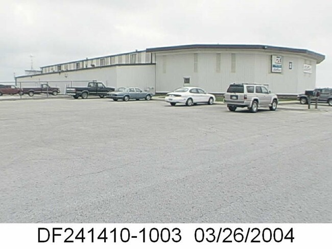
DF241410-1003
10-14-24 BG 2411.36 E 563.81S & 223.32 W NW CR NW1/4 W 280 S 92.40 W 43.80 S 284.50 E 357.30 N 282.90 W 33.50 N 94 TO POB ( KCH INC HANGAR NO 1 ) ( EXECUTIVE AIRPORT ) 2.93 ACS M/L OLC 285A 1 BOTA 89 4584 ETAL
Aircraft
Johnson
AG
Kansas
B and X Area of moderate flood hazard, usually the area between the limits of the 100-year and 500-year floods.
2.93 AC
0
South Johnson County
2025
Kansas City
053425
Kansas City, MO-KS
26,114 SF
NEARBY LISTINGS FOR SALE OR LEASE
-
-
View all Olathe listings for lease on LoopNet.com
DEMOGRAPHICS near 12901 W 151St St
1 mile
3 mile
5 mile
2024 Total Population
4,983
77,420
196,178
2029 Population
5,118
79,759
202,410
Pop Growth 2024-2029
+ 2.71%
+ 3.02%
+ 3.18%
Average Age
38
38
39
2024 Total Households
1,567
25,875
73,144
HH Growth 2024-2029
+ 2.81%
+ 3.11%
+ 3.27%
Median Household Inc
$169,607
$148,943
$115,195
Avg Household Size
3.10
2.90
2.60
2024 Avg HH Vehicles
2.00
2.00
2.00
Median Home Value
$496,778
$468,041
$419,013
Median Year Built
2002
1999
1995
Nearby Places
Map Layers
Map Styles
 Street
 Aerial
Transit
 Traffic
 Biking
Places
Listings with unknown addresses are not visible on the map
- Restaurants
- Banks
- Shops
- Fitness
- Groceries
PUBLIC TRANSPORTATION
AIRPORT
Kansas City International
Drive
Walk
Distance
Kansas City International
55 min
42.1 mi
SALE & LEASE HISTORY
LISTING DATE
SALE/LEASE

Jul 31, 2017
For Lease
Nearby Properties
Address
Land Use
TOTAL SIZE
Lot Size
Zoning
Address
Land Use
TOTAL SIZE
Lot Size
Zoning
320,892 SF
74.58 AC
R-1
Address
Land Use
TOTAL SIZE
Lot Size
Zoning
316,630 SF
62.18 AC
RE
Address
Land Use
TOTAL SIZE
Lot Size
Zoning
211,054 SF
72.40 AC
R-1
Address
Land Use
TOTAL SIZE
Lot Size
Zoning
137,955 SF
23.80 AC
R-1
Address
Land Use
TOTAL SIZE
Lot Size
Zoning
129,325 SF
4.50 AC
R-1
Address
Land Use
TOTAL SIZE
Lot Size
Zoning
146,832 SF
30 AC
R-1
Address
Land Use
TOTAL SIZE
Lot Size
Zoning
150,122 SF
17.48 AC
R-1
Address
Land Use
TOTAL SIZE
Lot Size
Zoning
61,479 SF
8.14 AC
C-2
Address
Land Use
TOTAL SIZE
Lot Size
Zoning
157,344 SF
12.69 AC
R-1
Address
Land Use
TOTAL SIZE
Lot Size
Zoning
130,605 SF
18.01 AC
R-1
Address
Land Use
TOTAL SIZE
Lot Size
Zoning
119,299 SF
43.14 AC
RE
Address
Land Use
TOTAL SIZE
Lot Size
Zoning
86,095 SF
16.95 AC
R-1
Address
Land Use
TOTAL SIZE
Lot Size
Zoning
44,738 SF
10.21 AC
CP-2
Address
Land Use
TOTAL SIZE
Lot Size
Zoning
69,855 SF
6.86 AC
R
Address
Land Use
TOTAL SIZE
Lot Size
Zoning
81,753 SF
20.88 AC
R-1
Address
Land Use
TOTAL SIZE
Lot Size
Zoning
55,263 SF
10.81 AC
R-1A
Address
Land Use
TOTAL SIZE
Lot Size
Zoning
81,096 SF
121.30 AC
AG
Address
Land Use
TOTAL SIZE
Lot Size
Zoning
115,263 SF
23.66 AC
R-1
Address
Land Use
TOTAL SIZE
Lot Size
Zoning
69,077 SF
17.90 AC
R-1
Address
Land Use
TOTAL SIZE
Lot Size
Zoning
73,159 SF
12.54 AC
R-1
Address
Land Use
TOTAL SIZE
Lot Size
Zoning
65,388 SF
19.09 AC
RURJ
Address
Land Use
TOTAL SIZE
Lot Size
Zoning
72,091 SF
11.33 AC
R-1
Address
Land Use
TOTAL SIZE
Lot Size
Zoning
81,229 SF
34.32 AC
CP-O
Address
Land Use
TOTAL SIZE
Lot Size
Zoning
69,455 SF
18.26 AC
RE
Address
Land Use
TOTAL SIZE
Lot Size
Zoning
72,324 SF
8.84 AC
R-1
Address
Land Use
TOTAL SIZE
Lot Size
Zoning
60,223 SF
5.91 AC
R-1
Address
Land Use
TOTAL SIZE
Lot Size
Zoning
62,832 SF
15.43 AC
CTY RUR
Address
Land Use
TOTAL SIZE
Lot Size
Zoning
54,005 SF
10.49 AC
R-1/PUD
Address
Land Use
TOTAL SIZE
Lot Size
Zoning
32,119 SF
93.48 AC
R-1
Address
Land Use
TOTAL SIZE
Lot Size
Zoning
85,196 SF
22.16 AC
AG
The World's #1 Commercial Real Estate Marketplace
Connect with us
© 2026 CoStar Group
The information above has been obtained from sources believed reliable. While we do not doubt its accuracy we have not verified it and make no guarantee, warranty or representation about it. It is your responsibility to independently confirm its accuracy and completeness. Any projections, opinions, assumptions, or estimates used are for example only and do not represent the current or future performance of the property. The value of this transaction to you depends on tax and other factors which should be evaluated by your tax, financial, and legal advisors. You and your advisors should conduct a careful, independent investigation of the property to determine to your satisfaction the suitability of the property for your needs.