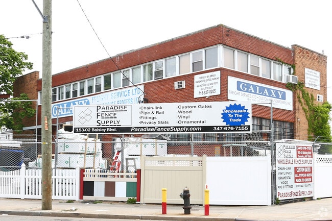
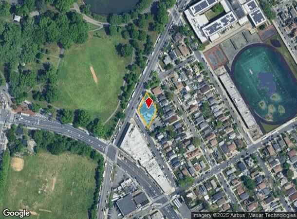
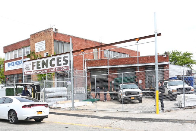
Property Record
12905 153Rd St, Jamaica, NY 11434
NEARBY LISTINGS FOR SALE OR LEASE
Property Detail
12905 153Rd St
12258-0027
Queens
Warehouse
New York
X
27
3604970241F
0.33 AC
2024
South Queens
2025
Long Island (New York)
033403
New York-Jersey City-White Plains, NY-NJ
11,462 SF
DEMOGRAPHICS near 12905 153Rd St
1 Mile
3 Mile
5 Mile
2024 Total Population
59,720
423,326
1,049,765
2029 Population
55,153
388,851
977,046
Pop Growth 2024-2029
(7.65%)
(8.14%)
(6.93%)
Average Age
42
41
41
2024 Total Households
19,865
128,929
338,855
HH Growth 2024-2029
(7.70%)
(8.51%)
(7.12%)
Median Household Inc
$66,032
$74,054
$79,733
Avg Household Size
2.80
3.10
2.90
2024 Avg HH Vehicles
1.00
1.00
1.00
Median Home Value
$560,424
$647,693
$649,081
Median Year Built
1960
1951
1951
Nearby Places
- Restaurants
- Banks
- Shops
- Fitness
- Groceries
PUBLIC TRANSPORTATION
COMMUTER RAIL
Locust Manor Station (Far Rockaway Branch - Long Island Rail Road)
DRIVE
WALK
Distance
Locust Manor Station (Far Rockaway Branch - Long Island Rail Road)
6 min
1.6 mi
Laurelton Station (Far Rockaway Branch - Long Island Rail Road)
DRIVE
WALK
Distance
Laurelton Station (Far Rockaway Branch - Long Island Rail Road)
9 min
2.3 mi
AIRPORT
John F Kennedy International
DRIVE
WALK
Distance
John F Kennedy International
8 min
3.5 mi
LaGuardia
DRIVE
WALK
Distance
LaGuardia
16 min
10.5 mi
Newark Liberty International
DRIVE
WALK
Distance
Newark Liberty International
46 min
30.2 mi
Freight Ports
NY - Red Hook Container Terminal
DRIVE
WALK
Distance
NY - Red Hook Container Terminal
1 min
11.6 mi
SALE & LEASE HISTORY
LISTING DATE
SALE/LEASE

Sep 26, 2023
For Lease
May 06, 2019
For Lease
Jan 27, 2020
For Lease
Jan 09, 2023
For Lease
Dec 24, 2019
For Lease
Nearby Properties
Address
Land Use
TOTAL SIZE
Lot Size
Zoning
Address
Land Use
TOTAL SIZE
Lot Size
Zoning
14,417,607 SF
4,921.45 AC
M1-1
Address
Land Use
TOTAL SIZE
Lot Size
Zoning
1,845,252 SF
172 AC
C8-1
Address
Land Use
TOTAL SIZE
Lot Size
Zoning
182.50 AC
M1-1
Address
Land Use
TOTAL SIZE
Lot Size
Zoning
532,011 SF
2.48 AC
R6
Address
Land Use
TOTAL SIZE
Lot Size
Zoning
124.60 AC
M1-1
Address
Land Use
TOTAL SIZE
Lot Size
Zoning
294.47 AC
PARK
Address
Land Use
TOTAL SIZE
Lot Size
Zoning
731,247 SF
56.09 AC
R3-2
Address
Land Use
TOTAL SIZE
Lot Size
Zoning
738,000 SF
1.92 AC
C6-3
Address
Land Use
TOTAL SIZE
Lot Size
Zoning
291,589 SF
1.55 AC
C6-3
Address
Land Use
TOTAL SIZE
Lot Size
Zoning
320,535 SF
1.52 AC
C4-4A
Address
Land Use
TOTAL SIZE
Lot Size
Zoning
384,249 SF
5.56 AC
R5
Address
Land Use
TOTAL SIZE
Lot Size
Zoning
364,424 SF
C5-3
Address
Land Use
TOTAL SIZE
Lot Size
Zoning
478,384 SF
1.23 AC
C6-3
Address
Land Use
TOTAL SIZE
Lot Size
Zoning
360,000 SF
8.78 AC
R6
Address
Land Use
TOTAL SIZE
Lot Size
Zoning
569,583 SF
2.28 AC
C4-5X
Address
Land Use
TOTAL SIZE
Lot Size
Zoning
230,580 SF
3.41 AC
C8-1
Address
Land Use
TOTAL SIZE
Lot Size
Zoning
460,540 SF
0.69 AC
C6-4
Address
Land Use
TOTAL SIZE
Lot Size
Zoning
535,609 SF
0.82 AC
C6-4
Address
Land Use
TOTAL SIZE
Lot Size
Zoning
208,952 SF
9.03 AC
M1-1
Address
Land Use
TOTAL SIZE
Lot Size
Zoning
107,000 SF
1.84 AC
R6
Address
Land Use
TOTAL SIZE
Lot Size
Zoning
552,216 SF
9.41 AC
R4
Address
Land Use
TOTAL SIZE
Lot Size
Zoning
240,000 SF
14.50 AC
R4
Address
Land Use
TOTAL SIZE
Lot Size
Zoning
183,070 SF
4.47 AC
M1-1
Address
Land Use
TOTAL SIZE
Lot Size
Zoning
295,904 SF
0.63 AC
C6-3
Address
Land Use
TOTAL SIZE
Lot Size
Zoning
240,000 SF
1.91 AC
C6-3
Address
Land Use
TOTAL SIZE
Lot Size
Zoning
273,882 SF
2.90 AC
R4-1
Address
Land Use
TOTAL SIZE
Lot Size
Zoning
285,170 SF
12.63 AC
R3-1
Address
Land Use
TOTAL SIZE
Lot Size
Zoning
471,648 SF
1.46 AC
C6-3
Address
Land Use
TOTAL SIZE
Lot Size
Zoning
27.23 AC
PARK
Address
Land Use
TOTAL SIZE
Lot Size
Zoning
50,000 SF
52.45 AC
PARK
The World's #1 Commercial Real Estate Marketplace
Connect with us
© 2025 CoStar Group
The information above has been obtained from sources believed reliable. While we do not doubt its accuracy we have not verified it and make no guarantee, warranty or representation about it. It is your responsibility to independently confirm its accuracy and completeness. Any projections, opinions, assumptions, or estimates used are for example only and do not represent the current or future performance of the property. The value of this transaction to you depends on tax and other factors which should be evaluated by your tax, financial, and legal advisors. You and your advisors should conduct a careful, independent investigation of the property to determine to your satisfaction the suitability of the property for your needs.