Property Record
12905 Mapleview St, Lakeside, CA 92040
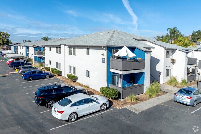

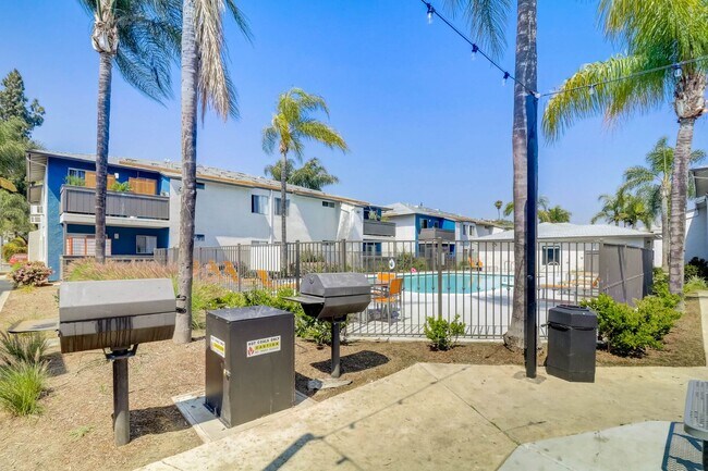
Property Detail
12905 Mapleview St
San Diego-Chula Vista-Carlsbad, CA
LOT 43 5.77 AC M/L IN STS CLSD ADJ&IN TR 353
394-480-51
San Diego
Multifamilydwelling
California
RU
43
B and X Area of moderate flood hazard, usually the area between the limits of the 100-year and 500-year floods.
5.77 AC
2025
Lakeside
2025
San Diego
016804
NEARBY LISTINGS FOR SALE OR LEASE
-
-
View all Lakeside listings for sale on LoopNet.com
DEMOGRAPHICS near 12905 Mapleview St
1 mile
3 mile
5 mile
2024 Total Population
11,192
59,829
152,478
2029 Population
11,376
59,854
152,141
Pop Growth 2024-2029
+ 1.64%
+ 0.04%
(0.22%)
Average Age
37
40
40
2024 Total Households
3,836
20,618
51,753
HH Growth 2024-2029
+ 1.46%
(0.12%)
(0.37%)
Median Household Inc
$86,725
$107,729
$93,730
Avg Household Size
2.80
2.80
2.80
2024 Avg HH Vehicles
2.00
2.00
2.00
Median Home Value
$702,803
$694,935
$683,550
Median Year Built
1978
1978
1977
Nearby Places
Map Layers
Map Styles
 Street
 Aerial
Transit
 Traffic
 Biking
Places
Listings with unknown addresses are not visible on the map
- Restaurants
- Banks
- Shops
- Fitness
- Groceries
PUBLIC TRANSPORTATION
AIRPORT
San Diego International
Drive
Walk
Distance
San Diego International
31 min
22.9 mi
Freight Ports
Port of San Diego
Drive
Walk
Distance
Port of San Diego
29 min
21.8 mi
Nearby Properties
Address
Land Use
TOTAL SIZE
Lot Size
Zoning
Address
Land Use
TOTAL SIZE
Lot Size
Zoning
38.80 AC
RMH8
Address
Land Use
TOTAL SIZE
Lot Size
Zoning
4.93 AC
C36
Address
Land Use
TOTAL SIZE
Lot Size
Zoning
79,662 SF
8.21 AC
S88
Address
Land Use
TOTAL SIZE
Lot Size
Zoning
67,722 SF
3.57 AC
RM-2500
Address
Land Use
TOTAL SIZE
Lot Size
Zoning
14.80 AC
S88
Address
Land Use
TOTAL SIZE
Lot Size
Zoning
56,525 SF
6.29 AC
S88
Address
Land Use
TOTAL SIZE
Lot Size
Zoning
87,704 SF
3.74 AC
RU
Address
Land Use
TOTAL SIZE
Lot Size
Zoning
9.93 AC
S88
Address
Land Use
TOTAL SIZE
Lot Size
Zoning
57,840 SF
5.59 AC
R7
Address
Land Use
TOTAL SIZE
Lot Size
Zoning
7.66 AC
S88
Address
Land Use
TOTAL SIZE
Lot Size
Zoning
90,936 SF
3.70 AC
C34
Address
Land Use
TOTAL SIZE
Lot Size
Zoning
35,424 SF
3.13 AC
RV
Address
Land Use
TOTAL SIZE
Lot Size
Zoning
11,285 SF
2.81 AC
C37
Address
Land Use
TOTAL SIZE
Lot Size
Zoning
3,368 SF
33.63 AC
RMH6
Address
Land Use
TOTAL SIZE
Lot Size
Zoning
43,500 SF
3.79 AC
C34
Address
Land Use
TOTAL SIZE
Lot Size
Zoning
7.01 AC
RU
Address
Land Use
TOTAL SIZE
Lot Size
Zoning
53,357 SF
2.04 AC
C34
Address
Land Use
TOTAL SIZE
Lot Size
Zoning
78,759 SF
7.28 AC
IG
Address
Land Use
TOTAL SIZE
Lot Size
Zoning
78,577 SF
14.03 AC
M54
Address
Land Use
TOTAL SIZE
Lot Size
Zoning
74,018 SF
4.49 AC
R14
Address
Land Use
TOTAL SIZE
Lot Size
Zoning
6.95 AC
RU
Address
Land Use
TOTAL SIZE
Lot Size
Zoning
49,350 SF
4.32 AC
C36
Address
Land Use
TOTAL SIZE
Lot Size
Zoning
6.67 AC
RU
Address
Land Use
TOTAL SIZE
Lot Size
Zoning
4.87 AC
RU
Address
Land Use
TOTAL SIZE
Lot Size
Zoning
80.56 AC
S88
Address
Land Use
TOTAL SIZE
Lot Size
Zoning
2,781 SF
8.10 AC
M58
Address
Land Use
TOTAL SIZE
Lot Size
Zoning
4.57 AC
RU
Address
Land Use
TOTAL SIZE
Lot Size
Zoning
65,870 SF
4.31 AC
S88
Address
Land Use
TOTAL SIZE
Lot Size
Zoning
29,174 SF
1.24 AC
RU
The World's #1 Commercial Real Estate Marketplace
Connect with us
© 2026 CoStar Group
The information above has been obtained from sources believed reliable. While we do not doubt its accuracy we have not verified it and make no guarantee, warranty or representation about it. It is your responsibility to independently confirm its accuracy and completeness. Any projections, opinions, assumptions, or estimates used are for example only and do not represent the current or future performance of the property. The value of this transaction to you depends on tax and other factors which should be evaluated by your tax, financial, and legal advisors. You and your advisors should conduct a careful, independent investigation of the property to determine to your satisfaction the suitability of the property for your needs.