Property Record
12910 Boyette Rd, Riverview, FL 33569


This Property Is For Sale
Property Detail
12910 Boyette Rd
U-23-30-20-ZZZ-000003-03790.0
COMM AT NE COR OF NE 1/4 OF SW 1/4 THENCE N 89 DEG 36 MIN 56 SEC W ALG THE NORTH LINE OF SD NE 1/4 OF SW 1/4 A DISTANCE OF 50.06 FT TO FOUND RION PIPE AT NORTHEAST CORNER OF ACE LAKELAND INC AND THE POB THN S 00 DEG 36 MIN 35 SEC E ALG THE WEST LINE
Golfcourse
HILLSBOROUGH
PD
Florida
A Areas with a 1% annual chance of flooding and a 26% chance of flooding over the life of a 30-year mortgage.
3790
2024
15.15 AC
2025
East Tampa
013413
Tampa/St Petersburg
1,380 SF
Tampa-St. Petersburg-Clearwater, FL
NEARBY LISTINGS FOR SALE OR LEASE
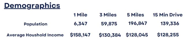
DEMOGRAPHICS near 12910 Boyette Rd
1 mile
3 mile
5 mile
2025 Total Population
5,877
66,282
212,704
2030 Population
6,293
71,598
229,406
Pop Growth 2025-2030
+ 7.08%
+ 8.02%
+ 7.85%
Average Age
41
40
39
2025 Total Households
1,948
23,076
74,360
HH Growth 2025-2030
+ 7.29%
+ 8.21%
+ 7.98%
Median Household Inc
$118,875
$103,479
$100,422
Avg Household Size
3.00
2.80
2.80
2025 Avg HH Vehicles
2.00
2.00
2.00
Median Home Value
$442,814
$417,536
$414,982
Median Year Built
1995
1998
2002
Nearby Places
Map Layers
Map Styles
 Street
 Aerial
Layers
 Traffic
 Biking
Places
Listings with unknown addresses are not visible on the map
- Restaurants
- Banks
- Shops
- Fitness
- Groceries
PUBLIC TRANSPORTATION
AIRPORT
Tampa International
Drive
Walk
Distance
Tampa International
39 min
24.8 mi
St Pete-Clearwater International
Drive
Walk
Distance
St Pete-Clearwater International
56 min
34.1 mi
Freight Ports
Port of Tampa Bay
Drive
Walk
Distance
Port of Tampa Bay
26 min
14.8 mi
Nearby Properties
Address
Land Use
TOTAL SIZE
Lot Size
Zoning
Address
Land Use
TOTAL SIZE
Lot Size
Zoning
378,117 SF
22.88 AC
PD
Address
Land Use
TOTAL SIZE
Lot Size
Zoning
382,521 SF
24.27 AC
PD
Address
Land Use
TOTAL SIZE
Lot Size
Zoning
361,294 SF
10.35 AC
PD
Address
Land Use
TOTAL SIZE
Lot Size
Zoning
231,811 SF
26.54 AC
PD
Address
Land Use
TOTAL SIZE
Lot Size
Zoning
289,109 SF
75.56 AC
AR
Address
Land Use
TOTAL SIZE
Lot Size
Zoning
182,688 SF
14.69 AC
PD
Address
Land Use
TOTAL SIZE
Lot Size
Zoning
190,080 SF
22.45 AC
PD
Address
Land Use
TOTAL SIZE
Lot Size
Zoning
113,134 SF
7.96 AC
PD
Address
Land Use
TOTAL SIZE
Lot Size
Zoning
870.14 AC
AR
Address
Land Use
TOTAL SIZE
Lot Size
Zoning
190.14 AC
PD
Address
Land Use
TOTAL SIZE
Lot Size
Zoning
73,541 SF
10.22 AC
AR
Address
Land Use
TOTAL SIZE
Lot Size
Zoning
57,438 SF
12.28 AC
PD
Address
Land Use
TOTAL SIZE
Lot Size
Zoning
163,701 SF
87.66 AC
PD
Address
Land Use
TOTAL SIZE
Lot Size
Zoning
97,039 SF
35.42 AC
PD
Address
Land Use
TOTAL SIZE
Lot Size
Zoning
104,130 SF
19.71 AC
PD
Address
Land Use
TOTAL SIZE
Lot Size
Zoning
96,158 SF
11.98 AC
PD
Address
Land Use
TOTAL SIZE
Lot Size
Zoning
101,809 SF
15.02 AC
PD
Address
Land Use
TOTAL SIZE
Lot Size
Zoning
110,461 SF
5.72 AC
PD
Address
Land Use
TOTAL SIZE
Lot Size
Zoning
61,120 SF
7.10 AC
PD
Address
Land Use
TOTAL SIZE
Lot Size
Zoning
97,587 SF
24.06 AC
PD
Address
Land Use
TOTAL SIZE
Lot Size
Zoning
89,725 SF
23.64 AC
PD
Address
Land Use
TOTAL SIZE
Lot Size
Zoning
82,340 SF
11.12 AC
PD
Address
Land Use
TOTAL SIZE
Lot Size
Zoning
71,818 SF
13.94 AC
PD
Address
Land Use
TOTAL SIZE
Lot Size
Zoning
68,422 SF
9.14 AC
PD
Address
Land Use
TOTAL SIZE
Lot Size
Zoning
60,984 SF
11.30 AC
PD
Address
Land Use
TOTAL SIZE
Lot Size
Zoning
76,308 SF
5.80 AC
PD
Address
Land Use
TOTAL SIZE
Lot Size
Zoning
36,254 SF
3.48 AC
PD
Address
Land Use
TOTAL SIZE
Lot Size
Zoning
54,698 SF
7.30 AC
PD
Address
Land Use
TOTAL SIZE
Lot Size
Zoning
13,772 SF
48.14 AC
PD
Address
Land Use
TOTAL SIZE
Lot Size
Zoning
93,043 SF
9.46 AC
PD
The World's #1 Commercial Real Estate Marketplace
Connect with us
© 2026 CoStar Group
The information above has been obtained from sources believed reliable. While we do not doubt its accuracy we have not verified it and make no guarantee, warranty or representation about it. It is your responsibility to independently confirm its accuracy and completeness. Any projections, opinions, assumptions, or estimates used are for example only and do not represent the current or future performance of the property. The value of this transaction to you depends on tax and other factors which should be evaluated by your tax, financial, and legal advisors. You and your advisors should conduct a careful, independent investigation of the property to determine to your satisfaction the suitability of the property for your needs.