Property Record
12916 Us Highway 290 E, Manor, TX 78653

Property Detail
12916 Us Highway 290 E
Austin-Round Rock-San Marcos, TX
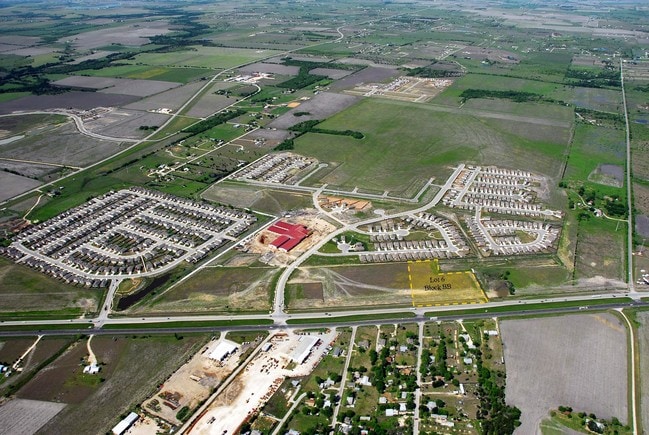
LOT 6 BLK BB PRESIDENTIAL MEADOWS COMMERCIAL SEC 2
756006
Travis
Warehouse
Texas
B and X Area of moderate flood hazard, usually the area between the limits of the 100-year and 500-year floods.
6
2025
4.08 AC
2025
Far Northeast
045900
Austin
9,574 SF
NEARBY LISTINGS FOR SALE OR LEASE
DEMOGRAPHICS near 12916 Us Highway 290 E
1 mile
3 mile
5 mile
2025 Total Population
10,318
29,559
37,729
2030 Population
11,064
31,743
40,556
Pop Growth 2025-2030
+ 7.23%
+ 7.39%
+ 7.49%
Average Age
35
35
36
2025 Total Households
3,215
9,369
12,018
HH Growth 2025-2030
+ 7.90%
+ 8.11%
+ 8.21%
Median Household Inc
$85,455
$93,239
$97,057
Avg Household Size
3.20
3.10
3.10
2025 Avg HH Vehicles
2.00
2.00
2.00
Median Home Value
$349,823
$354,412
$359,961
Median Year Built
2010
2010
2010
Nearby Places
Map Layers
Map Styles
 Street
 Aerial
Transit
 Traffic
 Biking
Places
Listings with unknown addresses are not visible on the map
- Restaurants
- Banks
- Shops
- Fitness
- Groceries
PUBLIC TRANSPORTATION
AIRPORT
Austin-Bergstrom International
Drive
Walk
Distance
Austin-Bergstrom International
30 min
19.9 mi
Freight Ports
Calhoun Port
Drive
Walk
Distance
Calhoun Port
190 min
162.9 mi
Nearby Properties
Address
Land Use
TOTAL SIZE
Lot Size
Zoning
Address
Land Use
TOTAL SIZE
Lot Size
Zoning
469,500 SF
24.44 AC
Address
Land Use
TOTAL SIZE
Lot Size
Zoning
264,000 SF
14.22 AC
Address
Land Use
TOTAL SIZE
Lot Size
Zoning
300,492 SF
13.20 AC
Address
Land Use
TOTAL SIZE
Lot Size
Zoning
266,564 SF
27.40 AC
Address
Land Use
TOTAL SIZE
Lot Size
Zoning
204,356 SF
12.18 AC
Address
Land Use
TOTAL SIZE
Lot Size
Zoning
223,575 SF
12.47 AC
Address
Land Use
TOTAL SIZE
Lot Size
Zoning
149,640 SF
10.39 AC
Address
Land Use
TOTAL SIZE
Lot Size
Zoning
191,300 SF
30.73 AC
Address
Land Use
TOTAL SIZE
Lot Size
Zoning
150,000 SF
10.04 AC
Address
Land Use
TOTAL SIZE
Lot Size
Zoning
248,325 SF
14.73 AC
Address
Land Use
TOTAL SIZE
Lot Size
Zoning
111,966 SF
11.61 AC
Address
Land Use
TOTAL SIZE
Lot Size
Zoning
138,000 SF
9.69 AC
Address
Land Use
TOTAL SIZE
Lot Size
Zoning
109,184 SF
13.45 AC
Address
Land Use
TOTAL SIZE
Lot Size
Zoning
132,500 SF
15.56 AC
Address
Land Use
TOTAL SIZE
Lot Size
Zoning
147,908 SF
15.54 AC
Address
Land Use
TOTAL SIZE
Lot Size
Zoning
200.38 AC
Address
Land Use
TOTAL SIZE
Lot Size
Zoning
236.07 AC
Address
Land Use
TOTAL SIZE
Lot Size
Zoning
51,910 SF
13.19 AC
Address
Land Use
TOTAL SIZE
Lot Size
Zoning
80,872 SF
14.75 AC
Address
Land Use
TOTAL SIZE
Lot Size
Zoning
3,460 SF
150.67 AC
Address
Land Use
TOTAL SIZE
Lot Size
Zoning
100,100 SF
8.52 AC
Address
Land Use
TOTAL SIZE
Lot Size
Zoning
137.27 AC
Address
Land Use
TOTAL SIZE
Lot Size
Zoning
67,410 SF
7 AC
Address
Land Use
TOTAL SIZE
Lot Size
Zoning
136.34 AC
Address
Land Use
TOTAL SIZE
Lot Size
Zoning
25,495 SF
5.95 AC
Address
Land Use
TOTAL SIZE
Lot Size
Zoning
71,436 SF
8 AC
Address
Land Use
TOTAL SIZE
Lot Size
Zoning
52,500 SF
5.47 AC
Address
Land Use
TOTAL SIZE
Lot Size
Zoning
35,016 SF
4.27 AC
Address
Land Use
TOTAL SIZE
Lot Size
Zoning
49,062 SF
1.97 AC
Address
Land Use
TOTAL SIZE
Lot Size
Zoning
12.08 AC
The World's #1 Commercial Real Estate Marketplace
Connect with us
© 2026 CoStar Group
The information above has been obtained from sources believed reliable. While we do not doubt its accuracy we have not verified it and make no guarantee, warranty or representation about it. It is your responsibility to independently confirm its accuracy and completeness. Any projections, opinions, assumptions, or estimates used are for example only and do not represent the current or future performance of the property. The value of this transaction to you depends on tax and other factors which should be evaluated by your tax, financial, and legal advisors. You and your advisors should conduct a careful, independent investigation of the property to determine to your satisfaction the suitability of the property for your needs.