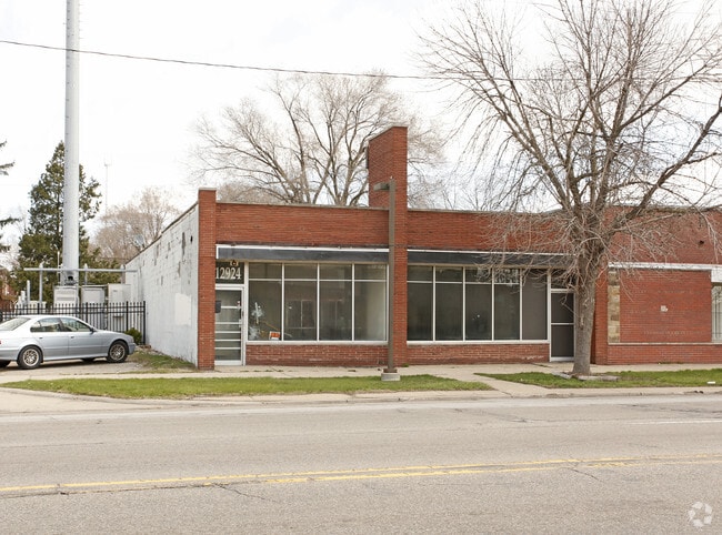
Property Record
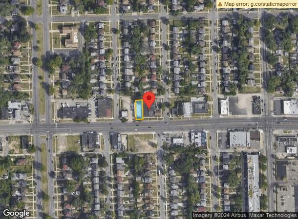
12924 W 7 Mile Rd, Detroit, MI 48235
NEARBY LISTINGS FOR SALE OR LEASE
Property Detail
12924 W 7 Mile Rd
22-017459
Greenwich Park
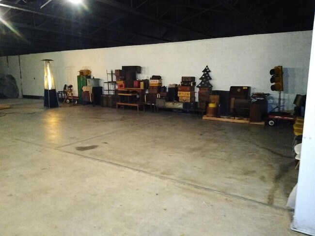
Storebuilding
N SEVEN MILE W 16 EXC SEVEN MILE RD AS WD GREENWICH PARK SUB L41 P28 PLATS, W C R 22/225 40 X 112.79A
X
Wayne
26163C0100E
Michigan
2024
0.10 AC
2025
Detroit W of Woodward
539300
Detroit
3,428 SF
Detroit-Warren-Dearborn, MI
DEMOGRAPHICS near 12924 W 7 Mile Rd
1 Mile
3 Mile
5 Mile
2024 Total Population
22,477
164,136
408,215
2029 Population
21,645
161,091
405,581
Pop Growth 2024-2029
(3.70%)
(1.86%)
(0.65%)
Average Age
41
40
40
2024 Total Households
9,014
66,731
170,355
HH Growth 2024-2029
(3.77%)
(1.85%)
(0.61%)
Median Household Inc
$46,840
$45,616
$47,117
Avg Household Size
2.40
2.40
2.30
2024 Avg HH Vehicles
1.00
1.00
1.00
Median Home Value
$87,690
$115,292
$134,864
Median Year Built
1951
1950
1950
Nearby Places
Map Layers
Map Styles
 Street
 Aerial
- Restaurants
- Banks
- Shops
- Fitness
- Groceries
PUBLIC TRANSPORTATION
COMMUTER RAIL
DRIVE
WALK
Distance
15 min
5.5 mi
DRIVE
WALK
Distance
15 min
8.1 mi
AIRPORT
Windsor International
DRIVE
WALK
Distance
Windsor International
40 min
20.5 mi
Detroit Metro Wayne County
DRIVE
WALK
Distance
Detroit Metro Wayne County
40 min
24.5 mi
SALE & LEASE HISTORY
LISTING DATE
SALE/LEASE

Mar 17, 2020
For Sale
Jul 13, 2022
For Sale
Nearby Properties
Address
Land Use
TOTAL SIZE
Lot Size
Zoning
Address
Land Use
TOTAL SIZE
Lot Size
Zoning
925,367 SF
12.82 AC
R6
Address
Land Use
TOTAL SIZE
Lot Size
Zoning
300,830 SF
54 AC
LI
Address
Land Use
TOTAL SIZE
Lot Size
Zoning
120,093 SF
38.18 AC
TV-R
Address
Land Use
TOTAL SIZE
Lot Size
Zoning
339,780 SF
22.29 AC
RM-1
Address
Land Use
TOTAL SIZE
Lot Size
Zoning
199,592 SF
17.02 AC
B3
Address
Land Use
TOTAL SIZE
Lot Size
Zoning
273,000 SF
17.31 AC
LI
Address
Land Use
TOTAL SIZE
Lot Size
Zoning
10.32 AC
LI
Address
Land Use
TOTAL SIZE
Lot Size
Zoning
133,544 SF
19.65 AC
ERO
Address
Land Use
TOTAL SIZE
Lot Size
Zoning
163,661 SF
8.92 AC
PD
Address
Land Use
TOTAL SIZE
Lot Size
Zoning
216 SF
13.14 AC
RM
Address
Land Use
TOTAL SIZE
Lot Size
Zoning
240,520 SF
8.14 AC
B-3
Address
Land Use
TOTAL SIZE
Lot Size
Zoning
165,829 SF
5.56 AC
R5
Address
Land Use
TOTAL SIZE
Lot Size
Zoning
119,418 SF
13.81 AC
B4
Address
Land Use
TOTAL SIZE
Lot Size
Zoning
97.05 AC
RS
Address
Land Use
TOTAL SIZE
Lot Size
Zoning
66,032 SF
3.61 AC
R-1
Address
Land Use
TOTAL SIZE
Lot Size
Zoning
180,056 SF
1.45 AC
II
Address
Land Use
TOTAL SIZE
Lot Size
Zoning
180 SF
5.09 AC
RMU
Address
Land Use
TOTAL SIZE
Lot Size
Zoning
54,672 SF
1.37 AC
R6
Address
Land Use
TOTAL SIZE
Lot Size
Zoning
116,790 SF
5.86 AC
R4
Address
Land Use
TOTAL SIZE
Lot Size
Zoning
107,914 SF
6.41 AC
B-2
Address
Land Use
TOTAL SIZE
Lot Size
Zoning
90,958 SF
11.78 AC
R5
Address
Land Use
TOTAL SIZE
Lot Size
Zoning
Address
Land Use
TOTAL SIZE
Lot Size
Zoning
190 SF
4.68 AC
RT
Address
Land Use
TOTAL SIZE
Lot Size
Zoning
201,800 SF
4.03 AC
RMU
Address
Land Use
TOTAL SIZE
Lot Size
Zoning
93,329 SF
2.07 AC
ERO
Address
Land Use
TOTAL SIZE
Lot Size
Zoning
Address
Land Use
TOTAL SIZE
Lot Size
Zoning
181,798 SF
10.48 AC
B4
Address
Land Use
TOTAL SIZE
Lot Size
Zoning
4,060 SF
18.42 AC
RM
Address
Land Use
TOTAL SIZE
Lot Size
Zoning
63,216 SF
2.87 AC
R5
Address
Land Use
TOTAL SIZE
Lot Size
Zoning
66,870 SF
2.77 AC
The World's #1 Commercial Real Estate Marketplace
Connect with us
© 2025 CoStar Group
The information above has been obtained from sources believed reliable. While we do not doubt its accuracy we have not verified it and make no guarantee, warranty or representation about it. It is your responsibility to independently confirm its accuracy and completeness. Any projections, opinions, assumptions, or estimates used are for example only and do not represent the current or future performance of the property. The value of this transaction to you depends on tax and other factors which should be evaluated by your tax, financial, and legal advisors. You and your advisors should conduct a careful, independent investigation of the property to determine to your satisfaction the suitability of the property for your needs.