Property Record
12929 Jackson Rd, Sloughhouse, CA 95683

NEARBY LISTINGS FOR SALE OR LEASE
-
-
View all Sloughhouse listings for sale on LoopNet.com
Property Detail
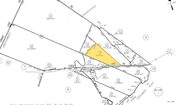
12929 Jackson Rd
126-0080-033
POR OF SEC 36 T7N R7E BEING A POR OF OMOCHUMNES GRANTDESC AS BEG AT MOST SLY COR OF ORANGEMEAD COLONY ASSHOWN ON SURVEY FOR
Pasture
Sacramento
AE
California
06067C0355J
63.94 AC
2024
Outer Sacramento County
2025
Sacramento
008602
Sacramento-Roseville-Folsom, CA
4,727 SF
DEMOGRAPHICS near 12929 Jackson Rd
1 Mile
3 Mile
5 Mile
2024 Total Population
25
689
18,496
2029 Population
24
668
18,696
Pop Growth 2024-2029
(4.00%)
(3.05%)
+ 1.08%
Average Age
46
45
38
2024 Total Households
9
255
5,746
HH Growth 2024-2029
0.00%
(3.14%)
+ 0.90%
Median Household Inc
$87,500
$81,151
$141,429
Avg Household Size
2.40
2.60
3.20
2024 Avg HH Vehicles
3.00
3.00
2.00
Median Home Value
$874,999
$827,669
$619,445
Median Year Built
1975
1977
2006
Nearby Places
Map Layers
Map Styles
 Street
 Aerial
- Restaurants
- Banks
- Shops
- Fitness
- Groceries
PUBLIC TRANSPORTATION
AIRPORT
Sacramento International
DRIVE
WALK
Distance
Sacramento International
43 min
30.0 mi
Freight Ports
Port of Stockton
DRIVE
WALK
Distance
Port of Stockton
65 min
49.0 mi
SALE & LEASE HISTORY
LISTING DATE
SALE/LEASE

Jun 18, 2020
For Sale
Nearby Properties
Address
Land Use
TOTAL SIZE
Lot Size
Zoning
Address
Land Use
TOTAL SIZE
Lot Size
Zoning
10,361 SF
61.36 AC
AG-20
Address
Land Use
TOTAL SIZE
Lot Size
Zoning
72.06 AC
AG-20
Address
Land Use
TOTAL SIZE
Lot Size
Zoning
16,710 SF
19.49 AC
AG-20
Address
Land Use
TOTAL SIZE
Lot Size
Zoning
66,125 SF
20 AC
AG-20 (SM)
Address
Land Use
TOTAL SIZE
Lot Size
Zoning
1,616 SF
80 AC
LDR (SCSP)
Address
Land Use
TOTAL SIZE
Lot Size
Zoning
2,410 SF
302.35 AC
AG-80
Address
Land Use
TOTAL SIZE
Lot Size
Zoning
2,064 SF
140.43 AC
AG-20
Address
Land Use
TOTAL SIZE
Lot Size
Zoning
166.36 AC
AG-40 AG-2
Address
Land Use
TOTAL SIZE
Lot Size
Zoning
214.16 AC
AG-80 AG-2
Address
Land Use
TOTAL SIZE
Lot Size
Zoning
8,888 SF
40.06 AC
AG-20
Address
Land Use
TOTAL SIZE
Lot Size
Zoning
2,349 SF
80 AC
CS (SCSP)
Address
Land Use
TOTAL SIZE
Lot Size
Zoning
168.20 AC
AG-20
Address
Land Use
TOTAL SIZE
Lot Size
Zoning
80 AC
MDR (SCSP)
Address
Land Use
TOTAL SIZE
Lot Size
Zoning
7,387 SF
18.81 AC
AG-20
Address
Land Use
TOTAL SIZE
Lot Size
Zoning
101.17 AC
AG-40
Address
Land Use
TOTAL SIZE
Lot Size
Zoning
115.89 AC
AG-40
Address
Land Use
TOTAL SIZE
Lot Size
Zoning
4,481 SF
20.25 AC
AG-20
Address
Land Use
TOTAL SIZE
Lot Size
Zoning
7,569 SF
78.33 AC
AG-20
Address
Land Use
TOTAL SIZE
Lot Size
Zoning
181.53 AC
AG-80
Address
Land Use
TOTAL SIZE
Lot Size
Zoning
211.43 AC
AG-80
Address
Land Use
TOTAL SIZE
Lot Size
Zoning
2,341 SF
50.25 AC
AG-20
Address
Land Use
TOTAL SIZE
Lot Size
Zoning
4,898 SF
87.49 AC
AG-20
Address
Land Use
TOTAL SIZE
Lot Size
Zoning
RTC (SCSP)
Address
Land Use
TOTAL SIZE
Lot Size
Zoning
4,855 SF
61.41 AC
AG-20
Address
Land Use
TOTAL SIZE
Lot Size
Zoning
3,440 SF
43.95 AC
AG-20
Address
Land Use
TOTAL SIZE
Lot Size
Zoning
1,090 SF
305.36 AC
AG-80
Address
Land Use
TOTAL SIZE
Lot Size
Zoning
826 SF
80 AC
AG-20
Address
Land Use
TOTAL SIZE
Lot Size
Zoning
3,668 SF
10.72 AC
A-10
Address
Land Use
TOTAL SIZE
Lot Size
Zoning
3,480 SF
2.85 AC
A-2
Address
Land Use
TOTAL SIZE
Lot Size
Zoning
4,143 SF
99.29 AC
AG-80
The World's #1 Commercial Real Estate Marketplace
Connect with us
© 2026 CoStar Group
The information above has been obtained from sources believed reliable. While we do not doubt its accuracy we have not verified it and make no guarantee, warranty or representation about it. It is your responsibility to independently confirm its accuracy and completeness. Any projections, opinions, assumptions, or estimates used are for example only and do not represent the current or future performance of the property. The value of this transaction to you depends on tax and other factors which should be evaluated by your tax, financial, and legal advisors. You and your advisors should conduct a careful, independent investigation of the property to determine to your satisfaction the suitability of the property for your needs.