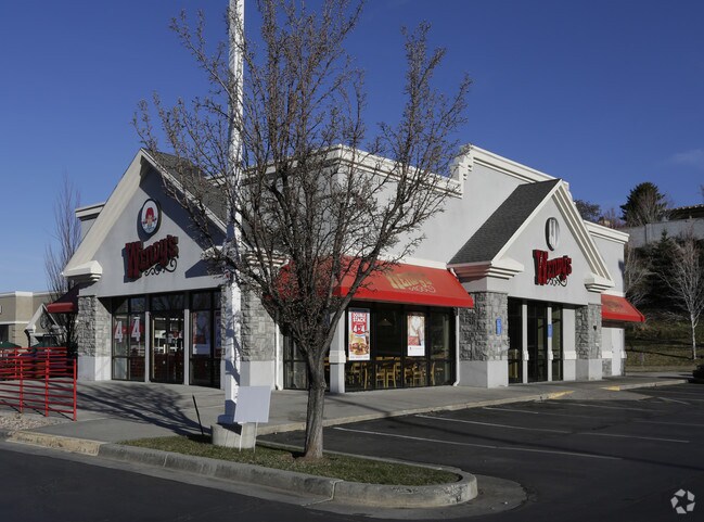
Property Record
1293 E Draper Pky, Draper, UT 84020
NEARBY LISTINGS FOR SALE OR LEASE
Property Detail
1293 E Draper Pky
28-29-430-007-0000
BEG N 89^2741 W 288.19 FT ALG 1/4 SEC LINE FR E 1/4 COR SEC 29, T 3S, R 1E, SLM; S 0^3219 W 202.65 FT; S 25^5741E 59.4 FT TO W LINE OF 1300 E ST; S 64^0219 W 75.2 FT; N 37^5549 W 60.72 FT; N 89^4711 W 67.69 FT; N 0^3219 E 242.2 FT; S 89^2741 E 146.25
Restaurantdrivein
Salt Lake
X
Utah
49035C0463H
0.89 AC
2024
Draper
2025
Salt Lake City
112805
Salt Lake City-Murray, UT
3,337 SF
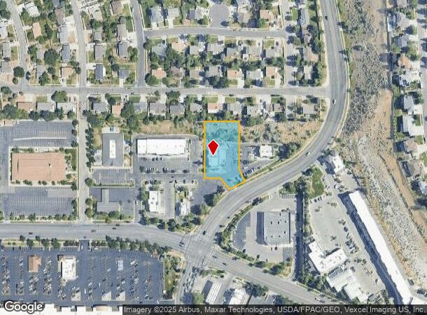
DEMOGRAPHICS near 1293 E Draper Pky
1 Mile
3 Mile
5 Mile
2024 Total Population
10,899
81,098
183,197
2029 Population
11,025
82,357
186,530
Pop Growth 2024-2029
+ 1.16%
+ 1.55%
+ 1.82%
Average Age
38
38
38
2024 Total Households
3,233
24,663
59,370
HH Growth 2024-2029
+ 1.05%
+ 1.51%
+ 1.78%
Median Household Inc
$125,368
$113,662
$105,968
Avg Household Size
3.30
3.10
3.00
2024 Avg HH Vehicles
3.00
2.00
2.00
Median Home Value
$693,362
$648,547
$594,135
Median Year Built
1991
1994
1994
Nearby Places
Map Layers
Map Styles
 Street
 Aerial
- Restaurants
- Banks
- Shops
- Fitness
- Groceries
PUBLIC TRANSPORTATION
TRANSIT/SUBWAY
Draper Town Center Station (Blue Line - Utah Transit Authority (UTA))
DRIVE
WALK
Distance
Draper Town Center Station (Blue Line - Utah Transit Authority (UTA))
2 min
11 min
0.6 mi
COMMUTER RAIL
Draper Station (FrontRunner - Utah Transit Authority (UTA))
DRIVE
WALK
Distance
Draper Station (FrontRunner - Utah Transit Authority (UTA))
9 min
3.7 mi
South Jordan Station (FrontRunner - Utah Transit Authority (UTA))
DRIVE
WALK
Distance
South Jordan Station (FrontRunner - Utah Transit Authority (UTA))
8 min
4.8 mi
AIRPORT
Salt Lake City International
DRIVE
WALK
Distance
Salt Lake City International
30 min
23.7 mi
Provo Municipal
DRIVE
WALK
Distance
Provo Municipal
43 min
31.0 mi
Freight Ports
Port of Stockton
DRIVE
WALK
Distance
Port of Stockton
731 min
714.0 mi
Nearby Properties
Address
Land Use
TOTAL SIZE
Lot Size
Zoning
Address
Land Use
TOTAL SIZE
Lot Size
Zoning
40,495 SF
33.28 AC
RM-1
Address
Land Use
TOTAL SIZE
Lot Size
Zoning
774,515 SF
87.50 AC
M-1
Address
Land Use
TOTAL SIZE
Lot Size
Zoning
1,055,572 SF
8.31 AC
CR
Address
Land Use
TOTAL SIZE
Lot Size
Zoning
210,421 SF
6.87 AC
CR
Address
Land Use
TOTAL SIZE
Lot Size
Zoning
398,320 SF
40 AC
1110
Address
Land Use
TOTAL SIZE
Lot Size
Zoning
392,144 SF
30.63 AC
1113
Address
Land Use
TOTAL SIZE
Lot Size
Zoning
186,651 SF
35.87 AC
C-R
Address
Land Use
TOTAL SIZE
Lot Size
Zoning
81,865 SF
19.46 AC
Z-C-FF
Address
Land Use
TOTAL SIZE
Lot Size
Zoning
277,938 SF
13.90 AC
CSD-DD
Address
Land Use
TOTAL SIZE
Lot Size
Zoning
197,645 SF
19.51 AC
1122
Address
Land Use
TOTAL SIZE
Lot Size
Zoning
34,872 SF
11.59 AC
c-f
Address
Land Use
TOTAL SIZE
Lot Size
Zoning
126,531 SF
11.50 AC
1244
Address
Land Use
TOTAL SIZE
Lot Size
Zoning
311,202 SF
0.01 AC
4180
Address
Land Use
TOTAL SIZE
Lot Size
Zoning
391,078 SF
5.78 AC
IC
Address
Land Use
TOTAL SIZE
Lot Size
Zoning
101,790 SF
5.69 AC
PUD(16
Address
Land Use
TOTAL SIZE
Lot Size
Zoning
115,637 SF
36.38 AC
TSD
Address
Land Use
TOTAL SIZE
Lot Size
Zoning
374,097 SF
6.87 AC
CSDDPM
Address
Land Use
TOTAL SIZE
Lot Size
Zoning
130,809 SF
16.13 AC
RM 1
Address
Land Use
TOTAL SIZE
Lot Size
Zoning
265,332 SF
8.94 AC
C-C
Address
Land Use
TOTAL SIZE
Lot Size
Zoning
279,829 SF
18.28 AC
CSD-LP
Address
Land Use
TOTAL SIZE
Lot Size
Zoning
353,500 SF
29.38 AC
CR
Address
Land Use
TOTAL SIZE
Lot Size
Zoning
255,090 SF
17.91 AC
CSDDRC
Address
Land Use
TOTAL SIZE
Lot Size
Zoning
146,280 SF
0.01 AC
CBD
Address
Land Use
TOTAL SIZE
Lot Size
Zoning
77,905 SF
7.15 AC
CO2
Address
Land Use
TOTAL SIZE
Lot Size
Zoning
319,222 SF
6.12 AC
CSD-DD
Address
Land Use
TOTAL SIZE
Lot Size
Zoning
179,860 SF
11.50 AC
M-1
Address
Land Use
TOTAL SIZE
Lot Size
Zoning
198.67 AC
4280
Address
Land Use
TOTAL SIZE
Lot Size
Zoning
255,928 SF
14.90 AC
M-1
Address
Land Use
TOTAL SIZE
Lot Size
Zoning
174,573 SF
13.78 AC
CBD
Address
Land Use
TOTAL SIZE
Lot Size
Zoning
144,648 SF
20.53 AC
1110
The World's #1 Commercial Real Estate Marketplace
Connect with us
© 2026 CoStar Group
The information above has been obtained from sources believed reliable. While we do not doubt its accuracy we have not verified it and make no guarantee, warranty or representation about it. It is your responsibility to independently confirm its accuracy and completeness. Any projections, opinions, assumptions, or estimates used are for example only and do not represent the current or future performance of the property. The value of this transaction to you depends on tax and other factors which should be evaluated by your tax, financial, and legal advisors. You and your advisors should conduct a careful, independent investigation of the property to determine to your satisfaction the suitability of the property for your needs.