Property Record
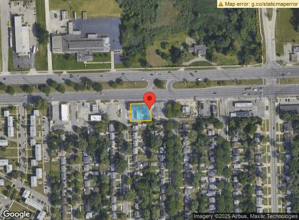
12933 W 8 Mile Rd, Detroit, MI 48235

NEARBY LISTINGS FOR SALE OR LEASE
Property Detail
12933 W 8 Mile Rd
22-01856-267
Blackstone Park No 6
Officebuilding
S EIGHT MILE W W 13 FT 2824 2823 THRU 2819 AND HALF VAC ALLEY ADJ BLACKSTONE PARK SUB NO 6 L52 P91 PLATS, W C R 22/240 119.99 X 110
X
Wayne
26163C0100E
Michigan
2025
0.30 AC
2025
Detroit West
539200
Detroit
9,250 SF
Detroit-Warren-Dearborn, MI
DEMOGRAPHICS near 12933 W 8 Mile Rd
1 Mile
3 Mile
5 Mile
2024 Total Population
16,217
158,756
403,874
2029 Population
15,737
155,630
399,958
Pop Growth 2024-2029
(2.96%)
(1.97%)
(0.97%)
Average Age
41
40
40
2024 Total Households
6,805
66,056
170,942
HH Growth 2024-2029
(3.01%)
(1.91%)
(0.93%)
Median Household Inc
$42,387
$53,286
$52,138
Avg Household Size
2.40
2.30
2.30
2024 Avg HH Vehicles
1.00
1.00
1.00
Median Home Value
$81,027
$153,455
$153,444
Median Year Built
1953
1952
1952
Nearby Places
Map Layers
Map Styles
 Street
 Aerial
- Restaurants
- Banks
- Shops
- Fitness
- Groceries
PUBLIC TRANSPORTATION
COMMUTER RAIL
Royal Oak Amtrak (Wolverine - Amtrak)
DRIVE
WALK
Distance
Royal Oak Amtrak (Wolverine - Amtrak)
13 min
4.6 mi
Troy Amtrak Station (Wolverine - Amtrak)
DRIVE
WALK
Distance
Troy Amtrak Station (Wolverine - Amtrak)
20 min
8.3 mi
AIRPORT
Windsor International
DRIVE
WALK
Distance
Windsor International
42 min
22.3 mi
Detroit Metro Wayne County
DRIVE
WALK
Distance
Detroit Metro Wayne County
41 min
25.9 mi
Freight Ports
Port of Toledo
DRIVE
WALK
Distance
Port of Toledo
90 min
68.9 mi
SALE & LEASE HISTORY
LISTING DATE
SALE/LEASE

Oct 14, 2024
For Sale
Oct 14, 2024
For Lease
Jul 20, 2023
For Sale
Dec 20, 2018
For Sale
Aug 09, 2018
For Sale
Apr 23, 2019
For Sale
Nearby Properties
Address
Land Use
TOTAL SIZE
Lot Size
Zoning
Address
Land Use
TOTAL SIZE
Lot Size
Zoning
925,367 SF
12.82 AC
R6
Address
Land Use
TOTAL SIZE
Lot Size
Zoning
187,801 SF
5.49 AC
RM-2
Address
Land Use
TOTAL SIZE
Lot Size
Zoning
120,093 SF
38.18 AC
TV-R
Address
Land Use
TOTAL SIZE
Lot Size
Zoning
300,830 SF
54 AC
LI
Address
Land Use
TOTAL SIZE
Lot Size
Zoning
97.05 AC
RS
Address
Land Use
TOTAL SIZE
Lot Size
Zoning
150,703 SF
Address
Land Use
TOTAL SIZE
Lot Size
Zoning
339,780 SF
22.29 AC
RM-1
Address
Land Use
TOTAL SIZE
Lot Size
Zoning
133,544 SF
19.65 AC
ERO
Address
Land Use
TOTAL SIZE
Lot Size
Zoning
417,880 SF
6.76 AC
RM-2
Address
Land Use
TOTAL SIZE
Lot Size
Zoning
273,000 SF
17.31 AC
LI
Address
Land Use
TOTAL SIZE
Lot Size
Zoning
290,448 SF
9.01 AC
O
Address
Land Use
TOTAL SIZE
Lot Size
Zoning
199,592 SF
17.02 AC
B3
Address
Land Use
TOTAL SIZE
Lot Size
Zoning
103,320 SF
Address
Land Use
TOTAL SIZE
Lot Size
Zoning
200 SF
12.69 AC
RM
Address
Land Use
TOTAL SIZE
Lot Size
Zoning
11.11 AC
RS
Address
Land Use
TOTAL SIZE
Lot Size
Zoning
128,309 SF
1.74 AC
Address
Land Use
TOTAL SIZE
Lot Size
Zoning
1.07 AC
MIX USE 2
Address
Land Use
TOTAL SIZE
Lot Size
Zoning
10.32 AC
LI
Address
Land Use
TOTAL SIZE
Lot Size
Zoning
216 SF
13.14 AC
RM
Address
Land Use
TOTAL SIZE
Lot Size
Zoning
43,437 SF
3.30 AC
REG BUS
Address
Land Use
TOTAL SIZE
Lot Size
Zoning
163,661 SF
8.92 AC
PD
Address
Land Use
TOTAL SIZE
Lot Size
Zoning
290,448 SF
8.92 AC
O
Address
Land Use
TOTAL SIZE
Lot Size
Zoning
137,583 SF
2.96 AC
BI
Address
Land Use
TOTAL SIZE
Lot Size
Zoning
176 SF
9.85 AC
RM
Address
Land Use
TOTAL SIZE
Lot Size
Zoning
240,520 SF
8.14 AC
B-3
Address
Land Use
TOTAL SIZE
Lot Size
Zoning
165,829 SF
5.56 AC
R5
Address
Land Use
TOTAL SIZE
Lot Size
Zoning
180,056 SF
1.45 AC
II
Address
Land Use
TOTAL SIZE
Lot Size
Zoning
119,418 SF
13.81 AC
B4
Address
Land Use
TOTAL SIZE
Lot Size
Zoning
Address
Land Use
TOTAL SIZE
Lot Size
Zoning
93,329 SF
2.07 AC
ERO
The World's #1 Commercial Real Estate Marketplace
Connect with us
© 2026 CoStar Group
The information above has been obtained from sources believed reliable. While we do not doubt its accuracy we have not verified it and make no guarantee, warranty or representation about it. It is your responsibility to independently confirm its accuracy and completeness. Any projections, opinions, assumptions, or estimates used are for example only and do not represent the current or future performance of the property. The value of this transaction to you depends on tax and other factors which should be evaluated by your tax, financial, and legal advisors. You and your advisors should conduct a careful, independent investigation of the property to determine to your satisfaction the suitability of the property for your needs.