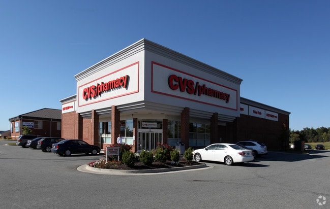
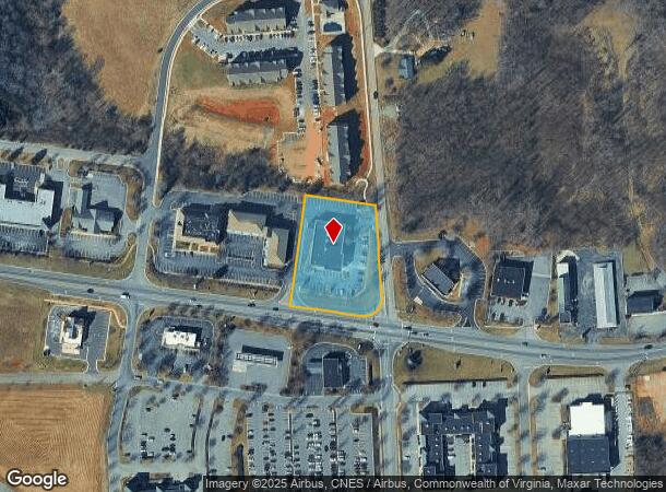
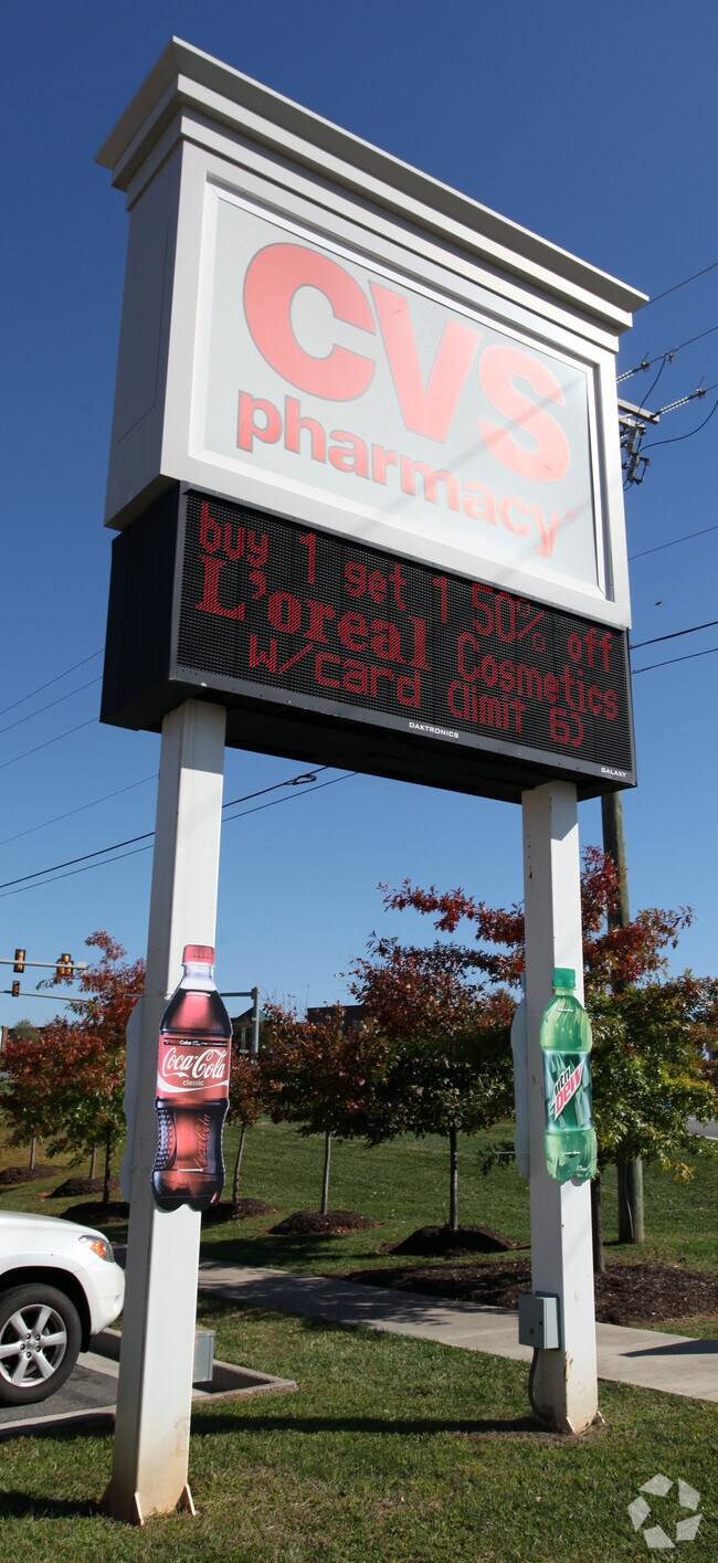
Property Record
12935 Booker T Washington Hwy, Hardy, VA 24101
NEARBY LISTINGS FOR SALE OR LEASE
Property Detail
12935 Booker T Washington Hwy
Roanoke, VA
Westlake Village Business Park
0300000103B
WESTLAKE VILLAGE BUSINESS PARK LOT 8
Drugstorepharmacycvswalgreens
Franklin
X
Virginia
51019C0550D
8
2025
1.73 AC
2025
North Franklin County
020302
Roanoke
11,016 SF
DEMOGRAPHICS near 12935 Booker T Washington Hwy
1 Mile
3 Mile
5 Mile
2024 Total Population
329
3,252
11,751
2029 Population
342
3,420
12,428
Pop Growth 2024-2029
+ 3.95%
+ 5.17%
+ 5.76%
Average Age
51
51
50
2024 Total Households
144
1,436
5,163
HH Growth 2024-2029
+ 4.17%
+ 5.15%
+ 5.81%
Median Household Inc
$63,750
$77,979
$79,182
Avg Household Size
2.20
2.20
2.20
2024 Avg HH Vehicles
2.00
2.00
2.00
Median Home Value
$375,861
$403,437
$385,472
Median Year Built
1992
1990
1990
Nearby Places
- Restaurants
- Banks
- Shops
- Fitness
- Groceries
PUBLIC TRANSPORTATION
AIRPORT
Roanoke/Blacksburg Regional (Woodrum Field)
DRIVE
WALK
Distance
Roanoke/Blacksburg Regional (Woodrum Field)
43 min
27.6 mi
Freight Ports
Virginia Port Authority - Richmond
DRIVE
WALK
Distance
Virginia Port Authority - Richmond
208 min
154.0 mi
Nearby Properties
Address
Land Use
TOTAL SIZE
Lot Size
Zoning
Address
Land Use
TOTAL SIZE
Lot Size
Zoning
37,702 SF
3.90 AC
PCD
Address
Land Use
TOTAL SIZE
Lot Size
Zoning
22,488 SF
5.86 AC
PCD
Address
Land Use
TOTAL SIZE
Lot Size
Zoning
40,454 SF
16.22 AC
SM
Address
Land Use
TOTAL SIZE
Lot Size
Zoning
69,458 SF
5.12 AC
PCD
Address
Land Use
TOTAL SIZE
Lot Size
Zoning
588.45 AC
SM
Address
Land Use
TOTAL SIZE
Lot Size
Zoning
29,863 SF
10.48 AC
PCD
Address
Land Use
TOTAL SIZE
Lot Size
Zoning
46,034 SF
5.99 AC
PCD
Address
Land Use
TOTAL SIZE
Lot Size
Zoning
41,054 SF
12.91 AC
B2
Address
Land Use
TOTAL SIZE
Lot Size
Zoning
18,044 SF
2.63 AC
PCD
Address
Land Use
TOTAL SIZE
Lot Size
Zoning
43,707 SF
4.37 AC
B2
Address
Land Use
TOTAL SIZE
Lot Size
Zoning
26,420 SF
13.83 AC
A1
Address
Land Use
TOTAL SIZE
Lot Size
Zoning
21,703 SF
6.34 AC
A1
Address
Land Use
TOTAL SIZE
Lot Size
Zoning
10,272 SF
19.60 AC
PCD
Address
Land Use
TOTAL SIZE
Lot Size
Zoning
15,000 SF
7.72 AC
B2
Address
Land Use
TOTAL SIZE
Lot Size
Zoning
56.62 AC
PCD
Address
Land Use
TOTAL SIZE
Lot Size
Zoning
21,360 SF
3.76 AC
PCD
Address
Land Use
TOTAL SIZE
Lot Size
Zoning
45,064 SF
3.02 AC
PCD
Address
Land Use
TOTAL SIZE
Lot Size
Zoning
19,676 SF
4.01 AC
PCD
Address
Land Use
TOTAL SIZE
Lot Size
Zoning
2,690 SF
5.54 AC
Address
Land Use
TOTAL SIZE
Lot Size
Zoning
21,120 SF
1.55 AC
B2
Address
Land Use
TOTAL SIZE
Lot Size
Zoning
57,250 SF
19.63 AC
B2
Address
Land Use
TOTAL SIZE
Lot Size
Zoning
19,102 SF
1.44 AC
B2
Address
Land Use
TOTAL SIZE
Lot Size
Zoning
8,860 SF
3.67 AC
B2
Address
Land Use
TOTAL SIZE
Lot Size
Zoning
4,450 SF
5.76 AC
RPD
Address
Land Use
TOTAL SIZE
Lot Size
Zoning
17,300 SF
1.42 AC
B2
Address
Land Use
TOTAL SIZE
Lot Size
Zoning
3,750 SF
1.08 AC
PCD
Address
Land Use
TOTAL SIZE
Lot Size
Zoning
6,300 SF
4.86 AC
B2
Address
Land Use
TOTAL SIZE
Lot Size
Zoning
6,091 SF
1.70 AC
B2
The World's #1 Commercial Real Estate Marketplace
Connect with us
© 2025 CoStar Group
The information above has been obtained from sources believed reliable. While we do not doubt its accuracy we have not verified it and make no guarantee, warranty or representation about it. It is your responsibility to independently confirm its accuracy and completeness. Any projections, opinions, assumptions, or estimates used are for example only and do not represent the current or future performance of the property. The value of this transaction to you depends on tax and other factors which should be evaluated by your tax, financial, and legal advisors. You and your advisors should conduct a careful, independent investigation of the property to determine to your satisfaction the suitability of the property for your needs.