Property Record
12954 Shady Hills Rd, Spring Hill, FL 34610

NEARBY LISTINGS FOR SALE OR LEASE
Property Detail
12954 Shady Hills Rd
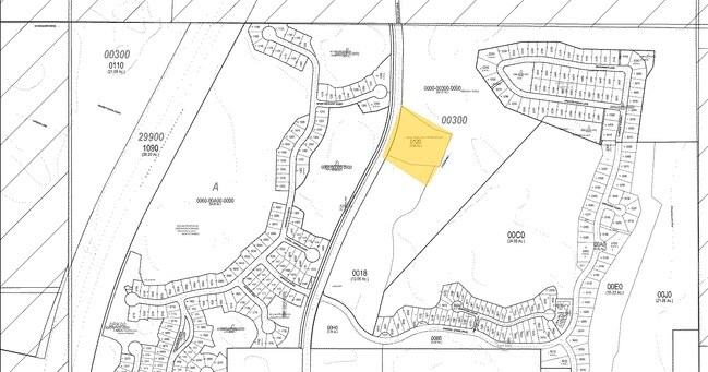
06-25-18-0000-00300-0000
Quail Ridge Unit One & Two
Agriculturalland
THAT POR OF THE FOLL DESC PCL LYING NORTH OF THE PCL DESC IN OR 9491 PG 2182: COM AT NE COR OF SECTION 6 FOR POB TH S00DG 3816E 974.55FT THN89DG0704 W511.55FTTHN07DG0051E531.02 FTTHN30DG5102E 118.76FTTHN04 DG0549E129.55FT THN89DG04 52W612.76FTTHN72DG
A
Pasco
12101C0206F
Florida
2024
23.80 AC
2026
Pasco County
031809
Tampa/St Petersburg
1,216 SF
Tampa-St. Petersburg-Clearwater, FL
DEMOGRAPHICS near 12954 Shady Hills Rd
1 Mile
3 Mile
5 Mile
2024 Total Population
1,818
12,384
34,680
2029 Population
2,183
15,152
42,268
Pop Growth 2024-2029
+ 20.08%
+ 22.35%
+ 21.88%
Average Age
38
40
41
2024 Total Households
661
4,517
12,813
HH Growth 2024-2029
+ 19.82%
+ 22.27%
+ 21.76%
Median Household Inc
$84,431
$76,240
$65,534
Avg Household Size
2.70
2.70
2.60
2024 Avg HH Vehicles
2.00
2.00
2.00
Median Home Value
$222,592
$268,333
$234,462
Median Year Built
2002
2006
2002
Nearby Places
Map Layers
Map Styles
 Street
 Aerial
- Restaurants
- Banks
- Shops
- Fitness
- Groceries
PUBLIC TRANSPORTATION
AIRPORT
Tampa International
DRIVE
WALK
Distance
Tampa International
47 min
32.2 mi
Freight Ports
Port of Tampa Bay
DRIVE
WALK
Distance
Port of Tampa Bay
58 min
34.3 mi
Nearby Properties
Address
Land Use
TOTAL SIZE
Lot Size
Zoning
Address
Land Use
TOTAL SIZE
Lot Size
Zoning
207,043 SF
18.17 AC
AC
Address
Land Use
TOTAL SIZE
Lot Size
Zoning
501,673 SF
37.63 AC
I1
Address
Land Use
TOTAL SIZE
Lot Size
Zoning
451,725 SF
34.99 AC
I1
Address
Land Use
TOTAL SIZE
Lot Size
Zoning
181,328 SF
88.76 AC
AC
Address
Land Use
TOTAL SIZE
Lot Size
Zoning
103,893 SF
4.80 AC
I1
Address
Land Use
TOTAL SIZE
Lot Size
Zoning
172,977 SF
433.08 AC
AC
Address
Land Use
TOTAL SIZE
Lot Size
Zoning
20,914 SF
8.10 AC
MPUD
Address
Land Use
TOTAL SIZE
Lot Size
Zoning
78,182 SF
18.60 AC
MPUD
Address
Land Use
TOTAL SIZE
Lot Size
Zoning
139,565 SF
303.79 AC
AC
Address
Land Use
TOTAL SIZE
Lot Size
Zoning
74,254 SF
19.66 AC
AC
Address
Land Use
TOTAL SIZE
Lot Size
Zoning
218.89 AC
AC
Address
Land Use
TOTAL SIZE
Lot Size
Zoning
85,400 SF
14.46 AC
I2
Address
Land Use
TOTAL SIZE
Lot Size
Zoning
73,003 SF
78.69 AC
AC
Address
Land Use
TOTAL SIZE
Lot Size
Zoning
10,449 SF
14.22 AC
C2
Address
Land Use
TOTAL SIZE
Lot Size
Zoning
16,669 SF
4.67 AC
MPUD
Address
Land Use
TOTAL SIZE
Lot Size
Zoning
16,108 SF
3.01 AC
MPUD
Address
Land Use
TOTAL SIZE
Lot Size
Zoning
3,080 SF
11.32 AC
I1
Address
Land Use
TOTAL SIZE
Lot Size
Zoning
29.77 AC
MPUD
Address
Land Use
TOTAL SIZE
Lot Size
Zoning
30,912 SF
176.98 AC
AC
Address
Land Use
TOTAL SIZE
Lot Size
Zoning
4,362 SF
1.59 AC
C1
Address
Land Use
TOTAL SIZE
Lot Size
Zoning
2,982 SF
8.84 AC
PO2
Address
Land Use
TOTAL SIZE
Lot Size
Zoning
24,184 SF
28.31 AC
C3
Address
Land Use
TOTAL SIZE
Lot Size
Zoning
19.24 AC
MF1
Address
Land Use
TOTAL SIZE
Lot Size
Zoning
4,859 SF
2.15 AC
MPUD
Address
Land Use
TOTAL SIZE
Lot Size
Zoning
55 AC
MPUD
Address
Land Use
TOTAL SIZE
Lot Size
Zoning
25.30 AC
MPUD
Address
Land Use
TOTAL SIZE
Lot Size
Zoning
18.65 AC
C2
Address
Land Use
TOTAL SIZE
Lot Size
Zoning
31,815 SF
5 AC
I2
Address
Land Use
TOTAL SIZE
Lot Size
Zoning
3.73 AC
MPUD
The World's #1 Commercial Real Estate Marketplace
Connect with us
© 2026 CoStar Group
The information above has been obtained from sources believed reliable. While we do not doubt its accuracy we have not verified it and make no guarantee, warranty or representation about it. It is your responsibility to independently confirm its accuracy and completeness. Any projections, opinions, assumptions, or estimates used are for example only and do not represent the current or future performance of the property. The value of this transaction to you depends on tax and other factors which should be evaluated by your tax, financial, and legal advisors. You and your advisors should conduct a careful, independent investigation of the property to determine to your satisfaction the suitability of the property for your needs.