Property Record
1296 Worcester Rd, Framingham, MA 01702
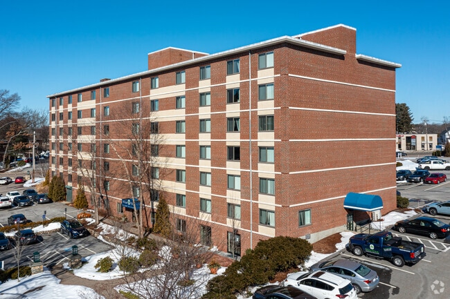

Property Detail
1296 Worcester Rd
FRAM-000099-000093-004067
Middlesex
Apartment
Massachusetts
B
4067
B and X Area of moderate flood hazard, usually the area between the limits of the 100-year and 500-year floods.
7.46 AC
2025
Metro West
2025
Boston
384003
Boston-Cambridge-Newton, MA-NH
273,474 SF
NEARBY LISTINGS FOR SALE OR LEASE
DEMOGRAPHICS near 1296 Worcester Rd
1 mile
3 mile
5 mile
2025 Total Population
10,571
76,426
145,475
2030 Population
11,123
79,842
151,657
Pop Growth 2025-2030
+ 5.22%
+ 4.47%
+ 4.25%
Average Age
39
40
41
2025 Total Households
4,005
28,877
56,018
HH Growth 2025-2030
+ 5.67%
+ 4.67%
+ 4.38%
Median Household Inc
$107,262
$102,006
$114,214
Avg Household Size
2.20
2.50
2.50
2025 Avg HH Vehicles
2.00
2.00
2.00
Median Home Value
$720,306
$696,127
$710,070
Median Year Built
1972
1966
1970
Nearby Places
Map Layers
Map Styles
 Street
 Aerial
Layers
 Traffic
 Biking
Places
Listings with unknown addresses are not visible on the map
- Restaurants
- Banks
- Shops
- Fitness
- Groceries
PUBLIC TRANSPORTATION
COMMUTER RAIL
Framingham (Framingham/Worcester Line - Massachusetts Bay Transportation Authority Commuter Rail (Purple Line))
Drive
Walk
Distance
Framingham (Framingham/Worcester Line - Massachusetts Bay Transportation Authority Commuter Rail (Purple Line))
7 min
2.9 mi
Framingham Amtrak (Lake Shore Limited - Amtrak)
Drive
Walk
Distance
Framingham Amtrak (Lake Shore Limited - Amtrak)
7 min
3.0 mi
AIRPORT
Worcester Regional
Drive
Walk
Distance
Worcester Regional
40 min
23.7 mi
General Edward Lawrence Logan International
Drive
Walk
Distance
General Edward Lawrence Logan International
38 min
25.8 mi
Freight Ports
Port of Boston
Drive
Walk
Distance
Port of Boston
37 min
24.1 mi
Nearby Properties
Address
Land Use
TOTAL SIZE
Lot Size
Zoning
Address
Land Use
TOTAL SIZE
Lot Size
Zoning
478,440 SF
11.97 AC
B
Address
Land Use
TOTAL SIZE
Lot Size
Zoning
396,002 SF
44.44 AC
R1
Address
Land Use
TOTAL SIZE
Lot Size
Zoning
906,841 SF
47.93 AC
M1
Address
Land Use
TOTAL SIZE
Lot Size
Zoning
664,397 SF
15.78 AC
TP
Address
Land Use
TOTAL SIZE
Lot Size
Zoning
340,840 SF
4.25 AC
B
Address
Land Use
TOTAL SIZE
Lot Size
Zoning
137,000 SF
18.96 AC
R1
Address
Land Use
TOTAL SIZE
Lot Size
Zoning
292,608 SF
5.19 AC
B
Address
Land Use
TOTAL SIZE
Lot Size
Zoning
493,918 SF
28.90 AC
R1
Address
Land Use
TOTAL SIZE
Lot Size
Zoning
293,180 SF
5.10 AC
B
Address
Land Use
TOTAL SIZE
Lot Size
Zoning
264,247 SF
6.09 AC
M1
Address
Land Use
TOTAL SIZE
Lot Size
Zoning
444,182 SF
32.91 AC
TP
Address
Land Use
TOTAL SIZE
Lot Size
Zoning
256,830 SF
12.61 AC
B
Address
Land Use
TOTAL SIZE
Lot Size
Zoning
207,522 SF
10.11 AC
B
Address
Land Use
TOTAL SIZE
Lot Size
Zoning
191,520 SF
7.99 AC
B
Address
Land Use
TOTAL SIZE
Lot Size
Zoning
191,520 SF
5.03 AC
B
Address
Land Use
TOTAL SIZE
Lot Size
Zoning
182,524 SF
3.60 AC
B2
Address
Land Use
TOTAL SIZE
Lot Size
Zoning
244,033 SF
25.75 AC
R1
Address
Land Use
TOTAL SIZE
Lot Size
Zoning
372,275 SF
3.05 AC
CB
Address
Land Use
TOTAL SIZE
Lot Size
Zoning
139,356 SF
52 AC
30
Address
Land Use
TOTAL SIZE
Lot Size
Zoning
251,366 SF
14.42 AC
G
Address
Land Use
TOTAL SIZE
Lot Size
Zoning
231,897 SF
7.90 AC
B
Address
Land Use
TOTAL SIZE
Lot Size
Zoning
3.02 AC
CB
Address
Land Use
TOTAL SIZE
Lot Size
Zoning
174,988 SF
5.54 AC
TP
Address
Land Use
TOTAL SIZE
Lot Size
Zoning
183,338 SF
4.85 AC
B2
Address
Land Use
TOTAL SIZE
Lot Size
Zoning
15,204 SF
5.79 AC
BH
Address
Land Use
TOTAL SIZE
Lot Size
Zoning
112,000 SF
18.48 AC
R1
Address
Land Use
TOTAL SIZE
Lot Size
Zoning
112,000 SF
15.11 AC
G
Address
Land Use
TOTAL SIZE
Lot Size
Zoning
150,636 SF
30.34 AC
GE
Address
Land Use
TOTAL SIZE
Lot Size
Zoning
239,454 SF
12.65 AC
R3
The World's #1 Commercial Real Estate Marketplace
Connect with us
© 2026 CoStar Group
The information above has been obtained from sources believed reliable. While we do not doubt its accuracy we have not verified it and make no guarantee, warranty or representation about it. It is your responsibility to independently confirm its accuracy and completeness. Any projections, opinions, assumptions, or estimates used are for example only and do not represent the current or future performance of the property. The value of this transaction to you depends on tax and other factors which should be evaluated by your tax, financial, and legal advisors. You and your advisors should conduct a careful, independent investigation of the property to determine to your satisfaction the suitability of the property for your needs.