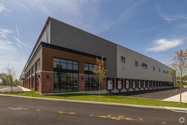
Property Record
1297 W Broad St, Stratford, CT 06615

NEARBY LISTINGS FOR SALE OR LEASE
Property Detail
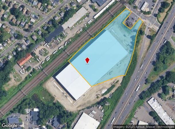
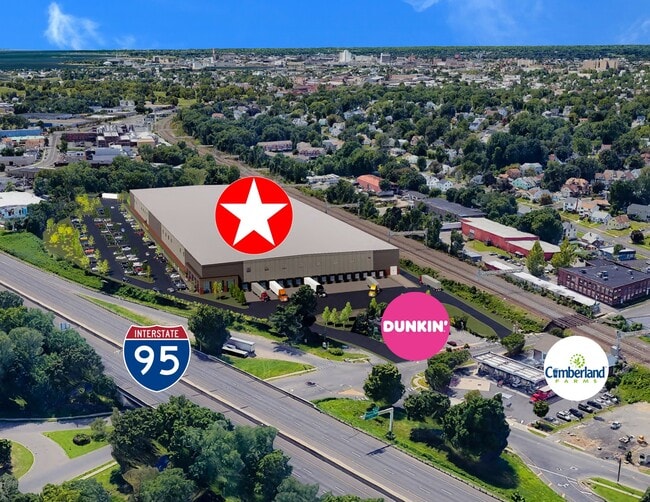
1297 W Broad St
STRA-000409-000017-000001
Fairfield
Industrialgeneral
Connecticut
AE
1
09001C0434G
7.05 AC
2025
Stratford
2025
Westchester/So Connecticut
080400
Bridgeport-Stamford-Norwalk, CT
231,026 SF
DEMOGRAPHICS near 1297 W Broad St
1 Mile
3 Mile
5 Mile
2024 Total Population
17,504
106,560
233,079
2029 Population
17,365
106,510
233,392
Pop Growth 2024-2029
(0.79%)
(0.05%)
+ 0.13%
Average Age
40
40
39
2024 Total Households
6,574
40,843
87,334
HH Growth 2024-2029
(0.84%)
0.00%
+ 0.14%
Median Household Inc
$73,039
$65,864
$64,249
Avg Household Size
2.60
2.50
2.60
2024 Avg HH Vehicles
2.00
2.00
2.00
Median Home Value
$249,493
$266,633
$274,818
Median Year Built
1953
1952
1954
Nearby Places
Map Layers
Map Styles
 Street
 Aerial
- Restaurants
- Banks
- Shops
- Fitness
- Groceries
PUBLIC TRANSPORTATION
COMMUTER RAIL
Stratford Station (New Haven Line - Metro-North Commuter Railroad Company (Metro-North))
DRIVE
WALK
Distance
Stratford Station (New Haven Line - Metro-North Commuter Railroad Company (Metro-North))
3 min
11 min
0.6 mi
Bridgeport Station (New Haven Line - Shore Line East, Shore Line East - Shore Line East)
DRIVE
WALK
Distance
Bridgeport Station (New Haven Line - Shore Line East, Shore Line East - Shore Line East)
8 min
4.5 mi
AIRPORT
Tweed/New Haven
DRIVE
WALK
Distance
Tweed/New Haven
32 min
19.5 mi
Long Island MacArthur
DRIVE
WALK
Distance
Long Island MacArthur
115 min
38.3 mi
Freight Ports
Port of New Haven
DRIVE
WALK
Distance
Port of New Haven
27 min
16.6 mi
Nearby Properties
Address
Land Use
TOTAL SIZE
Lot Size
Zoning
Address
Land Use
TOTAL SIZE
Lot Size
Zoning
Address
Land Use
TOTAL SIZE
Lot Size
Zoning
22.85 AC
Address
Land Use
TOTAL SIZE
Lot Size
Zoning
145,000 SF
15.70 AC
ILI
Address
Land Use
TOTAL SIZE
Lot Size
Zoning
4.14 AC
MUEM
Address
Land Use
TOTAL SIZE
Lot Size
Zoning
178,265 SF
6.92 AC
Address
Land Use
TOTAL SIZE
Lot Size
Zoning
83,122 SF
4.39 AC
Address
Land Use
TOTAL SIZE
Lot Size
Zoning
497,430 SF
4.16 AC
DCB
Address
Land Use
TOTAL SIZE
Lot Size
Zoning
23 AC
RC
Address
Land Use
TOTAL SIZE
Lot Size
Zoning
162,376 SF
7.82 AC
Address
Land Use
TOTAL SIZE
Lot Size
Zoning
585,480 SF
3.66 AC
Address
Land Use
TOTAL SIZE
Lot Size
Zoning
23.70 AC
RB
Address
Land Use
TOTAL SIZE
Lot Size
Zoning
92,318 SF
5.33 AC
Address
Land Use
TOTAL SIZE
Lot Size
Zoning
104,284 SF
13.36 AC
CDD5
Address
Land Use
TOTAL SIZE
Lot Size
Zoning
368,000 SF
18.69 AC
D-17
Address
Land Use
TOTAL SIZE
Lot Size
Zoning
216,972 SF
2.53 AC
DCB
Address
Land Use
TOTAL SIZE
Lot Size
Zoning
225,264 SF
28.22 AC
MC
Address
Land Use
TOTAL SIZE
Lot Size
Zoning
31.70 AC
R30
Address
Land Use
TOTAL SIZE
Lot Size
Zoning
110,506 SF
0.06 AC
RBB
Address
Land Use
TOTAL SIZE
Lot Size
Zoning
2.40 AC
DCB
Address
Land Use
TOTAL SIZE
Lot Size
Zoning
745,516 SF
32.74 AC
HDD
Address
Land Use
TOTAL SIZE
Lot Size
Zoning
56,762 SF
13.34 AC
BZZ
Address
Land Use
TOTAL SIZE
Lot Size
Zoning
2 AC
DCB
Address
Land Use
TOTAL SIZE
Lot Size
Zoning
722 SF
47.10 AC
RM-1
Address
Land Use
TOTAL SIZE
Lot Size
Zoning
630 SF
107.70 AC
RA
Address
Land Use
TOTAL SIZE
Lot Size
Zoning
265,059 SF
47.61 AC
F-17
Address
Land Use
TOTAL SIZE
Lot Size
Zoning
90 AC
RA
Address
Land Use
TOTAL SIZE
Lot Size
Zoning
8.27 AC
C
Address
Land Use
TOTAL SIZE
Lot Size
Zoning
160,957 SF
26.40 AC
R12.
Address
Land Use
TOTAL SIZE
Lot Size
Zoning
89,760 SF
18.58 AC
RM-1
Address
Land Use
TOTAL SIZE
Lot Size
Zoning
128,236 SF
2.88 AC
E-13
The World's #1 Commercial Real Estate Marketplace
Connect with us
© 2025 CoStar Group
The information above has been obtained from sources believed reliable. While we do not doubt its accuracy we have not verified it and make no guarantee, warranty or representation about it. It is your responsibility to independently confirm its accuracy and completeness. Any projections, opinions, assumptions, or estimates used are for example only and do not represent the current or future performance of the property. The value of this transaction to you depends on tax and other factors which should be evaluated by your tax, financial, and legal advisors. You and your advisors should conduct a careful, independent investigation of the property to determine to your satisfaction the suitability of the property for your needs.