Property Record
12970 Corkscrew Rd, Estero, FL 33928


Property Detail
12970 Corkscrew Rd
Cape Coral-Fort Myers, FL
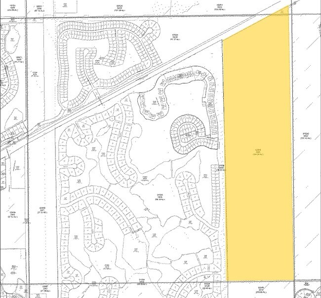
THAT PT OF S E 1/4 OF S E 1/4 LYING SOUTH OF CORKSCREW RD LESS RD ROW DESC IN INST#2006-180859
19-46-26-E3-U2613.2570
LEE
Residentialacreage
Florida
RPD
1
B and X Area of moderate flood hazard, usually the area between the limits of the 100-year and 500-year floods.
0.81 AC
2025
Estero
2025
Southwest Florida
050210
NEARBY LISTINGS FOR SALE OR LEASE
DEMOGRAPHICS near 12970 Corkscrew Rd
1 mile
3 mile
5 mile
2025 Total Population
3,801
20,997
58,780
2030 Population
4,297
23,673
65,370
Pop Growth 2025-2030
+ 13.05%
+ 12.74%
+ 11.21%
Average Age
49
46
48
2025 Total Households
1,601
8,886
24,931
HH Growth 2025-2030
+ 12.37%
+ 12.26%
+ 10.89%
Median Household Inc
$123,041
$103,283
$100,740
Avg Household Size
2.30
2.20
2.20
2025 Avg HH Vehicles
2.00
2.00
2.00
Median Home Value
$649,101
$563,648
$497,304
Median Year Built
2010
2008
2004
Nearby Places
Map Layers
Map Styles
 Street
 Aerial
Layers
 Traffic
 Biking
Places
Listings with unknown addresses are not visible on the map
- Restaurants
- Banks
- Shops
- Fitness
- Groceries
PUBLIC TRANSPORTATION
AIRPORT
Southwest Florida International
Drive
Walk
Distance
Southwest Florida International
21 min
13.8 mi
Freight Ports
Port Manatee
Drive
Walk
Distance
Port Manatee
129 min
113.6 mi
Nearby Properties
Address
Land Use
TOTAL SIZE
Lot Size
Zoning
Address
Land Use
TOTAL SIZE
Lot Size
Zoning
4,413,774 SF
760.09 AC
AG-2
Address
Land Use
TOTAL SIZE
Lot Size
Zoning
20.19 AC
MPD
Address
Land Use
TOTAL SIZE
Lot Size
Zoning
482,782 SF
27.98 AC
CPD
Address
Land Use
TOTAL SIZE
Lot Size
Zoning
294,689 SF
17.95 AC
MPD
Address
Land Use
TOTAL SIZE
Lot Size
Zoning
345,170 SF
21.32 AC
RPD
Address
Land Use
TOTAL SIZE
Lot Size
Zoning
291,157 SF
23.38 AC
RPD
Address
Land Use
TOTAL SIZE
Lot Size
Zoning
320,574 SF
16.10 AC
MPD
Address
Land Use
TOTAL SIZE
Lot Size
Zoning
14,515 SF
468.10 AC
AG-2
Address
Land Use
TOTAL SIZE
Lot Size
Zoning
240,044 SF
14.19 AC
MPD
Address
Land Use
TOTAL SIZE
Lot Size
Zoning
69.37 AC
RPD
Address
Land Use
TOTAL SIZE
Lot Size
Zoning
236,456 SF
27.05 AC
MPD
Address
Land Use
TOTAL SIZE
Lot Size
Zoning
166,672 SF
8.58 AC
CPD
Address
Land Use
TOTAL SIZE
Lot Size
Zoning
174,712 SF
9.70 AC
MPD
Address
Land Use
TOTAL SIZE
Lot Size
Zoning
139,174 SF
4.73 AC
CPD
Address
Land Use
TOTAL SIZE
Lot Size
Zoning
151,366 SF
15.47 AC
CPD
Address
Land Use
TOTAL SIZE
Lot Size
Zoning
120,254 SF
5.32 AC
CPD
Address
Land Use
TOTAL SIZE
Lot Size
Zoning
101,930 SF
6.60 AC
CPD
Address
Land Use
TOTAL SIZE
Lot Size
Zoning
98,312 SF
8.71 AC
MPD
Address
Land Use
TOTAL SIZE
Lot Size
Zoning
269,023 SF
13.60 AC
CPD
Address
Land Use
TOTAL SIZE
Lot Size
Zoning
119,757 SF
37.66 AC
PUD
Address
Land Use
TOTAL SIZE
Lot Size
Zoning
195.10 AC
MPD
Address
Land Use
TOTAL SIZE
Lot Size
Zoning
68,187 SF
2.47 AC
CPD
Address
Land Use
TOTAL SIZE
Lot Size
Zoning
88,785 SF
8.73 AC
MPD
Address
Land Use
TOTAL SIZE
Lot Size
Zoning
58,339 SF
2 AC
CPD
Address
Land Use
TOTAL SIZE
Lot Size
Zoning
62,495 SF
9.01 AC
CPD
Address
Land Use
TOTAL SIZE
Lot Size
Zoning
38,496 SF
10.29 AC
AG-2
Address
Land Use
TOTAL SIZE
Lot Size
Zoning
28,750 SF
5.05 AC
MPD
Address
Land Use
TOTAL SIZE
Lot Size
Zoning
44.41 AC
MPD
Address
Land Use
TOTAL SIZE
Lot Size
Zoning
30,448 SF
2 AC
MPD
Address
Land Use
TOTAL SIZE
Lot Size
Zoning
1,440 SF
499.27 AC
IPD
The World's #1 Commercial Real Estate Marketplace
Connect with us
© 2026 CoStar Group
The information above has been obtained from sources believed reliable. While we do not doubt its accuracy we have not verified it and make no guarantee, warranty or representation about it. It is your responsibility to independently confirm its accuracy and completeness. Any projections, opinions, assumptions, or estimates used are for example only and do not represent the current or future performance of the property. The value of this transaction to you depends on tax and other factors which should be evaluated by your tax, financial, and legal advisors. You and your advisors should conduct a careful, independent investigation of the property to determine to your satisfaction the suitability of the property for your needs.