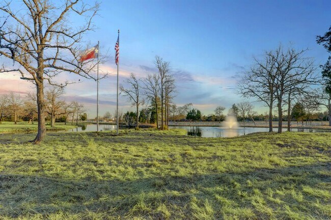
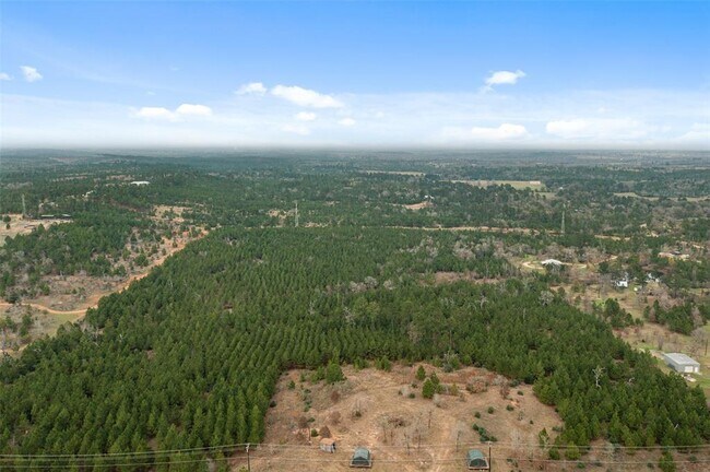
Property Record
1298 E Sh 71 E, Bastrop, TX 78602

Property Detail
1298 E Sh 71 E
Austin-Round Rock-San Marcos, TX
A39 HIGHSMITH, A. M., ACRES 47.258
16260
BASTROP
Agriculturalland
Texas
B and X Area of moderate flood hazard, usually the area between the limits of the 100-year and 500-year floods.
47.26 AC
2024
Bastrop County
2025
Austin
950502
NEARBY LISTINGS FOR SALE OR LEASE
DEMOGRAPHICS near 1298 E Sh 71 E
1 mile
3 mile
5 mile
2025 Total Population
588
3,514
11,088
2030 Population
669
4,016
12,718
Pop Growth 2025-2030
+ 13.78%
+ 14.29%
+ 14.70%
Average Age
42
43
42
2025 Total Households
235
1,377
4,320
HH Growth 2025-2030
+ 14.04%
+ 14.60%
+ 15.16%
Median Household Inc
$67,500
$77,809
$83,369
Avg Household Size
2.50
2.50
2.50
2025 Avg HH Vehicles
2.00
2.00
2.00
Median Home Value
$304,082
$344,559
$354,351
Median Year Built
2002
2005
2005
Nearby Places
Map Layers
Map Styles
 Street
 Aerial
Transit
 Traffic
 Biking
Places
Listings with unknown addresses are not visible on the map
- Restaurants
- Banks
- Shops
- Fitness
- Groceries
PUBLIC TRANSPORTATION
AIRPORT
Austin-Bergstrom International
Drive
Walk
Distance
Austin-Bergstrom International
47 min
33.2 mi
Freight Ports
Calhoun Port
Drive
Walk
Distance
Calhoun Port
163 min
138.9 mi
SALE & LEASE HISTORY
LISTING DATE
SALE/LEASE

Mar 18, 2022
For Sale
Mar 02, 2022
For Sale
Nearby Properties
Address
Land Use
TOTAL SIZE
Lot Size
Zoning
Address
Land Use
TOTAL SIZE
Lot Size
Zoning
Address
Land Use
TOTAL SIZE
Lot Size
Zoning
4,907 SF
10.28 AC
Address
Land Use
TOTAL SIZE
Lot Size
Zoning
6,972 SF
71.30 AC
Address
Land Use
TOTAL SIZE
Lot Size
Zoning
13,608 SF
11.19 AC
Address
Land Use
TOTAL SIZE
Lot Size
Zoning
22.38 AC
Address
Land Use
TOTAL SIZE
Lot Size
Zoning
72.49 AC
Address
Land Use
TOTAL SIZE
Lot Size
Zoning
30,446 SF
141.24 AC
Address
Land Use
TOTAL SIZE
Lot Size
Zoning
2,236 SF
61 AC
Address
Land Use
TOTAL SIZE
Lot Size
Zoning
3,237 SF
15.64 AC
Address
Land Use
TOTAL SIZE
Lot Size
Zoning
4,793 SF
106.09 AC
Address
Land Use
TOTAL SIZE
Lot Size
Zoning
7,150 SF
5.94 AC
Address
Land Use
TOTAL SIZE
Lot Size
Zoning
22,980 SF
2.52 AC
Address
Land Use
TOTAL SIZE
Lot Size
Zoning
11,201 SF
2.57 AC
Address
Land Use
TOTAL SIZE
Lot Size
Zoning
3,600 SF
5 AC
Address
Land Use
TOTAL SIZE
Lot Size
Zoning
4,503 SF
0.42 AC
Address
Land Use
TOTAL SIZE
Lot Size
Zoning
3,214 SF
0.34 AC
Address
Land Use
TOTAL SIZE
Lot Size
Zoning
4,801 SF
2.04 AC
Address
Land Use
TOTAL SIZE
Lot Size
Zoning
12,392 SF
25 AC
Address
Land Use
TOTAL SIZE
Lot Size
Zoning
7,125 SF
7.36 AC
Address
Land Use
TOTAL SIZE
Lot Size
Zoning
3,111 SF
5 AC
Address
Land Use
TOTAL SIZE
Lot Size
Zoning
4,203 SF
10 AC
Address
Land Use
TOTAL SIZE
Lot Size
Zoning
9,860 SF
1.18 AC
Address
Land Use
TOTAL SIZE
Lot Size
Zoning
3,984 SF
40 AC
Address
Land Use
TOTAL SIZE
Lot Size
Zoning
2,532 SF
6 AC
Address
Land Use
TOTAL SIZE
Lot Size
Zoning
27.26 AC
Address
Land Use
TOTAL SIZE
Lot Size
Zoning
2,072 SF
1.44 AC
Address
Land Use
TOTAL SIZE
Lot Size
Zoning
3,420 SF
9.48 AC
The World's #1 Commercial Real Estate Marketplace
Connect with us
© 2026 CoStar Group
The information above has been obtained from sources believed reliable. While we do not doubt its accuracy we have not verified it and make no guarantee, warranty or representation about it. It is your responsibility to independently confirm its accuracy and completeness. Any projections, opinions, assumptions, or estimates used are for example only and do not represent the current or future performance of the property. The value of this transaction to you depends on tax and other factors which should be evaluated by your tax, financial, and legal advisors. You and your advisors should conduct a careful, independent investigation of the property to determine to your satisfaction the suitability of the property for your needs.