Property Record
1298 New Cut Rd, Spartanburg, SC 29303


NEARBY LISTINGS FOR SALE OR LEASE
Property Detail
1298 New Cut Rd
6-12-00-096.00
S SIDE RD 65 & E SIDE RD 30 PB 102-337-337A
Commercialnec
Spartanburg
X
South Carolina
45083C0251D
25.42 AC
0
North Side/Rt 9 Corr
2025
Greenville/Spartanburg
021805
Spartanburg, SC
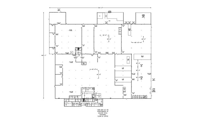
7,524 SF
DEMOGRAPHICS near 1298 New Cut Rd
1 Mile
3 Mile
5 Mile
2024 Total Population
2,673
34,259
101,851
2029 Population
3,014
38,710
115,551
Pop Growth 2024-2029
+ 12.76%
+ 12.99%
+ 13.45%
Average Age
35
36
37
2024 Total Households
755
12,605
38,896
HH Growth 2024-2029
+ 13.25%
+ 13.44%
+ 13.97%
Median Household Inc
$32,450
$44,892
$49,529
Avg Household Size
2.80
2.50
2.40
2024 Avg HH Vehicles
2.00
2.00
2.00
Median Home Value
$86,718
$142,228
$169,812
Median Year Built
1988
1983
1986
Nearby Places
Map Layers
Map Styles
 Street
 Aerial
- Restaurants
- Banks
- Shops
- Fitness
- Groceries
PUBLIC TRANSPORTATION
COMMUTER RAIL
Spartanburg Amtrak Station (Crescent - Amtrak)
DRIVE
WALK
Distance
Spartanburg Amtrak Station (Crescent - Amtrak)
10 min
4.1 mi
AIRPORT
Greenville Spartanburg International
DRIVE
WALK
Distance
Greenville Spartanburg International
25 min
16.5 mi
Freight Ports
North Charleston Terminal
DRIVE
WALK
Distance
North Charleston Terminal
220 min
196.5 mi
SALE & LEASE HISTORY
LISTING DATE
SALE/LEASE

Jun 13, 2023
For Lease
Feb 26, 2021
For Sale
Nearby Properties
Address
Land Use
TOTAL SIZE
Lot Size
Zoning
Address
Land Use
TOTAL SIZE
Lot Size
Zoning
5,130 SF
19.69 AC
Address
Land Use
TOTAL SIZE
Lot Size
Zoning
4,172 SF
15.98 AC
Address
Land Use
TOTAL SIZE
Lot Size
Zoning
2,134 SF
27.72 AC
Address
Land Use
TOTAL SIZE
Lot Size
Zoning
5,547 SF
6.58 AC
Address
Land Use
TOTAL SIZE
Lot Size
Zoning
175,000 SF
17.70 AC
Address
Land Use
TOTAL SIZE
Lot Size
Zoning
100,000 SF
8.29 AC
Address
Land Use
TOTAL SIZE
Lot Size
Zoning
19,876 SF
0.03 AC
Address
Land Use
TOTAL SIZE
Lot Size
Zoning
239,095 SF
22.41 AC
Address
Land Use
TOTAL SIZE
Lot Size
Zoning
128,755 SF
4.47 AC
Address
Land Use
TOTAL SIZE
Lot Size
Zoning
12,069 SF
0.03 AC
Address
Land Use
TOTAL SIZE
Lot Size
Zoning
Address
Land Use
TOTAL SIZE
Lot Size
Zoning
64,092 SF
30.61 AC
Address
Land Use
TOTAL SIZE
Lot Size
Zoning
122,626 SF
7.70 AC
Address
Land Use
TOTAL SIZE
Lot Size
Zoning
8,872 SF
0.03 AC
Address
Land Use
TOTAL SIZE
Lot Size
Zoning
37.35 AC
Address
Land Use
TOTAL SIZE
Lot Size
Zoning
23,884 SF
3.90 AC
Address
Land Use
TOTAL SIZE
Lot Size
Zoning
1,475 SF
41.85 AC
Address
Land Use
TOTAL SIZE
Lot Size
Zoning
1,221,473 SF
36.50 AC
Address
Land Use
TOTAL SIZE
Lot Size
Zoning
341,895 SF
31.62 AC
Address
Land Use
TOTAL SIZE
Lot Size
Zoning
81,040 SF
15.39 AC
Address
Land Use
TOTAL SIZE
Lot Size
Zoning
33,550 SF
3.77 AC
Address
Land Use
TOTAL SIZE
Lot Size
Zoning
101,622 SF
19.63 AC
Address
Land Use
TOTAL SIZE
Lot Size
Zoning
20,976 SF
23.72 AC
Address
Land Use
TOTAL SIZE
Lot Size
Zoning
41,694 SF
4.01 AC
Address
Land Use
TOTAL SIZE
Lot Size
Zoning
2,328 SF
16.99 AC
Address
Land Use
TOTAL SIZE
Lot Size
Zoning
5,888 SF
17.04 AC
Address
Land Use
TOTAL SIZE
Lot Size
Zoning
8,911 SF
23.64 AC
Address
Land Use
TOTAL SIZE
Lot Size
Zoning
6,816 SF
14.16 AC
Address
Land Use
TOTAL SIZE
Lot Size
Zoning
39.65 AC
Address
Land Use
TOTAL SIZE
Lot Size
Zoning
5,693 SF
0.03 AC
The World's #1 Commercial Real Estate Marketplace
Connect with us
© 2026 CoStar Group
The information above has been obtained from sources believed reliable. While we do not doubt its accuracy we have not verified it and make no guarantee, warranty or representation about it. It is your responsibility to independently confirm its accuracy and completeness. Any projections, opinions, assumptions, or estimates used are for example only and do not represent the current or future performance of the property. The value of this transaction to you depends on tax and other factors which should be evaluated by your tax, financial, and legal advisors. You and your advisors should conduct a careful, independent investigation of the property to determine to your satisfaction the suitability of the property for your needs.