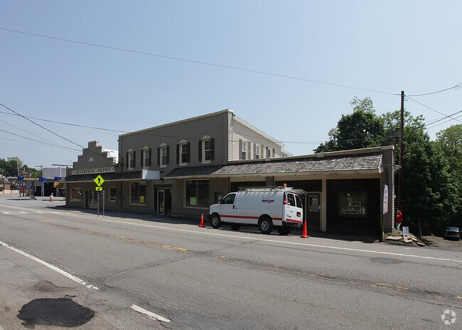
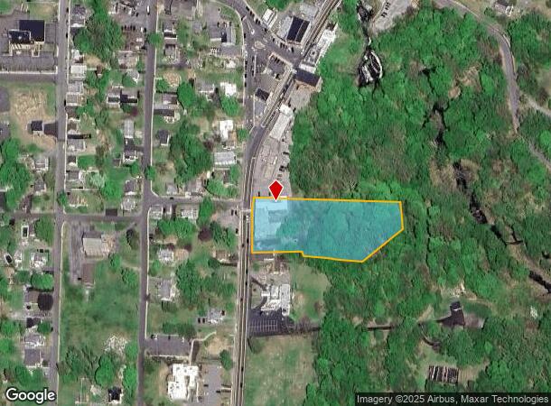
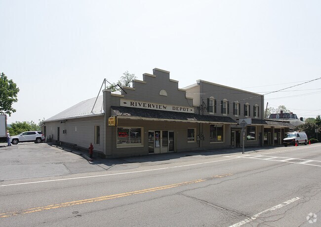
Property Record
1298 Route 9W, Marlboro, NY 12542
NEARBY LISTINGS FOR SALE OR LEASE
Property Detail
1298 Route 9W
Commercialofficeresidentialmixeduse
Ulster
X
New York
36111C0905E
25.110
2025
1.90 AC
2024
Other Market Areas
953800
Kingston, NY
10,324 SF
3600-108.004-0003-025.110-0000
DEMOGRAPHICS near 1298 Route 9W
1 Mile
3 Mile
5 Mile
2024 Total Population
1,976
14,807
51,628
2029 Population
1,921
14,742
51,558
Pop Growth 2024-2029
(2.78%)
(0.44%)
(0.14%)
Average Age
43
42
42
2024 Total Households
824
5,893
20,089
HH Growth 2024-2029
(2.79%)
(0.44%)
(0.17%)
Median Household Inc
$103,211
$92,845
$98,441
Avg Household Size
2.40
2.50
2.50
2024 Avg HH Vehicles
2.00
2.00
2.00
Median Home Value
$322,527
$319,747
$340,815
Median Year Built
1968
1967
1970
Nearby Places
- Restaurants
- Banks
- Shops
- Fitness
- Groceries
PUBLIC TRANSPORTATION
AIRPORT
New York Stewart International
DRIVE
WALK
Distance
New York Stewart International
21 min
13.9 mi
Freight Ports
Port of New Haven
DRIVE
WALK
Distance
Port of New Haven
107 min
80.6 mi
SALE & LEASE HISTORY
LISTING DATE
SALE/LEASE

Feb 19, 2019
For Lease
Nearby Properties
Address
Land Use
TOTAL SIZE
Lot Size
Zoning
Address
Land Use
TOTAL SIZE
Lot Size
Zoning
Address
Land Use
TOTAL SIZE
Lot Size
Zoning
114 AC
Address
Land Use
TOTAL SIZE
Lot Size
Zoning
535,543 SF
72.62 AC
BSC
Address
Land Use
TOTAL SIZE
Lot Size
Zoning
141,167 SF
46.50 AC
R1
Address
Land Use
TOTAL SIZE
Lot Size
Zoning
100 SF
5.70 AC
IN
Address
Land Use
TOTAL SIZE
Lot Size
Zoning
1,095 SF
21.70 AC
R1
Address
Land Use
TOTAL SIZE
Lot Size
Zoning
128,806 SF
11.93 AC
BSC
Address
Land Use
TOTAL SIZE
Lot Size
Zoning
50.90 AC
Address
Land Use
TOTAL SIZE
Lot Size
Zoning
35 AC
R40
Address
Land Use
TOTAL SIZE
Lot Size
Zoning
43,877 SF
10.10 AC
R1
Address
Land Use
TOTAL SIZE
Lot Size
Zoning
22 AC
R40
Address
Land Use
TOTAL SIZE
Lot Size
Zoning
29,027 SF
4.34 AC
RM2
Address
Land Use
TOTAL SIZE
Lot Size
Zoning
59,033 SF
87.70 AC
IN
Address
Land Use
TOTAL SIZE
Lot Size
Zoning
25,045 SF
4.90 AC
RAG1
Address
Land Use
TOTAL SIZE
Lot Size
Zoning
92,346 SF
665.31 AC
Q
Address
Land Use
TOTAL SIZE
Lot Size
Zoning
247.75 AC
R4A
Address
Land Use
TOTAL SIZE
Lot Size
Zoning
138.90 AC
Address
Land Use
TOTAL SIZE
Lot Size
Zoning
54,908 SF
7.60 AC
HD
Address
Land Use
TOTAL SIZE
Lot Size
Zoning
14.30 AC
RAG1
Address
Land Use
TOTAL SIZE
Lot Size
Zoning
11,367 SF
14.97 AC
R80
Address
Land Use
TOTAL SIZE
Lot Size
Zoning
24,192 SF
3.40 AC
RM1
Address
Land Use
TOTAL SIZE
Lot Size
Zoning
50,657 SF
15.60 AC
R1
Address
Land Use
TOTAL SIZE
Lot Size
Zoning
0.01 AC
R80
Address
Land Use
TOTAL SIZE
Lot Size
Zoning
15,154 SF
20.70 AC
R12.5
Address
Land Use
TOTAL SIZE
Lot Size
Zoning
161,390 SF
21.20 AC
HD
Address
Land Use
TOTAL SIZE
Lot Size
Zoning
43,633 SF
99.63 AC
R80
Address
Land Use
TOTAL SIZE
Lot Size
Zoning
28,422 SF
38.70 AC
R40/80
Address
Land Use
TOTAL SIZE
Lot Size
Zoning
15,948 SF
6.51 AC
RM
Address
Land Use
TOTAL SIZE
Lot Size
Zoning
42,008 SF
9.30 AC
R7.5
Address
Land Use
TOTAL SIZE
Lot Size
Zoning
40.30 AC
The World's #1 Commercial Real Estate Marketplace
Connect with us
© 2025 CoStar Group
The information above has been obtained from sources believed reliable. While we do not doubt its accuracy we have not verified it and make no guarantee, warranty or representation about it. It is your responsibility to independently confirm its accuracy and completeness. Any projections, opinions, assumptions, or estimates used are for example only and do not represent the current or future performance of the property. The value of this transaction to you depends on tax and other factors which should be evaluated by your tax, financial, and legal advisors. You and your advisors should conduct a careful, independent investigation of the property to determine to your satisfaction the suitability of the property for your needs.