Property Record
1299 Farmville Ave, Memphis, TN 38122
NEARBY LISTINGS FOR SALE OR LEASE
Property Detail
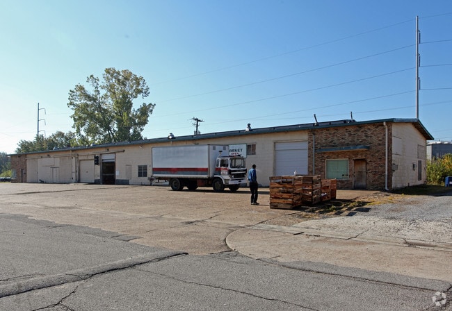
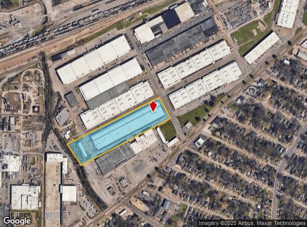
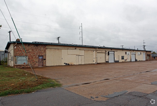
1299 Farmville Ave
Memphis, TN-MS-AR
General Robert E Lee
04-3009-0-0134
MAP 115 K WS FARMVILLE AVE
Warehouse
Shelby
X
Tennessee
47157C0290F
4
2023
8.92 AC
2025
Northwest
011100
Memphis
188,495 SF
DEMOGRAPHICS near 1299 Farmville Ave
1 Mile
3 Mile
5 Mile
2024 Total Population
9,048
84,770
232,215
2029 Population
9,130
84,606
231,443
Pop Growth 2024-2029
+ 0.91%
(0.19%)
(0.33%)
Average Age
35
37
38
2024 Total Households
3,241
33,667
96,449
HH Growth 2024-2029
+ 0.83%
(0.24%)
(0.43%)
Median Household Inc
$31,755
$42,016
$43,495
Avg Household Size
2.60
2.40
2.30
2024 Avg HH Vehicles
2.00
2.00
2.00
Median Home Value
$76,899
$172,413
$178,186
Median Year Built
1954
1955
1958
Nearby Places
Map Layers
Map Styles
 Street
 Aerial
- Restaurants
- Banks
- Shops
- Fitness
- Groceries
PUBLIC TRANSPORTATION
COMMUTER RAIL
Central Station (Riverfront Loop - Memphis Area Transit Authority Trolley (MataTrolley))
DRIVE
WALK
Distance
Central Station (Riverfront Loop - Memphis Area Transit Authority Trolley (MataTrolley))
13 min
7.9 mi
AIRPORT
Memphis International
DRIVE
WALK
Distance
Memphis International
17 min
10.4 mi
Freight Ports
Port of Shreveport
DRIVE
WALK
Distance
Port of Shreveport
406 min
374.0 mi
Nearby Properties
Address
Land Use
TOTAL SIZE
Lot Size
Zoning
Address
Land Use
TOTAL SIZE
Lot Size
Zoning
218,327 SF
4.89 AC
R-6
Address
Land Use
TOTAL SIZE
Lot Size
Zoning
115,053 SF
4.63 AC
CMU-1
Address
Land Use
TOTAL SIZE
Lot Size
Zoning
2,137 SF
346 AC
R-15
Address
Land Use
TOTAL SIZE
Lot Size
Zoning
222,671 SF
8.77 AC
EMP
Address
Land Use
TOTAL SIZE
Lot Size
Zoning
38,348 SF
1.74 AC
RW
Address
Land Use
TOTAL SIZE
Lot Size
Zoning
114,326 SF
1.99 AC
R-6
Address
Land Use
TOTAL SIZE
Lot Size
Zoning
96 AC
R-10
Address
Land Use
TOTAL SIZE
Lot Size
Zoning
17,438 SF
25.84 AC
RU-3
Address
Land Use
TOTAL SIZE
Lot Size
Zoning
31,305 SF
17.89 AC
RU-3
Address
Land Use
TOTAL SIZE
Lot Size
Zoning
699,184 SF
19.67 AC
IH
Address
Land Use
TOTAL SIZE
Lot Size
Zoning
104.22 AC
R-15
Address
Land Use
TOTAL SIZE
Lot Size
Zoning
40,270 SF
2 AC
Address
Land Use
TOTAL SIZE
Lot Size
Zoning
66,728 SF
346 AC
RS-15
Address
Land Use
TOTAL SIZE
Lot Size
Zoning
11,446 SF
29.76 AC
RU-3
Address
Land Use
TOTAL SIZE
Lot Size
Zoning
55,082 SF
2.31 AC
CMU-1
Address
Land Use
TOTAL SIZE
Lot Size
Zoning
190,456 SF
13.71 AC
CMU-1
Address
Land Use
TOTAL SIZE
Lot Size
Zoning
399,662 SF
27.28 AC
EMP
Address
Land Use
TOTAL SIZE
Lot Size
Zoning
35,150 SF
3.59 AC
CMU-3
Address
Land Use
TOTAL SIZE
Lot Size
Zoning
151,958 SF
12.78 AC
CMU-3
Address
Land Use
TOTAL SIZE
Lot Size
Zoning
96,666 SF
6.71 AC
R-6
Address
Land Use
TOTAL SIZE
Lot Size
Zoning
195,097 SF
8.71 AC
CMU-1
Address
Land Use
TOTAL SIZE
Lot Size
Zoning
54,178 SF
10.24 AC
CMU-3
Address
Land Use
TOTAL SIZE
Lot Size
Zoning
35,793 SF
2.81 AC
R-10
Address
Land Use
TOTAL SIZE
Lot Size
Zoning
99,370 SF
108.70 AC
RU-1
Address
Land Use
TOTAL SIZE
Lot Size
Zoning
212,449 SF
14.07 AC
EMP
Address
Land Use
TOTAL SIZE
Lot Size
Zoning
91,341 SF
7.98 AC
CMU-1
Address
Land Use
TOTAL SIZE
Lot Size
Zoning
71,875 SF
4.86 AC
R-6
Address
Land Use
TOTAL SIZE
Lot Size
Zoning
134,350 SF
9.88 AC
RU-3
Address
Land Use
TOTAL SIZE
Lot Size
Zoning
26.13 AC
R-6
Address
Land Use
TOTAL SIZE
Lot Size
Zoning
21,509 SF
2.35 AC
RU-1
The World's #1 Commercial Real Estate Marketplace
Connect with us
© 2025 CoStar Group
The information above has been obtained from sources believed reliable. While we do not doubt its accuracy we have not verified it and make no guarantee, warranty or representation about it. It is your responsibility to independently confirm its accuracy and completeness. Any projections, opinions, assumptions, or estimates used are for example only and do not represent the current or future performance of the property. The value of this transaction to you depends on tax and other factors which should be evaluated by your tax, financial, and legal advisors. You and your advisors should conduct a careful, independent investigation of the property to determine to your satisfaction the suitability of the property for your needs.