Property Record
12991 Highway 65, Eckert, CO 81418


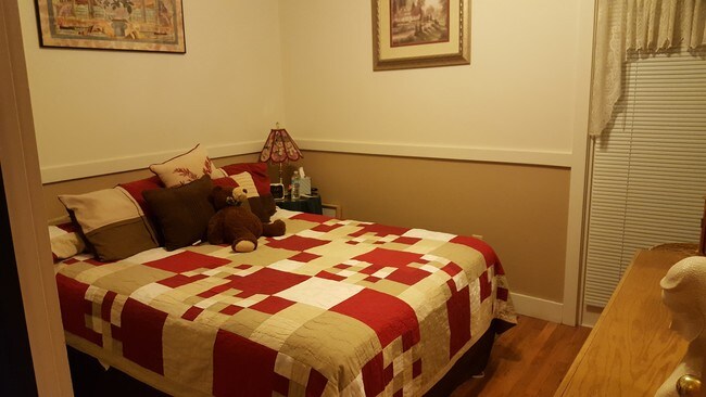

Property Detail
12991 Highway 65
32371300000001
12991 HIGHWAY 65 ECKERT - ORCHARD CITY 81418 12995 HIGHWAY 65 ECKERT - ORCHARD CITY 81418 S: 13 T: 14S R: 95W SUBDIVISION: RURAL AREA TOTAL 0.192 AC+- PARCEL B OF I.O.O.F. GRAND LODGE OF COLORADO/DROST BA. PT NE4NW4 SEC 13 T14S R95W 6P.M. BEG PT COM
Commercialnec
DELTA
AE The base floodplain where base flood elevations are provided. AE Zones are now used on new format FIRMs instead of A1-A30 Zones.
Colorado
2024
0.19 AC
2024
Colorado Southwest Area
964700
Other Market Areas
5,076 SF
NEARBY LISTINGS FOR SALE OR LEASE
-
-
View all Eckert listings for sale on LoopNet.com
DEMOGRAPHICS near 12991 Highway 65
1 mile
3 mile
5 mile
2025 Total Population
1,212
2,525
7,065
2030 Population
1,250
2,608
7,311
Pop Growth 2025-2030
+ 3.14%
+ 3.29%
+ 3.48%
Average Age
48
48
49
2025 Total Households
515
1,080
3,174
HH Growth 2025-2030
+ 3.30%
+ 3.33%
+ 3.50%
Median Household Inc
$63,964
$66,465
$63,388
Avg Household Size
2.30
2.30
2.20
2025 Avg HH Vehicles
3.00
3.00
2.00
Median Home Value
$297,344
$328,057
$339,666
Median Year Built
1978
1980
1985
Nearby Places
Map Layers
Map Styles
 Street
 Aerial
Transit
 Traffic
 Biking
Places
Listings with unknown addresses are not visible on the map
- Restaurants
- Banks
- Shops
- Fitness
- Groceries
PUBLIC TRANSPORTATION
AIRPORT
Montrose Regional
Drive
Walk
Distance
Montrose Regional
45 min
28.5 mi
Freight Ports
Port of San Diego
Drive
Walk
Distance
Port of San Diego
937 min
887.5 mi
SALE & LEASE HISTORY
LISTING DATE
SALE/LEASE

Jun 13, 2017
For Sale
Nearby Properties
Address
Land Use
TOTAL SIZE
Lot Size
Zoning
Address
Land Use
TOTAL SIZE
Lot Size
Zoning
40,671 SF
16.20 AC
Address
Land Use
TOTAL SIZE
Lot Size
Zoning
6,847 SF
1,395.31 AC
Address
Land Use
TOTAL SIZE
Lot Size
Zoning
12,800 SF
7.12 AC
Address
Land Use
TOTAL SIZE
Lot Size
Zoning
406.64 AC
Address
Land Use
TOTAL SIZE
Lot Size
Zoning
19,750 SF
2.18 AC
Address
Land Use
TOTAL SIZE
Lot Size
Zoning
3,986 SF
40.90 AC
Address
Land Use
TOTAL SIZE
Lot Size
Zoning
7,592 SF
6.47 AC
Address
Land Use
TOTAL SIZE
Lot Size
Zoning
322.22 AC
Address
Land Use
TOTAL SIZE
Lot Size
Zoning
1,576 SF
325 AC
Address
Land Use
TOTAL SIZE
Lot Size
Zoning
260.03 AC
Address
Land Use
TOTAL SIZE
Lot Size
Zoning
240 AC
Address
Land Use
TOTAL SIZE
Lot Size
Zoning
1,208 SF
40 AC
Address
Land Use
TOTAL SIZE
Lot Size
Zoning
10,436 SF
3.63 AC
Address
Land Use
TOTAL SIZE
Lot Size
Zoning
6,480 SF
1.30 AC
Address
Land Use
TOTAL SIZE
Lot Size
Zoning
3,837 SF
1.05 AC
Address
Land Use
TOTAL SIZE
Lot Size
Zoning
200 AC
Address
Land Use
TOTAL SIZE
Lot Size
Zoning
3,703 SF
1.01 AC
Address
Land Use
TOTAL SIZE
Lot Size
Zoning
4,563 SF
0.38 AC
Address
Land Use
TOTAL SIZE
Lot Size
Zoning
4,080 SF
3.30 AC
Address
Land Use
TOTAL SIZE
Lot Size
Zoning
768 SF
32.18 AC
Address
Land Use
TOTAL SIZE
Lot Size
Zoning
4,335 SF
3 AC
Address
Land Use
TOTAL SIZE
Lot Size
Zoning
5,205 SF
0.40 AC
Address
Land Use
TOTAL SIZE
Lot Size
Zoning
480 SF
28.06 AC
Address
Land Use
TOTAL SIZE
Lot Size
Zoning
4,722 SF
62.74 AC
Address
Land Use
TOTAL SIZE
Lot Size
Zoning
6,242 SF
0.67 AC
Address
Land Use
TOTAL SIZE
Lot Size
Zoning
4,802 SF
2.93 AC
Address
Land Use
TOTAL SIZE
Lot Size
Zoning
Address
Land Use
TOTAL SIZE
Lot Size
Zoning
88.74 AC
Address
Land Use
TOTAL SIZE
Lot Size
Zoning
7,500 SF
1.09 AC
Address
Land Use
TOTAL SIZE
Lot Size
Zoning
3,180 SF
55 AC
The World's #1 Commercial Real Estate Marketplace
Connect with us
© 2026 CoStar Group
The information above has been obtained from sources believed reliable. While we do not doubt its accuracy we have not verified it and make no guarantee, warranty or representation about it. It is your responsibility to independently confirm its accuracy and completeness. Any projections, opinions, assumptions, or estimates used are for example only and do not represent the current or future performance of the property. The value of this transaction to you depends on tax and other factors which should be evaluated by your tax, financial, and legal advisors. You and your advisors should conduct a careful, independent investigation of the property to determine to your satisfaction the suitability of the property for your needs.