Property Record
1742 Dairy Ave, Corcoran, CA 93212
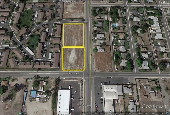
Property Detail
1742 Dairy Ave
Hanford-Corcoran, CA
LOT 2 OF WESTPORT VILLAGE, TRACT NO. 538
034-200-013-000
KINGS
Storesoffices
California
B and X Area of moderate flood hazard, usually the area between the limits of the 100-year and 500-year floods.
2
2024
0.89 AC
2025
Outlying Kings County
001300
Fresno
NEARBY LISTINGS FOR SALE OR LEASE
DEMOGRAPHICS near 1742 Dairy Ave
1 mile
3 mile
5 mile
2025 Total Population
10,711
14,864
15,172
2030 Population
10,859
15,080
15,404
Pop Growth 2025-2030
+ 1.38%
+ 1.45%
+ 1.53%
Average Age
35
34
34
2025 Total Households
3,238
4,464
4,552
HH Growth 2025-2030
+ 1.51%
+ 1.59%
+ 1.65%
Median Household Inc
$51,493
$53,194
$54,016
Avg Household Size
3.30
3.30
3.30
2025 Avg HH Vehicles
2.00
2.00
2.00
Median Home Value
$252,264
$262,952
$263,938
Median Year Built
1982
1984
1984
Nearby Places
Map Layers
Map Styles
 Street
 Aerial
Layers
 Traffic
 Biking
Places
Listings with unknown addresses are not visible on the map
- Restaurants
- Banks
- Shops
- Fitness
- Groceries
SALE & LEASE HISTORY
LISTING DATE
SALE/LEASE

Aug 22, 2017
For Sale
Nearby Properties
Address
Land Use
TOTAL SIZE
Lot Size
Zoning
Address
Land Use
TOTAL SIZE
Lot Size
Zoning
315.73 AC
Address
Land Use
TOTAL SIZE
Lot Size
Zoning
157.58 AC
Address
Land Use
TOTAL SIZE
Lot Size
Zoning
80,986 SF
5.60 AC
Address
Land Use
TOTAL SIZE
Lot Size
Zoning
17,465 SF
539.91 AC
Address
Land Use
TOTAL SIZE
Lot Size
Zoning
264,634 SF
16.87 AC
Address
Land Use
TOTAL SIZE
Lot Size
Zoning
308.01 AC
AG40
Address
Land Use
TOTAL SIZE
Lot Size
Zoning
1,449 SF
8.83 AC
Address
Land Use
TOTAL SIZE
Lot Size
Zoning
5.53 AC
Address
Land Use
TOTAL SIZE
Lot Size
Zoning
68,000 SF
3.87 AC
Address
Land Use
TOTAL SIZE
Lot Size
Zoning
14,080 SF
28.71 AC
Address
Land Use
TOTAL SIZE
Lot Size
Zoning
1,008 SF
0.19 AC
Address
Land Use
TOTAL SIZE
Lot Size
Zoning
9.58 AC
Address
Land Use
TOTAL SIZE
Lot Size
Zoning
10.90 AC
MH
Address
Land Use
TOTAL SIZE
Lot Size
Zoning
1.62 AC
Address
Land Use
TOTAL SIZE
Lot Size
Zoning
47,415 SF
3.03 AC
R18
Address
Land Use
TOTAL SIZE
Lot Size
Zoning
45,920 SF
5.48 AC
Address
Land Use
TOTAL SIZE
Lot Size
Zoning
6.12 AC
MH
Address
Land Use
TOTAL SIZE
Lot Size
Zoning
0.60 AC
Address
Land Use
TOTAL SIZE
Lot Size
Zoning
11.27 AC
Address
Land Use
TOTAL SIZE
Lot Size
Zoning
4.59 AC
Address
Land Use
TOTAL SIZE
Lot Size
Zoning
23,800 SF
6.46 AC
Address
Land Use
TOTAL SIZE
Lot Size
Zoning
2.43 AC
Address
Land Use
TOTAL SIZE
Lot Size
Zoning
10,500 SF
10.20 AC
Address
Land Use
TOTAL SIZE
Lot Size
Zoning
81,175 SF
19.39 AC
Address
Land Use
TOTAL SIZE
Lot Size
Zoning
13,465 SF
1.49 AC
Address
Land Use
TOTAL SIZE
Lot Size
Zoning
14,934 SF
0.48 AC
Address
Land Use
TOTAL SIZE
Lot Size
Zoning
32,940 SF
1.14 AC
Address
Land Use
TOTAL SIZE
Lot Size
Zoning
0.37 AC
Address
Land Use
TOTAL SIZE
Lot Size
Zoning
720 SF
1.45 AC
Address
Land Use
TOTAL SIZE
Lot Size
Zoning
220.96 AC
AG40
The World's #1 Commercial Real Estate Marketplace
Connect with us
© 2026 CoStar Group
The information above has been obtained from sources believed reliable. While we do not doubt its accuracy we have not verified it and make no guarantee, warranty or representation about it. It is your responsibility to independently confirm its accuracy and completeness. Any projections, opinions, assumptions, or estimates used are for example only and do not represent the current or future performance of the property. The value of this transaction to you depends on tax and other factors which should be evaluated by your tax, financial, and legal advisors. You and your advisors should conduct a careful, independent investigation of the property to determine to your satisfaction the suitability of the property for your needs.