Property Record
13 Dudley Rd, Roebuck, SC 29376


Property Detail
13 Dudley Rd
Spartanburg, SC
LOT 13 MOYER CONST CO INC SUR PB 107-760
6-25-00-164.06
Spartanburg
Commercialnec
South Carolina
B and X Area of moderate flood hazard, usually the area between the limits of the 100-year and 500-year floods.
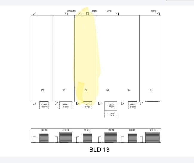
13
2024
1.23 AC
2025
West Side
020702
Greenville/Spartanburg
15,000 SF
NEARBY LISTINGS FOR SALE OR LEASE
DEMOGRAPHICS near 13 Dudley Rd
1 mile
3 mile
5 mile
2025 Total Population
4,096
48,574
97,174
2030 Population
4,541
54,351
108,557
Pop Growth 2025-2030
+ 10.86%
+ 11.89%
+ 11.71%
Average Age
38
38
39
2025 Total Households
1,746
19,411
38,393
HH Growth 2025-2030
+ 10.94%
+ 11.96%
+ 11.87%
Median Household Inc
$53,687
$52,567
$55,487
Avg Household Size
2.30
2.40
2.40
2025 Avg HH Vehicles
2.00
2.00
2.00
Median Home Value
$217,618
$213,887
$225,777
Median Year Built
1980
1980
1981
Nearby Places
Map Layers
Map Styles
 Street
 Aerial
Layers
 Traffic
 Biking
Places
Listings with unknown addresses are not visible on the map
- Restaurants
- Banks
- Shops
- Fitness
- Groceries
PUBLIC TRANSPORTATION
COMMUTER RAIL
Spartanburg Amtrak Station (Crescent - Amtrak)
Drive
Walk
Distance
Spartanburg Amtrak Station (Crescent - Amtrak)
9 min
4.3 mi
AIRPORT
Greenville Spartanburg International
Drive
Walk
Distance
Greenville Spartanburg International
30 min
18.6 mi
Freight Ports
North Charleston Terminal
Drive
Walk
Distance
North Charleston Terminal
216 min
191.9 mi
SALE & LEASE HISTORY
LISTING DATE
SALE/LEASE

Feb 05, 2020
For Lease
Nearby Properties
Address
Land Use
TOTAL SIZE
Lot Size
Zoning
Address
Land Use
TOTAL SIZE
Lot Size
Zoning
5,130 SF
19.69 AC
Address
Land Use
TOTAL SIZE
Lot Size
Zoning
3,352 SF
14 AC
Address
Land Use
TOTAL SIZE
Lot Size
Zoning
2,134 SF
27.72 AC
Address
Land Use
TOTAL SIZE
Lot Size
Zoning
50,096 SF
5.88 AC
Address
Land Use
TOTAL SIZE
Lot Size
Zoning
2,112 SF
5.26 AC
Address
Land Use
TOTAL SIZE
Lot Size
Zoning
6,148 SF
4.18 AC
Address
Land Use
TOTAL SIZE
Lot Size
Zoning
7,245 SF
18.10 AC
Address
Land Use
TOTAL SIZE
Lot Size
Zoning
2,100 SF
10.12 AC
Address
Land Use
TOTAL SIZE
Lot Size
Zoning
3,171 SF
21.41 AC
Address
Land Use
TOTAL SIZE
Lot Size
Zoning
2,297 SF
42.76 AC
Address
Land Use
TOTAL SIZE
Lot Size
Zoning
8,140 SF
20.42 AC
Address
Land Use
TOTAL SIZE
Lot Size
Zoning
30,016 SF
1.07 AC
Address
Land Use
TOTAL SIZE
Lot Size
Zoning
3,072 SF
5.60 AC
Address
Land Use
TOTAL SIZE
Lot Size
Zoning
2,176 SF
20.63 AC
Address
Land Use
TOTAL SIZE
Lot Size
Zoning
227,480 SF
22.22 AC
Address
Land Use
TOTAL SIZE
Lot Size
Zoning
109,024 SF
2.30 AC
Address
Land Use
TOTAL SIZE
Lot Size
Zoning
69,836 SF
7.56 AC
Address
Land Use
TOTAL SIZE
Lot Size
Zoning
6,820 SF
1.71 AC
Address
Land Use
TOTAL SIZE
Lot Size
Zoning
25,380 SF
0.75 AC
Address
Land Use
TOTAL SIZE
Lot Size
Zoning
6,907 SF
17.39 AC
Address
Land Use
TOTAL SIZE
Lot Size
Zoning
1,475 SF
9.27 AC
Address
Land Use
TOTAL SIZE
Lot Size
Zoning
128,060 SF
18.70 AC
Address
Land Use
TOTAL SIZE
Lot Size
Zoning
212,111 SF
14.11 AC
Address
Land Use
TOTAL SIZE
Lot Size
Zoning
38,268 SF
4.45 AC
Address
Land Use
TOTAL SIZE
Lot Size
Zoning
124,696 SF
7.75 AC
Address
Land Use
TOTAL SIZE
Lot Size
Zoning
10,216 SF
3.03 AC
Address
Land Use
TOTAL SIZE
Lot Size
Zoning
159,150 SF
16.37 AC
Address
Land Use
TOTAL SIZE
Lot Size
Zoning
69,036 SF
9.93 AC
Address
Land Use
TOTAL SIZE
Lot Size
Zoning
157,769 SF
13.12 AC
Address
Land Use
TOTAL SIZE
Lot Size
Zoning
6,264 SF
1.03 AC
The World's #1 Commercial Real Estate Marketplace
Connect with us
© 2026 CoStar Group
The information above has been obtained from sources believed reliable. While we do not doubt its accuracy we have not verified it and make no guarantee, warranty or representation about it. It is your responsibility to independently confirm its accuracy and completeness. Any projections, opinions, assumptions, or estimates used are for example only and do not represent the current or future performance of the property. The value of this transaction to you depends on tax and other factors which should be evaluated by your tax, financial, and legal advisors. You and your advisors should conduct a careful, independent investigation of the property to determine to your satisfaction the suitability of the property for your needs.