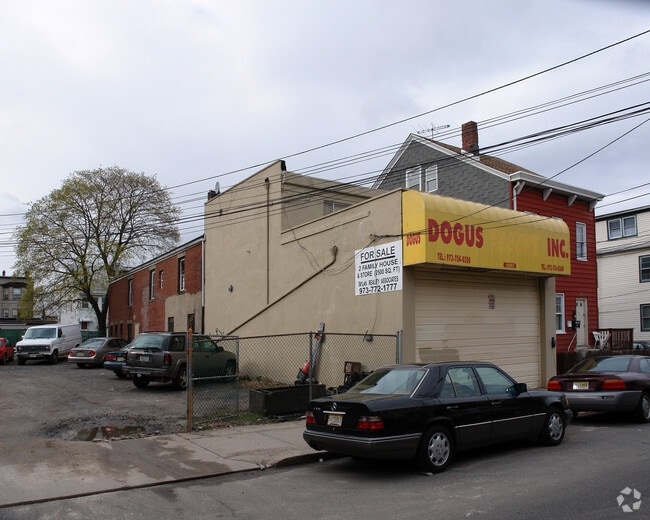
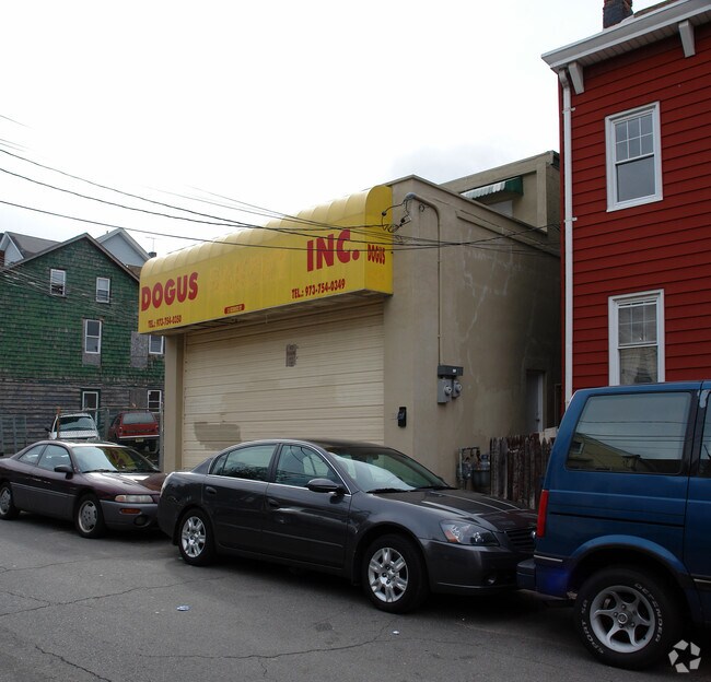
Property Record
13 George St, Paterson, NJ 07503

Property Detail
13 George St
08-06708-0000-00014
Passaic
Commercialnec
New Jersey
R-2
14
B and X Area of moderate flood hazard, usually the area between the limits of the 100-year and 500-year floods.
0.06 AC
2024
Passaic Urban Region
2025
Northern New Jersey
183001
New York-Jersey City-White Plains, NY-NJ
2,469 SF
NEARBY LISTINGS FOR SALE OR LEASE
DEMOGRAPHICS near 13 George St
1 mile
3 mile
5 mile
2025 Total Population
39,399
335,184
623,131
2030 Population
39,291
338,073
632,596
Pop Growth 2025-2030
(0.27%)
+ 0.86%
+ 1.52%
Average Age
38
38
39
2025 Total Households
12,563
109,689
212,046
HH Growth 2025-2030
(0.31%)
+ 0.95%
+ 1.60%
Median Household Inc
$59,741
$68,386
$87,612
Avg Household Size
3.00
2.90
2.80
2025 Avg HH Vehicles
1.00
1.00
2.00
Median Home Value
$406,840
$441,943
$496,786
Median Year Built
1954
1952
1954
Nearby Places
Map Layers
Map Styles
 Street
 Aerial
Transit
 Traffic
 Biking
Places
Listings with unknown addresses are not visible on the map
- Restaurants
- Banks
- Shops
- Fitness
- Groceries
PUBLIC TRANSPORTATION
COMMUTER RAIL
Paterson (Main/Port Jervis Line - NJ Transit Commuter Rail (NJ Transit))
Drive
Walk
Distance
Paterson (Main/Port Jervis Line - NJ Transit Commuter Rail (NJ Transit))
3 min
1.6 mi
Clifton (Main/Port Jervis Line - NJ Transit Commuter Rail (NJ Transit))
Drive
Walk
Distance
Clifton (Main/Port Jervis Line - NJ Transit Commuter Rail (NJ Transit))
5 min
2.4 mi
AIRPORT
Newark Liberty International
Drive
Walk
Distance
Newark Liberty International
25 min
18.6 mi
LaGuardia
Drive
Walk
Distance
LaGuardia
37 min
24.4 mi
Westchester County
Drive
Walk
Distance
Westchester County
58 min
40.2 mi
Freight Ports
Maher Terminal
Drive
Walk
Distance
Maher Terminal
31 min
18.8 mi
Nearby Properties
Address
Land Use
TOTAL SIZE
Lot Size
Zoning
Address
Land Use
TOTAL SIZE
Lot Size
Zoning
8.75 AC
Address
Land Use
TOTAL SIZE
Lot Size
Zoning
7.10 AC
R-3
Address
Land Use
TOTAL SIZE
Lot Size
Zoning
12,506 SF
130 AC
B-2
Address
Land Use
TOTAL SIZE
Lot Size
Zoning
20.43 AC
Address
Land Use
TOTAL SIZE
Lot Size
Zoning
79,310 SF
2 AC
B-2
Address
Land Use
TOTAL SIZE
Lot Size
Zoning
26,816 SF
25.50 AC
POP
Address
Land Use
TOTAL SIZE
Lot Size
Zoning
Address
Land Use
TOTAL SIZE
Lot Size
Zoning
152,050 SF
1.96 AC
B-1
Address
Land Use
TOTAL SIZE
Lot Size
Zoning
7.83 AC
Address
Land Use
TOTAL SIZE
Lot Size
Zoning
3.55 AC
Address
Land Use
TOTAL SIZE
Lot Size
Zoning
1.80 AC
Address
Land Use
TOTAL SIZE
Lot Size
Zoning
0.69 AC
I-1
Address
Land Use
TOTAL SIZE
Lot Size
Zoning
271,679 SF
20.79 AC
Address
Land Use
TOTAL SIZE
Lot Size
Zoning
1,512 SF
90 AC
Address
Land Use
TOTAL SIZE
Lot Size
Zoning
21.80 AC
R-A3
Address
Land Use
TOTAL SIZE
Lot Size
Zoning
648 SF
108.80 AC
Address
Land Use
TOTAL SIZE
Lot Size
Zoning
14,152 SF
23.87 AC
Address
Land Use
TOTAL SIZE
Lot Size
Zoning
15.80 AC
IND
Address
Land Use
TOTAL SIZE
Lot Size
Zoning
16.05 AC
Address
Land Use
TOTAL SIZE
Lot Size
Zoning
764,364 SF
16.60 AC
I-2
Address
Land Use
TOTAL SIZE
Lot Size
Zoning
11.87 AC
Address
Land Use
TOTAL SIZE
Lot Size
Zoning
0.12 AC
Address
Land Use
TOTAL SIZE
Lot Size
Zoning
Address
Land Use
TOTAL SIZE
Lot Size
Zoning
29.11 AC
Address
Land Use
TOTAL SIZE
Lot Size
Zoning
27.14 AC
M-2
Address
Land Use
TOTAL SIZE
Lot Size
Zoning
183,072 SF
5.50 AC
Address
Land Use
TOTAL SIZE
Lot Size
Zoning
192,252 SF
5 AC
Address
Land Use
TOTAL SIZE
Lot Size
Zoning
269,236 SF
10 AC
Address
Land Use
TOTAL SIZE
Lot Size
Zoning
140,626 SF
3.28 AC
B-2
Address
Land Use
TOTAL SIZE
Lot Size
Zoning
91,212 SF
9.52 AC
R-03
The World's #1 Commercial Real Estate Marketplace
Connect with us
© 2026 CoStar Group
The information above has been obtained from sources believed reliable. While we do not doubt its accuracy we have not verified it and make no guarantee, warranty or representation about it. It is your responsibility to independently confirm its accuracy and completeness. Any projections, opinions, assumptions, or estimates used are for example only and do not represent the current or future performance of the property. The value of this transaction to you depends on tax and other factors which should be evaluated by your tax, financial, and legal advisors. You and your advisors should conduct a careful, independent investigation of the property to determine to your satisfaction the suitability of the property for your needs.