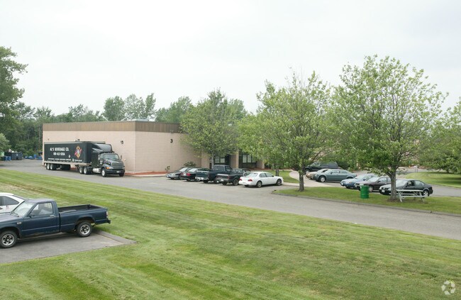
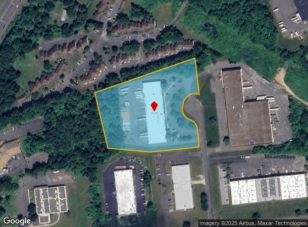
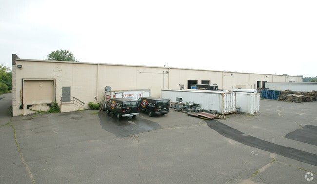
Property Record
13 Revay Rd, East Windsor, CT 06088
NEARBY LISTINGS FOR SALE OR LEASE
Property Detail
13 Revay Rd
EWIN-000082-000018-000010A
Hartford
Industrialgeneral
Connecticut
X
10a
09003C0236F
5.47 AC
2025
East Windsor
2025
Hartford
484100
Hartford-West Hartford-East Hartford, CT
35,750 SF
DEMOGRAPHICS near 13 Revay Rd
1 Mile
3 Mile
5 Mile
2024 Total Population
2,338
23,316
58,682
2029 Population
2,311
23,221
58,327
Pop Growth 2024-2029
(1.15%)
(0.41%)
(0.60%)
Average Age
44
44
44
2024 Total Households
1,116
10,172
24,306
HH Growth 2024-2029
(1.25%)
(0.49%)
(0.71%)
Median Household Inc
$69,342
$83,966
$91,522
Avg Household Size
2.00
2.20
2.30
2024 Avg HH Vehicles
2.00
2.00
2.00
Median Home Value
$156,382
$240,376
$255,037
Median Year Built
1977
1969
1970
Nearby Places
Map Layers
Map Styles
 Street
 Aerial
- Restaurants
- Banks
- Shops
- Fitness
- Groceries
PUBLIC TRANSPORTATION
COMMUTER RAIL
Windsor Locks (Hartford Line - CT Rail (CTRail))
DRIVE
WALK
Distance
Windsor Locks (Hartford Line - CT Rail (CTRail))
7 min
3.1 mi
DRIVE
WALK
Distance
15 min
8.7 mi
AIRPORT
Bradley International
DRIVE
WALK
Distance
Bradley International
24 min
8.6 mi
Nearby Properties
Address
Land Use
TOTAL SIZE
Lot Size
Zoning
Address
Land Use
TOTAL SIZE
Lot Size
Zoning
Address
Land Use
TOTAL SIZE
Lot Size
Zoning
492,240 SF
40.80 AC
Address
Land Use
TOTAL SIZE
Lot Size
Zoning
164,765 SF
17.40 AC
Address
Land Use
TOTAL SIZE
Lot Size
Zoning
143,800 SF
Address
Land Use
TOTAL SIZE
Lot Size
Zoning
269,325 SF
32.33 AC
IND3
Address
Land Use
TOTAL SIZE
Lot Size
Zoning
126,079 SF
38.72 AC
TZ5
Address
Land Use
TOTAL SIZE
Lot Size
Zoning
123,229 SF
4.08 AC
MFSD
Address
Land Use
TOTAL SIZE
Lot Size
Zoning
176,152 SF
27 AC
R44
Address
Land Use
TOTAL SIZE
Lot Size
Zoning
177,366 SF
61.60 AC
RESA
Address
Land Use
TOTAL SIZE
Lot Size
Zoning
334,788 SF
40.37 AC
IND3
Address
Land Use
TOTAL SIZE
Lot Size
Zoning
190,997 SF
18.47 AC
M-1
Address
Land Use
TOTAL SIZE
Lot Size
Zoning
277,552 SF
40.24 AC
M-1
Address
Land Use
TOTAL SIZE
Lot Size
Zoning
12.14 AC
I
Address
Land Use
TOTAL SIZE
Lot Size
Zoning
117,699 SF
6.83 AC
MFDD
Address
Land Use
TOTAL SIZE
Lot Size
Zoning
2,867 SF
17.27 AC
R-2
Address
Land Use
TOTAL SIZE
Lot Size
Zoning
124,964 SF
RESA
Address
Land Use
TOTAL SIZE
Lot Size
Zoning
11,952 SF
25 AC
MFDD
Address
Land Use
TOTAL SIZE
Lot Size
Zoning
11.65 AC
Address
Land Use
TOTAL SIZE
Lot Size
Zoning
25.92 AC
Address
Land Use
TOTAL SIZE
Lot Size
Zoning
Address
Land Use
TOTAL SIZE
Lot Size
Zoning
21.50 AC
R25
Address
Land Use
TOTAL SIZE
Lot Size
Zoning
44,054 SF
16.87 AC
A-1
Address
Land Use
TOTAL SIZE
Lot Size
Zoning
34,045 SF
181.32 AC
B-2
Address
Land Use
TOTAL SIZE
Lot Size
Zoning
14,295 SF
24.45 AC
R-1
Address
Land Use
TOTAL SIZE
Lot Size
Zoning
14,864 SF
0.25 AC
IND1
Address
Land Use
TOTAL SIZE
Lot Size
Zoning
15.58 AC
RESA
Address
Land Use
TOTAL SIZE
Lot Size
Zoning
150,000 SF
22.20 AC
M-1
Address
Land Use
TOTAL SIZE
Lot Size
Zoning
243,624 SF
12.16 AC
I
Address
Land Use
TOTAL SIZE
Lot Size
Zoning
226,546 SF
16.40 AC
IND3
Address
Land Use
TOTAL SIZE
Lot Size
Zoning
52.53 AC
The World's #1 Commercial Real Estate Marketplace
Connect with us
© 2025 CoStar Group
The information above has been obtained from sources believed reliable. While we do not doubt its accuracy we have not verified it and make no guarantee, warranty or representation about it. It is your responsibility to independently confirm its accuracy and completeness. Any projections, opinions, assumptions, or estimates used are for example only and do not represent the current or future performance of the property. The value of this transaction to you depends on tax and other factors which should be evaluated by your tax, financial, and legal advisors. You and your advisors should conduct a careful, independent investigation of the property to determine to your satisfaction the suitability of the property for your needs.