Property Record
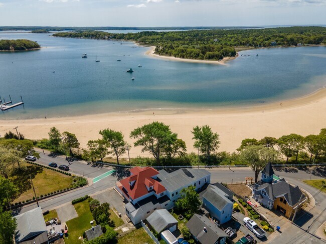
13 South Blvd, Onset, MA 02558


Save to a Folder
{{folder.Name}}
{{folder.ListingIds.length}} Properties
{{folder.ListingIds.length}} Property
Create a New Folder
Property Detail
13 South Blvd
WARE-000001-000000-000082B
PLYMOUTH
Apartment
Massachusetts
AE The base floodplain where base flood elevations are provided. AE Zones are now used on new format FIRMs instead of A1-A30 Zones.
82b
2025
0.16 AC
2025
Route 3 South
545300
Boston
6,244 SF
Boston-Cambridge-Newton, MA-NH
NEARBY LISTINGS FOR SALE OR LEASE
-
-
View all Onset listings for sale on LoopNet.com
DEMOGRAPHICS near 13 South Blvd
1 mile
3 mile
5 mile
2025 Total Population
3,154
18,919
38,879
2030 Population
3,228
19,436
39,714
Pop Growth 2025-2030
+ 2.35%
+ 2.73%
+ 2.15%
Average Age
49
46
46
2025 Total Households
1,450
8,035
16,621
HH Growth 2025-2030
+ 2.00%
+ 2.89%
+ 2.08%
Median Household Inc
$85,742
$88,783
$91,385
Avg Household Size
2.10
2.20
2.20
2025 Avg HH Vehicles
2.00
2.00
2.00
Median Home Value
$450,000
$449,061
$475,749
Median Year Built
1949
1956
1966
Nearby Places
Map Layers
Map Styles
 Street
 Aerial
Layers
 Traffic
 Biking
Places
Listings with unknown addresses are not visible on the map
- Restaurants
- Banks
- Shops
- Fitness
- Groceries
PUBLIC TRANSPORTATION
COMMUTER RAIL
Drive
Walk
Distance
6 min
2.7 mi
Drive
Walk
Distance
7 min
3.6 mi
AIRPORT
Martha's Vineyard
Drive
Walk
Distance
Martha's Vineyard
98 min
36.5 mi
Freight Ports
Port of New Bedford Harbor
Drive
Walk
Distance
Port of New Bedford Harbor
32 min
21.4 mi
SALE & LEASE HISTORY
LISTING DATE
SALE/LEASE

Jun 03, 2021
For Sale
Nearby Properties
Address
Land Use
TOTAL SIZE
Lot Size
Zoning
Address
Land Use
TOTAL SIZE
Lot Size
Zoning
163,433 SF
7.47 AC
Address
Land Use
TOTAL SIZE
Lot Size
Zoning
1,758 SF
269.51 AC
R40
Address
Land Use
TOTAL SIZE
Lot Size
Zoning
167,599 SF
0.34 AC
Address
Land Use
TOTAL SIZE
Lot Size
Zoning
106,987 SF
3.95 AC
Address
Land Use
TOTAL SIZE
Lot Size
Zoning
19.77 AC
Address
Land Use
TOTAL SIZE
Lot Size
Zoning
15,716 SF
7.85 AC
R40
Address
Land Use
TOTAL SIZE
Lot Size
Zoning
11,930 SF
4.81 AC
Address
Land Use
TOTAL SIZE
Lot Size
Zoning
68.53 AC
R40
Address
Land Use
TOTAL SIZE
Lot Size
Zoning
12,812 SF
19.12 AC
Address
Land Use
TOTAL SIZE
Lot Size
Zoning
8.89 AC
Address
Land Use
TOTAL SIZE
Lot Size
Zoning
116,476 SF
13.22 AC
Address
Land Use
TOTAL SIZE
Lot Size
Zoning
60.89 AC
Address
Land Use
TOTAL SIZE
Lot Size
Zoning
27,958 SF
5.85 AC
R40
Address
Land Use
TOTAL SIZE
Lot Size
Zoning
117,814 SF
16.49 AC
Address
Land Use
TOTAL SIZE
Lot Size
Zoning
26,053 SF
1.26 AC
Address
Land Use
TOTAL SIZE
Lot Size
Zoning
17.47 AC
Address
Land Use
TOTAL SIZE
Lot Size
Zoning
4,959 SF
2.30 AC
Address
Land Use
TOTAL SIZE
Lot Size
Zoning
30,195 SF
0.82 AC
Address
Land Use
TOTAL SIZE
Lot Size
Zoning
65,856 SF
6.70 AC
Address
Land Use
TOTAL SIZE
Lot Size
Zoning
2,024 SF
10.57 AC
R40
Address
Land Use
TOTAL SIZE
Lot Size
Zoning
32.24 AC
Address
Land Use
TOTAL SIZE
Lot Size
Zoning
2.44 AC
R40
Address
Land Use
TOTAL SIZE
Lot Size
Zoning
Address
Land Use
TOTAL SIZE
Lot Size
Zoning
7,856 SF
5.34 AC
R40
Address
Land Use
TOTAL SIZE
Lot Size
Zoning
22.30 AC
Address
Land Use
TOTAL SIZE
Lot Size
Zoning
21,240 SF
2.79 AC
Address
Land Use
TOTAL SIZE
Lot Size
Zoning
12.32 AC
Address
Land Use
TOTAL SIZE
Lot Size
Zoning
Address
Land Use
TOTAL SIZE
Lot Size
Zoning
2,951 SF
0.90 AC
R40
Address
Land Use
TOTAL SIZE
Lot Size
Zoning
61,316 SF
7.30 AC
The World's #1 Commercial Real Estate Marketplace
Connect with us
© 2026 CoStar Group
The information above has been obtained from sources believed reliable. While we do not doubt its accuracy we have not verified it and make no guarantee, warranty or representation about it. It is your responsibility to independently confirm its accuracy and completeness. Any projections, opinions, assumptions, or estimates used are for example only and do not represent the current or future performance of the property. The value of this transaction to you depends on tax and other factors which should be evaluated by your tax, financial, and legal advisors. You and your advisors should conduct a careful, independent investigation of the property to determine to your satisfaction the suitability of the property for your needs.