Property Record
130 N Beaverdale Rd, West Burlington, IA 52655
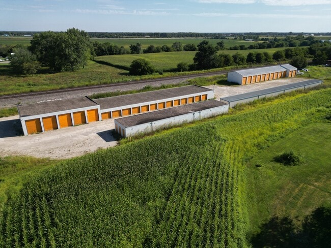
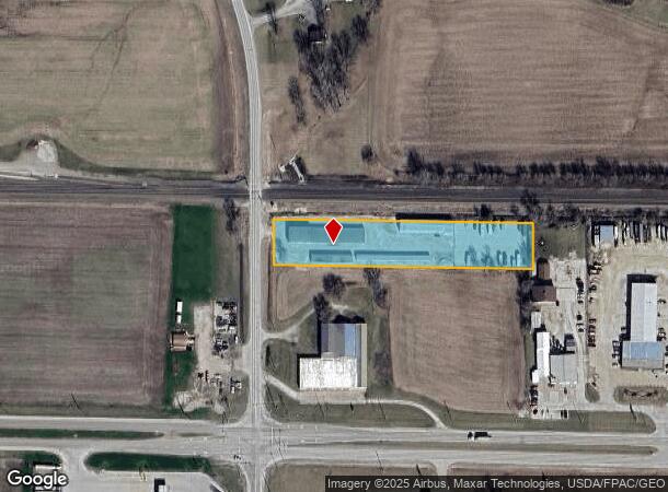
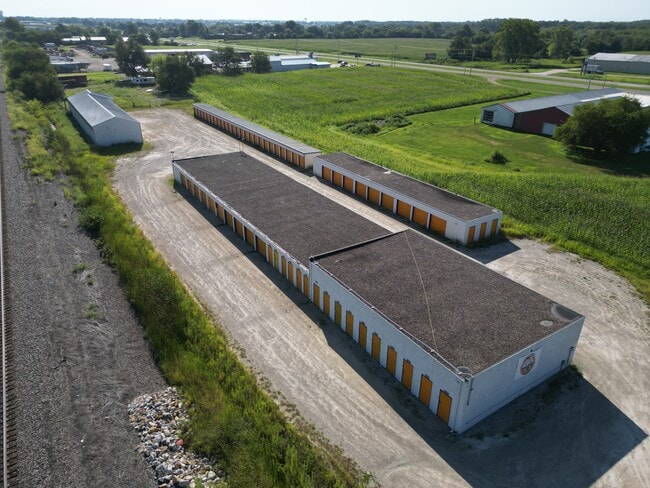
This Property Is For Sale
NEARBY LISTINGS FOR SALE OR LEASE
-
-
View all West Burlington listings for sale on LoopNet.com
Property Detail
130 N Beaverdale Rd
10-28-400-011
Burlington
Publicstorage
28-70-3 PT S1/2 SW SE
X
Des Moines
19057C0254F
Iowa
2024
2.03 AC
2025
Iowa Southeast Area
000800
Other Market Areas
8,446 SF
Burlington, IA-IL
DEMOGRAPHICS near 130 N Beaverdale Rd
1 Mile
3 Mile
5 Mile
2024 Total Population
159
4,762
17,275
2029 Population
161
4,762
17,110
Pop Growth 2024-2029
+ 1.26%
0.00%
(0.96%)
Average Age
46
44
44
2024 Total Households
63
2,005
7,551
HH Growth 2024-2029
+ 1.59%
(0.05%)
(1.07%)
Median Household Inc
$63,750
$55,784
$54,225
Avg Household Size
2.30
2.30
2.20
2024 Avg HH Vehicles
2.00
2.00
2.00
Median Home Value
$173,333
$155,924
$149,345
Median Year Built
1985
1971
1962
Nearby Places
- Restaurants
- Banks
- Shops
- Fitness
- Groceries
PUBLIC TRANSPORTATION
COMMUTER RAIL
DRIVE
WALK
Distance
11 min
6.6 mi
Nearby Properties
Address
Land Use
TOTAL SIZE
Lot Size
Zoning
Address
Land Use
TOTAL SIZE
Lot Size
Zoning
166,761 SF
39.52 AC
I1
Address
Land Use
TOTAL SIZE
Lot Size
Zoning
76,750 SF
37.58 AC
I1
Address
Land Use
TOTAL SIZE
Lot Size
Zoning
198,771 SF
13.31 AC
B2
Address
Land Use
TOTAL SIZE
Lot Size
Zoning
114,426 SF
20.77 AC
A1
Address
Land Use
TOTAL SIZE
Lot Size
Zoning
82,296 SF
31.76 AC
Address
Land Use
TOTAL SIZE
Lot Size
Zoning
205,237 SF
23.10 AC
B2
Address
Land Use
TOTAL SIZE
Lot Size
Zoning
30,076 SF
55.71 AC
Address
Land Use
TOTAL SIZE
Lot Size
Zoning
391,962 SF
17.04 AC
M2
Address
Land Use
TOTAL SIZE
Lot Size
Zoning
169,419 SF
28.67 AC
B2
Address
Land Use
TOTAL SIZE
Lot Size
Zoning
39,668 SF
3.41 AC
Address
Land Use
TOTAL SIZE
Lot Size
Zoning
52,730 SF
6.53 AC
R1
Address
Land Use
TOTAL SIZE
Lot Size
Zoning
88,783 SF
11.03 AC
B2
Address
Land Use
TOTAL SIZE
Lot Size
Zoning
25,584 SF
1.21 AC
Address
Land Use
TOTAL SIZE
Lot Size
Zoning
23,796 SF
14.30 AC
I2
Address
Land Use
TOTAL SIZE
Lot Size
Zoning
2,520 SF
32.75 AC
Address
Land Use
TOTAL SIZE
Lot Size
Zoning
10,222 SF
3.73 AC
Address
Land Use
TOTAL SIZE
Lot Size
Zoning
68,776 SF
5.89 AC
B2
Address
Land Use
TOTAL SIZE
Lot Size
Zoning
44,526 SF
0.02 AC
Address
Land Use
TOTAL SIZE
Lot Size
Zoning
85,592 SF
10.75 AC
B2
Address
Land Use
TOTAL SIZE
Lot Size
Zoning
21,000 SF
11.45 AC
B2
Address
Land Use
TOTAL SIZE
Lot Size
Zoning
25,685 SF
59.60 AC
A1
Address
Land Use
TOTAL SIZE
Lot Size
Zoning
21,213 SF
14.80 AC
Address
Land Use
TOTAL SIZE
Lot Size
Zoning
269,452 SF
31.37 AC
Address
Land Use
TOTAL SIZE
Lot Size
Zoning
22,744 SF
23.09 AC
Address
Land Use
TOTAL SIZE
Lot Size
Zoning
14,652 SF
19.59 AC
A1
Address
Land Use
TOTAL SIZE
Lot Size
Zoning
53,875 SF
2.20 AC
B2
Address
Land Use
TOTAL SIZE
Lot Size
Zoning
26,280 SF
2.85 AC
I3
Address
Land Use
TOTAL SIZE
Lot Size
Zoning
241,309 SF
12.13 AC
M2
Address
Land Use
TOTAL SIZE
Lot Size
Zoning
21,280 SF
3.64 AC
I2
Address
Land Use
TOTAL SIZE
Lot Size
Zoning
87,224 SF
11.80 AC
I3
The World's #1 Commercial Real Estate Marketplace
Connect with us
© 2025 CoStar Group
The information above has been obtained from sources believed reliable. While we do not doubt its accuracy we have not verified it and make no guarantee, warranty or representation about it. It is your responsibility to independently confirm its accuracy and completeness. Any projections, opinions, assumptions, or estimates used are for example only and do not represent the current or future performance of the property. The value of this transaction to you depends on tax and other factors which should be evaluated by your tax, financial, and legal advisors. You and your advisors should conduct a careful, independent investigation of the property to determine to your satisfaction the suitability of the property for your needs.