Property Record
120 Central Ave, Dover, NH 03820


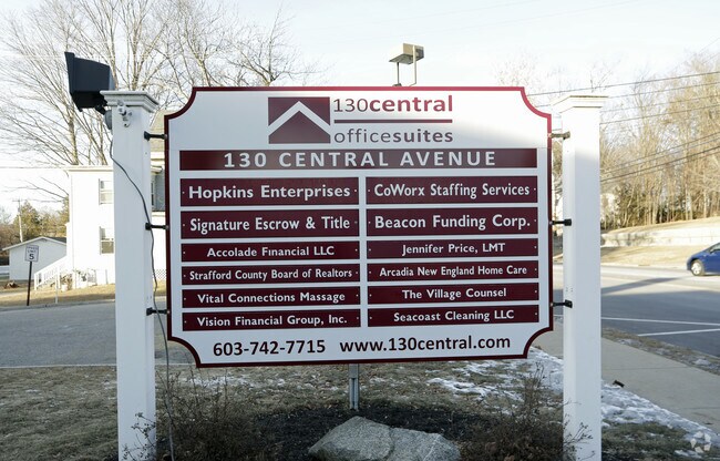
Property Detail
120 Central Ave
DOVR-015105
Strafford
Officebuilding
New Hampshire
G
1.06 AC
B and X Area of moderate flood hazard, usually the area between the limits of the 100-year and 500-year floods.
Strafford County
2025
Boston
2025
Boston-Cambridge-Newton, MA-NH
081300
NEARBY LISTINGS FOR SALE OR LEASE
DEMOGRAPHICS near 120 Central Ave
1 mile
3 mile
5 mile
2025 Total Population
10,693
31,333
61,960
2030 Population
11,015
31,938
62,911
Pop Growth 2025-2030
+ 3.01%
+ 1.93%
+ 1.53%
Average Age
40
40
39
2025 Total Households
5,360
14,335
24,885
HH Growth 2025-2030
+ 3.23%
+ 2.11%
+ 1.72%
Median Household Inc
$83,252
$92,115
$93,530
Avg Household Size
1.90
2.10
2.30
2025 Avg HH Vehicles
2.00
2.00
2.00
Median Home Value
$468,961
$458,276
$441,239
Median Year Built
1966
1975
1974
Nearby Places
Map Layers
Map Styles
 Street
 Aerial
Layers
 Traffic
 Biking
Places
Listings with unknown addresses are not visible on the map
- Restaurants
- Banks
- Shops
- Fitness
- Groceries
PUBLIC TRANSPORTATION
COMMUTER RAIL
Dover (Downeaster - Amtrak)
Drive
Walk
Distance
Dover (Downeaster - Amtrak)
4 min
20 min
1.0 mi
Durham (Downeaster - Amtrak)
Drive
Walk
Distance
Durham (Downeaster - Amtrak)
13 min
5.3 mi
AIRPORT
Portsmouth International at Pease
Drive
Walk
Distance
Portsmouth International at Pease
16 min
9.4 mi
Freight Ports
Portland, ME
Drive
Walk
Distance
Portland, ME
69 min
49.9 mi
SALE & LEASE HISTORY
LISTING DATE
SALE/LEASE

Sep 25, 2016
For Lease
Jul 24, 2018
For Lease
Jan 25, 2019
For Lease
Nearby Properties
Address
Land Use
TOTAL SIZE
Lot Size
Zoning
Address
Land Use
TOTAL SIZE
Lot Size
Zoning
24.83 AC
R-20
Address
Land Use
TOTAL SIZE
Lot Size
Zoning
220.20 AC
IT
Address
Land Use
TOTAL SIZE
Lot Size
Zoning
1.26 AC
CBD-G
Address
Land Use
TOTAL SIZE
Lot Size
Zoning
20.03 AC
R-20
Address
Land Use
TOTAL SIZE
Lot Size
Zoning
7.84 AC
C
Address
Land Use
TOTAL SIZE
Lot Size
Zoning
3.66 AC
IT
Address
Land Use
TOTAL SIZE
Lot Size
Zoning
1.22 AC
CBD-G
Address
Land Use
TOTAL SIZE
Lot Size
Zoning
50.52 AC
RM-SU*
Address
Land Use
TOTAL SIZE
Lot Size
Zoning
3.40 AC
CBD-M
Address
Land Use
TOTAL SIZE
Lot Size
Zoning
11.80 AC
R-12*
Address
Land Use
TOTAL SIZE
Lot Size
Zoning
26.40 AC
IT*
Address
Land Use
TOTAL SIZE
Lot Size
Zoning
71.83 AC
R-40
Address
Land Use
TOTAL SIZE
Lot Size
Zoning
12.60 AC
IT
Address
Land Use
TOTAL SIZE
Lot Size
Zoning
3.35 AC
CBD-G
Address
Land Use
TOTAL SIZE
Lot Size
Zoning
7.92 AC
R-12
Address
Land Use
TOTAL SIZE
Lot Size
Zoning
0.22 AC
CBD-G
Address
Land Use
TOTAL SIZE
Lot Size
Zoning
4.15 AC
R-12
Address
Land Use
TOTAL SIZE
Lot Size
Zoning
11.08 AC
RM-U
Address
Land Use
TOTAL SIZE
Lot Size
Zoning
15.46 AC
C
Address
Land Use
TOTAL SIZE
Lot Size
Zoning
3.66 AC
C
Address
Land Use
TOTAL SIZE
Lot Size
Zoning
11.47 AC
IT
Address
Land Use
TOTAL SIZE
Lot Size
Zoning
35.86 AC
R-40
Address
Land Use
TOTAL SIZE
Lot Size
Zoning
4.15 AC
RM-U
Address
Land Use
TOTAL SIZE
Lot Size
Zoning
15.46 AC
G
Address
Land Use
TOTAL SIZE
Lot Size
Zoning
9.29 AC
R-12*
Address
Land Use
TOTAL SIZE
Lot Size
Zoning
5 AC
C
Address
Land Use
TOTAL SIZE
Lot Size
Zoning
38.27 AC
RM-U
Address
Land Use
TOTAL SIZE
Lot Size
Zoning
8.96 AC
IT
Address
Land Use
TOTAL SIZE
Lot Size
Zoning
6.81 AC
CM
Address
Land Use
TOTAL SIZE
Lot Size
Zoning
3 AC
IT
The World's #1 Commercial Real Estate Marketplace
Connect with us
© 2026 CoStar Group
The information above has been obtained from sources believed reliable. While we do not doubt its accuracy we have not verified it and make no guarantee, warranty or representation about it. It is your responsibility to independently confirm its accuracy and completeness. Any projections, opinions, assumptions, or estimates used are for example only and do not represent the current or future performance of the property. The value of this transaction to you depends on tax and other factors which should be evaluated by your tax, financial, and legal advisors. You and your advisors should conduct a careful, independent investigation of the property to determine to your satisfaction the suitability of the property for your needs.