Property Record
130 Cloverfield Cr 130 Of, Pearland, TX 77581

NEARBY LISTINGS FOR SALE OR LEASE
Property Detail
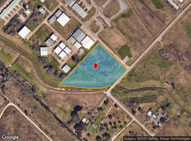
130 Cloverfield Cr 130 Of
Houston-The Woodlands-Sugar Land, TX
W H Snyder
0370-0003-135
A0370 W H SNYDER TRACT 1C4 ACRES 4.203
Vacantlandnec
Brazoria
AE
Texas
48039C0065K
4.20 AC
2024
NASA/Clear Lake
2025
Houston
660301
DEMOGRAPHICS near 130 Cloverfield Cr 130 Of
1 Mile
3 Mile
5 Mile
2024 Total Population
723
39,531
137,344
2029 Population
791
42,299
145,213
Pop Growth 2024-2029
+ 9.41%
+ 7.00%
+ 5.73%
Average Age
43
40
38
2024 Total Households
259
13,744
46,421
HH Growth 2024-2029
+ 9.65%
+ 7.08%
+ 5.79%
Median Household Inc
$91,435
$113,776
$102,786
Avg Household Size
2.60
2.80
2.90
2024 Avg HH Vehicles
2.00
2.00
2.00
Median Home Value
$434,020
$312,277
$284,036
Median Year Built
1990
1990
1994
Nearby Places
Map Layers
Map Styles
 Street
 Aerial
- Restaurants
- Banks
- Shops
- Fitness
- Groceries
PUBLIC TRANSPORTATION
AIRPORT
William P Hobby
DRIVE
WALK
Distance
William P Hobby
26 min
11.7 mi
Freight Ports
Port of Houston
DRIVE
WALK
Distance
Port of Houston
36 min
22.1 mi
Nearby Properties
Address
Land Use
TOTAL SIZE
Lot Size
Zoning
Address
Land Use
TOTAL SIZE
Lot Size
Zoning
40.52 AC
0017
Address
Land Use
TOTAL SIZE
Lot Size
Zoning
83.37 AC
0004
Address
Land Use
TOTAL SIZE
Lot Size
Zoning
97,736 SF
16.49 AC
Address
Land Use
TOTAL SIZE
Lot Size
Zoning
142,155 SF
19.16 AC
SP
Address
Land Use
TOTAL SIZE
Lot Size
Zoning
65,935 SF
81.27 AC
Address
Land Use
TOTAL SIZE
Lot Size
Zoning
161,803 SF
54.82 AC
Address
Land Use
TOTAL SIZE
Lot Size
Zoning
84,272 SF
16.93 AC
Address
Land Use
TOTAL SIZE
Lot Size
Zoning
113,376 SF
9.80 AC
Address
Land Use
TOTAL SIZE
Lot Size
Zoning
111,642 SF
9.53 AC
Address
Land Use
TOTAL SIZE
Lot Size
Zoning
115,805 SF
10.12 AC
SP
Address
Land Use
TOTAL SIZE
Lot Size
Zoning
99,042 SF
13 AC
MFRM
Address
Land Use
TOTAL SIZE
Lot Size
Zoning
229,097 SF
22.66 AC
Address
Land Use
TOTAL SIZE
Lot Size
Zoning
138,839 SF
7.46 AC
MFRH
Address
Land Use
TOTAL SIZE
Lot Size
Zoning
68,894 SF
6.11 AC
Address
Land Use
TOTAL SIZE
Lot Size
Zoning
83,995 SF
21.74 AC
CSC
Address
Land Use
TOTAL SIZE
Lot Size
Zoning
54,802 SF
12.63 AC
0014
Address
Land Use
TOTAL SIZE
Lot Size
Zoning
6,948 SF
54.94 AC
2080
Address
Land Use
TOTAL SIZE
Lot Size
Zoning
63,615 SF
6.42 AC
0010
Address
Land Use
TOTAL SIZE
Lot Size
Zoning
63,377 SF
2.71 AC
OBD
Address
Land Use
TOTAL SIZE
Lot Size
Zoning
76,646 SF
11.39 AC
SP
Address
Land Use
TOTAL SIZE
Lot Size
Zoning
110,923 SF
6.97 AC
Address
Land Use
TOTAL SIZE
Lot Size
Zoning
112,720 SF
8.21 AC
Address
Land Use
TOTAL SIZE
Lot Size
Zoning
108,250 SF
9.89 AC
Address
Land Use
TOTAL SIZE
Lot Size
Zoning
67,997 SF
3.98 AC
OBD
Address
Land Use
TOTAL SIZE
Lot Size
Zoning
77,997 SF
19 AC
0065
Address
Land Use
TOTAL SIZE
Lot Size
Zoning
56,905 SF
7 AC
Address
Land Use
TOTAL SIZE
Lot Size
Zoning
Address
Land Use
TOTAL SIZE
Lot Size
Zoning
3,680 SF
3.35 AC
OBD
Address
Land Use
TOTAL SIZE
Lot Size
Zoning
78,876 SF
9.22 AC
Address
Land Use
TOTAL SIZE
Lot Size
Zoning
98,005 SF
4.64 AC
The World's #1 Commercial Real Estate Marketplace
Connect with us
© 2025 CoStar Group
The information above has been obtained from sources believed reliable. While we do not doubt its accuracy we have not verified it and make no guarantee, warranty or representation about it. It is your responsibility to independently confirm its accuracy and completeness. Any projections, opinions, assumptions, or estimates used are for example only and do not represent the current or future performance of the property. The value of this transaction to you depends on tax and other factors which should be evaluated by your tax, financial, and legal advisors. You and your advisors should conduct a careful, independent investigation of the property to determine to your satisfaction the suitability of the property for your needs.