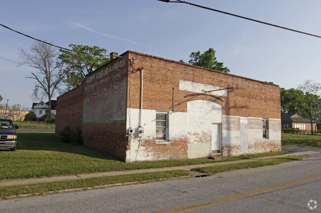
Property Record
130 E Hayne St, Woodruff, SC 29388


Property Detail
130 E Hayne St
4-32-03-175.00
N SIDE E HAYNE ST E OF S MAIN ST
Commercialnec
Spartanburg
B and X Area of moderate flood hazard, usually the area between the limits of the 100-year and 500-year floods.
South Carolina
2024
0.15 AC
2025
Lower Spartanburg Cty
023602
Greenville/Spartanburg
3,068 SF
Spartanburg, SC
NEARBY LISTINGS FOR SALE OR LEASE
DEMOGRAPHICS near 130 E Hayne St
1 mile
3 mile
5 mile
2025 Total Population
4,322
9,007
13,620
2030 Population
4,885
10,177
15,272
Pop Growth 2025-2030
+ 13.03%
+ 12.99%
+ 12.13%
Average Age
40
41
41
2025 Total Households
1,692
3,531
5,309
HH Growth 2025-2030
+ 13.18%
+ 13.11%
+ 12.28%
Median Household Inc
$63,813
$69,987
$71,019
Avg Household Size
2.40
2.40
2.50
2025 Avg HH Vehicles
2.00
2.00
2.00
Median Home Value
$182,904
$219,904
$225,768
Median Year Built
1980
1989
1990
Nearby Places
Map Layers
Map Styles
 Street
 Aerial
Layers
 Traffic
 Biking
Places
Listings with unknown addresses are not visible on the map
- Restaurants
- Banks
- Shops
- Fitness
- Groceries
PUBLIC TRANSPORTATION
AIRPORT
Greenville Spartanburg International
Drive
Walk
Distance
Greenville Spartanburg International
35 min
18.7 mi
Freight Ports
North Charleston Terminal
Drive
Walk
Distance
North Charleston Terminal
207 min
181.9 mi
Nearby Properties
Address
Land Use
TOTAL SIZE
Lot Size
Zoning
Address
Land Use
TOTAL SIZE
Lot Size
Zoning
825 SF
5 AC
Address
Land Use
TOTAL SIZE
Lot Size
Zoning
128.91 AC
Address
Land Use
TOTAL SIZE
Lot Size
Zoning
118.46 AC
Address
Land Use
TOTAL SIZE
Lot Size
Zoning
10,326 SF
314.80 AC
Address
Land Use
TOTAL SIZE
Lot Size
Zoning
48,964 SF
10.58 AC
Address
Land Use
TOTAL SIZE
Lot Size
Zoning
1,573 SF
38.19 AC
Address
Land Use
TOTAL SIZE
Lot Size
Zoning
13,758 SF
3.29 AC
Address
Land Use
TOTAL SIZE
Lot Size
Zoning
5,182 SF
0.77 AC
Address
Land Use
TOTAL SIZE
Lot Size
Zoning
14,155 SF
1.67 AC
Address
Land Use
TOTAL SIZE
Lot Size
Zoning
161,104 SF
5.09 AC
Address
Land Use
TOTAL SIZE
Lot Size
Zoning
2,599 SF
0.67 AC
Address
Land Use
TOTAL SIZE
Lot Size
Zoning
1,132 SF
31.09 AC
Address
Land Use
TOTAL SIZE
Lot Size
Zoning
4,456 SF
0.79 AC
Address
Land Use
TOTAL SIZE
Lot Size
Zoning
2,262 SF
0.21 AC
Address
Land Use
TOTAL SIZE
Lot Size
Zoning
47.19 AC
Address
Land Use
TOTAL SIZE
Lot Size
Zoning
43,925 SF
3.46 AC
Address
Land Use
TOTAL SIZE
Lot Size
Zoning
2,748 SF
0.14 AC
Address
Land Use
TOTAL SIZE
Lot Size
Zoning
3,564 SF
2.40 AC
Address
Land Use
TOTAL SIZE
Lot Size
Zoning
Address
Land Use
TOTAL SIZE
Lot Size
Zoning
1,972 SF
23.48 AC
Address
Land Use
TOTAL SIZE
Lot Size
Zoning
24,145 SF
8.19 AC
Address
Land Use
TOTAL SIZE
Lot Size
Zoning
3,426 SF
4 AC
Address
Land Use
TOTAL SIZE
Lot Size
Zoning
6,243 SF
7.09 AC
Address
Land Use
TOTAL SIZE
Lot Size
Zoning
12,313 SF
1.53 AC
Address
Land Use
TOTAL SIZE
Lot Size
Zoning
2,354 SF
1.41 AC
Address
Land Use
TOTAL SIZE
Lot Size
Zoning
2,402 SF
3.21 AC
Address
Land Use
TOTAL SIZE
Lot Size
Zoning
3,269 SF
1.61 AC
Address
Land Use
TOTAL SIZE
Lot Size
Zoning
10,874 SF
0.40 AC
Address
Land Use
TOTAL SIZE
Lot Size
Zoning
29.82 AC
Address
Land Use
TOTAL SIZE
Lot Size
Zoning
3,396 SF
0.45 AC
The World's #1 Commercial Real Estate Marketplace
Connect with us
© 2026 CoStar Group
The information above has been obtained from sources believed reliable. While we do not doubt its accuracy we have not verified it and make no guarantee, warranty or representation about it. It is your responsibility to independently confirm its accuracy and completeness. Any projections, opinions, assumptions, or estimates used are for example only and do not represent the current or future performance of the property. The value of this transaction to you depends on tax and other factors which should be evaluated by your tax, financial, and legal advisors. You and your advisors should conduct a careful, independent investigation of the property to determine to your satisfaction the suitability of the property for your needs.