Property Record
130 Fieldcrest Dr, Covington, GA 30014
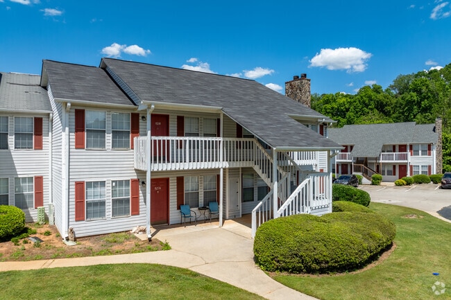
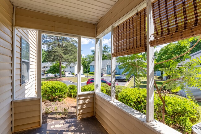

This Property Is For Sale
Property Detail
130 Fieldcrest Dr
C043000000068000
.42AC LT 12 FIELDCREST
Apartment
Newton
R1
Georgia
B and X Area of moderate flood hazard, usually the area between the limits of the 100-year and 500-year floods.
12
2025
0.41 AC
2025
Newton County
100506
Atlanta
3,942 SF
Atlanta-Sandy Springs-Roswell, GA
NEARBY LISTINGS FOR SALE OR LEASE
-
-
View all Covington listings for sale on LoopNet.com
DEMOGRAPHICS near 130 Fieldcrest Dr
1 mile
3 mile
5 mile
2025 Total Population
4,531
30,361
72,028
2030 Population
4,922
33,210
78,479
Pop Growth 2025-2030
+ 8.63%
+ 9.38%
+ 8.96%
Average Age
37
38
38
2025 Total Households
1,766
11,168
25,670
HH Growth 2025-2030
+ 8.66%
+ 9.52%
+ 9.09%
Median Household Inc
$59,292
$67,818
$73,417
Avg Household Size
2.30
2.60
2.70
2025 Avg HH Vehicles
2.00
2.00
2.00
Median Home Value
$177,131
$269,895
$276,963
Median Year Built
1987
1993
1998
Nearby Places
Map Layers
Map Styles
 Street
 Aerial
Layers
 Traffic
 Biking
Places
Listings with unknown addresses are not visible on the map
- Restaurants
- Banks
- Shops
- Fitness
- Groceries
Nearby Properties
Address
Land Use
TOTAL SIZE
Lot Size
Zoning
Address
Land Use
TOTAL SIZE
Lot Size
Zoning
8,358 SF
24.01 AC
Address
Land Use
TOTAL SIZE
Lot Size
Zoning
4,734 SF
35.19 AC
RMF
Address
Land Use
TOTAL SIZE
Lot Size
Zoning
207,237 SF
10.61 AC
E1
Address
Land Use
TOTAL SIZE
Lot Size
Zoning
306,886 SF
118.50 AC
R2
Address
Land Use
TOTAL SIZE
Lot Size
Zoning
391,932 SF
73.70 AC
R1
Address
Land Use
TOTAL SIZE
Lot Size
Zoning
14,624 SF
26.09 AC
C1
Address
Land Use
TOTAL SIZE
Lot Size
Zoning
19,292 SF
8.20 AC
H1
Address
Land Use
TOTAL SIZE
Lot Size
Zoning
7,130 SF
36.78 AC
A1
Address
Land Use
TOTAL SIZE
Lot Size
Zoning
45,900 AC
Address
Land Use
TOTAL SIZE
Lot Size
Zoning
88,944 SF
0.98 AC
E1
Address
Land Use
TOTAL SIZE
Lot Size
Zoning
92,162 SF
11.21 AC
R2
Address
Land Use
TOTAL SIZE
Lot Size
Zoning
5,160 SF
45.17 AC
C1
Address
Land Use
TOTAL SIZE
Lot Size
Zoning
262,782 SF
20.94 AC
Address
Land Use
TOTAL SIZE
Lot Size
Zoning
123,360 SF
109.16 AC
I1
Address
Land Use
TOTAL SIZE
Lot Size
Zoning
150,000 SF
34.05 AC
Address
Land Use
TOTAL SIZE
Lot Size
Zoning
34,384 SF
3.32 AC
Address
Land Use
TOTAL SIZE
Lot Size
Zoning
112,884 SF
2.74 AC
Address
Land Use
TOTAL SIZE
Lot Size
Zoning
50,464 SF
12.11 AC
Address
Land Use
TOTAL SIZE
Lot Size
Zoning
222,056 SF
13.35 AC
Address
Land Use
TOTAL SIZE
Lot Size
Zoning
3,888 SF
7.17 AC
C1
Address
Land Use
TOTAL SIZE
Lot Size
Zoning
28,790 SF
3.70 AC
E1
Address
Land Use
TOTAL SIZE
Lot Size
Zoning
33,550 SF
37.40 AC
I1
Address
Land Use
TOTAL SIZE
Lot Size
Zoning
48,144 SF
1.50 AC
E1
Address
Land Use
TOTAL SIZE
Lot Size
Zoning
65,520 SF
35 AC
E6
Address
Land Use
TOTAL SIZE
Lot Size
Zoning
65,008 SF
23.81 AC
R2
Address
Land Use
TOTAL SIZE
Lot Size
Zoning
169,660 SF
35.21 AC
I1
Address
Land Use
TOTAL SIZE
Lot Size
Zoning
4,768 SF
263.26 AC
C1
Address
Land Use
TOTAL SIZE
Lot Size
Zoning
41,772 SF
28.03 AC
E6
Address
Land Use
TOTAL SIZE
Lot Size
Zoning
6,936 SF
8.88 AC
C1
Address
Land Use
TOTAL SIZE
Lot Size
Zoning
28,512 SF
0.52 AC
The World's #1 Commercial Real Estate Marketplace
Connect with us
© 2026 CoStar Group
The information above has been obtained from sources believed reliable. While we do not doubt its accuracy we have not verified it and make no guarantee, warranty or representation about it. It is your responsibility to independently confirm its accuracy and completeness. Any projections, opinions, assumptions, or estimates used are for example only and do not represent the current or future performance of the property. The value of this transaction to you depends on tax and other factors which should be evaluated by your tax, financial, and legal advisors. You and your advisors should conduct a careful, independent investigation of the property to determine to your satisfaction the suitability of the property for your needs.