Property Record
130 High St, Upton, MA 01568
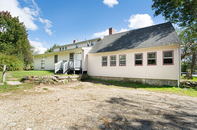
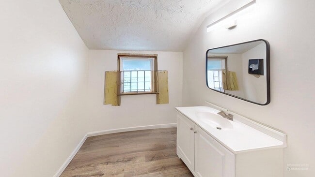
This Property Is For Sale
Current Lease Availabilities
NEARBY LISTINGS FOR SALE OR LEASE
Property Detail
130 High St
UPTO-000015-000000-000065
Worcester
Sfr
Massachusetts
X
65
25027C0861E
0.42 AC
2025
Outlying Worcester
2025
Boston
743100
Worcester, MA
2,714 SF
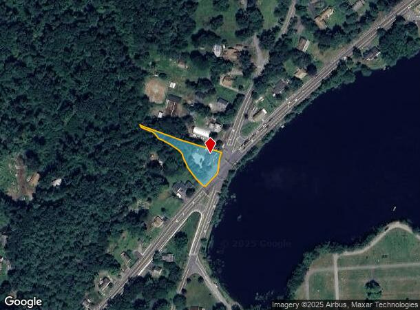
DEMOGRAPHICS near 130 High St
1 mile
3 mile
5 mile
2024 Total Population
1,833
14,003
62,996
2029 Population
1,825
13,969
62,805
Pop Growth 2024-2029
(0.44%)
(0.24%)
(0.30%)
Average Age
42
42
41
2024 Total Households
690
5,081
23,174
HH Growth 2024-2029
(0.43%)
(0.33%)
(0.38%)
Median Household Inc
$112,954
$140,488
$124,988
Avg Household Size
2.70
2.70
2.70
2024 Avg HH Vehicles
2.00
2.00
2.00
Median Home Value
$497,471
$537,879
$472,853
Median Year Built
1964
1981
1977
Nearby Places
Map Layers
Map Styles
 Street
 Aerial
Transit
 Traffic
 Biking
Places
Listings with unknown addresses are not visible on the map
- Restaurants
- Banks
- Shops
- Fitness
- Groceries
PUBLIC TRANSPORTATION
COMMUTER RAIL
Westborough (Framingham/Worcester Line - Massachusetts Bay Transportation Authority Commuter Rail (Purple Line))
Drive
Walk
Distance
Westborough (Framingham/Worcester Line - Massachusetts Bay Transportation Authority Commuter Rail (Purple Line))
18 min
8.5 mi
Grafton (Framingham/Worcester Line - Massachusetts Bay Transportation Authority Commuter Rail (Purple Line))
Drive
Walk
Distance
Grafton (Framingham/Worcester Line - Massachusetts Bay Transportation Authority Commuter Rail (Purple Line))
20 min
9.1 mi
AIRPORT
Worcester Regional
Drive
Walk
Distance
Worcester Regional
38 min
21.6 mi
Freight Ports
Port of Boston
Drive
Walk
Distance
Port of Boston
54 min
38.4 mi
Nearby Properties
Address
Land Use
TOTAL SIZE
Lot Size
Zoning
Address
Land Use
TOTAL SIZE
Lot Size
Zoning
147,000 SF
28.41 AC
5
Address
Land Use
TOTAL SIZE
Lot Size
Zoning
159,250 SF
28.89 AC
2
Address
Land Use
TOTAL SIZE
Lot Size
Zoning
99,891 SF
17.37 AC
1
Address
Land Use
TOTAL SIZE
Lot Size
Zoning
2,576 SF
3.37 AC
5
Address
Land Use
TOTAL SIZE
Lot Size
Zoning
51,441 SF
3.50 AC
3
Address
Land Use
TOTAL SIZE
Lot Size
Zoning
87,250 SF
4.46 AC
6
Address
Land Use
TOTAL SIZE
Lot Size
Zoning
23,326 SF
33.14 AC
7
Address
Land Use
TOTAL SIZE
Lot Size
Zoning
9,117 SF
3.34 AC
A
Address
Land Use
TOTAL SIZE
Lot Size
Zoning
5.78 AC
OLI
Address
Land Use
TOTAL SIZE
Lot Size
Zoning
22,864 SF
3.96 AC
1
Address
Land Use
TOTAL SIZE
Lot Size
Zoning
43,280 SF
4.58 AC
N/A
Address
Land Use
TOTAL SIZE
Lot Size
Zoning
7,921 SF
24.31 AC
A
Address
Land Use
TOTAL SIZE
Lot Size
Zoning
16,998 SF
42.57 AC
5
Address
Land Use
TOTAL SIZE
Lot Size
Zoning
25,345 SF
2.14 AC
6
Address
Land Use
TOTAL SIZE
Lot Size
Zoning
6,838 SF
1.39 AC
A
Address
Land Use
TOTAL SIZE
Lot Size
Zoning
6,842 SF
2.76 AC
A
Address
Land Use
TOTAL SIZE
Lot Size
Zoning
4.16 AC
R8
Address
Land Use
TOTAL SIZE
Lot Size
Zoning
6,930 SF
1.63 AC
A
Address
Land Use
TOTAL SIZE
Lot Size
Zoning
5,263 SF
3.01 AC
A
Address
Land Use
TOTAL SIZE
Lot Size
Zoning
13,520 SF
1.40 AC
R8
Address
Land Use
TOTAL SIZE
Lot Size
Zoning
5,262 SF
1.39 AC
A
Address
Land Use
TOTAL SIZE
Lot Size
Zoning
5,564 SF
1.66 AC
A
Address
Land Use
TOTAL SIZE
Lot Size
Zoning
6,957 SF
3.59 AC
A
Address
Land Use
TOTAL SIZE
Lot Size
Zoning
6,453 SF
1.58 AC
A2
Address
Land Use
TOTAL SIZE
Lot Size
Zoning
5,203 SF
1.45 AC
A
Address
Land Use
TOTAL SIZE
Lot Size
Zoning
7,739 SF
6.08 AC
A
Address
Land Use
TOTAL SIZE
Lot Size
Zoning
17,728 SF
1.45 AC
6
Address
Land Use
TOTAL SIZE
Lot Size
Zoning
6,078 SF
1.38 AC
A
Address
Land Use
TOTAL SIZE
Lot Size
Zoning
16,383 SF
0.24 AC
1
Address
Land Use
TOTAL SIZE
Lot Size
Zoning
5,985 SF
1.98 AC
A
The World's #1 Commercial Real Estate Marketplace
Connect with us
© 2026 CoStar Group
The information above has been obtained from sources believed reliable. While we do not doubt its accuracy we have not verified it and make no guarantee, warranty or representation about it. It is your responsibility to independently confirm its accuracy and completeness. Any projections, opinions, assumptions, or estimates used are for example only and do not represent the current or future performance of the property. The value of this transaction to you depends on tax and other factors which should be evaluated by your tax, financial, and legal advisors. You and your advisors should conduct a careful, independent investigation of the property to determine to your satisfaction the suitability of the property for your needs.