Property Record
130 Main St, Salem, NH 03079
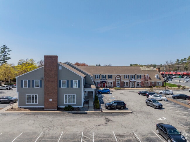


Property Detail
130 Main St
Regionalshoppingcenterormallwithanchorstore
Rockingham
CIC
New Hampshire
C and X Area of minimal flood hazard, usually depicted on FIRMs as above the 500-year flood level.
1.55 AC
2025
Rockingham
2025
Boston
100401
Boston-Cambridge-Newton, MA-NH
21,914 SF
SLEM-000089-011045
NEARBY LISTINGS FOR SALE OR LEASE
DEMOGRAPHICS near 130 Main St
1 mile
3 mile
5 mile
2025 Total Population
6,228
30,212
87,392
2030 Population
6,460
30,751
89,073
Pop Growth 2025-2030
+ 3.73%
+ 1.78%
+ 1.92%
Average Age
47
45
43
2025 Total Households
2,896
12,014
32,717
HH Growth 2025-2030
+ 4.07%
+ 1.87%
+ 1.86%
Median Household Inc
$84,057
$102,651
$112,915
Avg Household Size
2.10
2.50
2.60
2025 Avg HH Vehicles
2.00
2.00
2.00
Median Home Value
$454,643
$520,800
$558,892
Median Year Built
1978
1979
1978
Nearby Places
Map Layers
Map Styles
 Street
 Aerial
Layers
 Traffic
 Biking
Places
Listings with unknown addresses are not visible on the map
- Restaurants
- Banks
- Shops
- Fitness
- Groceries
PUBLIC TRANSPORTATION
COMMUTER RAIL
Lawrence (Haverhill Line - Massachusetts Bay Transportation Authority Commuter Rail (Purple Line))
Drive
Walk
Distance
Lawrence (Haverhill Line - Massachusetts Bay Transportation Authority Commuter Rail (Purple Line))
13 min
7.5 mi
Bradford (Haverhill Line - Massachusetts Bay Transportation Authority Commuter Rail (Purple Line))
Drive
Walk
Distance
Bradford (Haverhill Line - Massachusetts Bay Transportation Authority Commuter Rail (Purple Line))
18 min
8.7 mi
AIRPORT
Manchester Boston Regional
Drive
Walk
Distance
Manchester Boston Regional
33 min
19.8 mi
Portsmouth International at Pease
Drive
Walk
Distance
Portsmouth International at Pease
55 min
37.5 mi
Freight Ports
Port of Boston
Drive
Walk
Distance
Port of Boston
48 min
34.9 mi
SALE & LEASE HISTORY
LISTING DATE
SALE/LEASE

Sep 24, 2016
For Lease
May 15, 2019
For Lease
Jan 16, 2024
For Lease
Nearby Properties
Address
Land Use
TOTAL SIZE
Lot Size
Zoning
Address
Land Use
TOTAL SIZE
Lot Size
Zoning
555,715 SF
32.40 AC
CIC
Address
Land Use
TOTAL SIZE
Lot Size
Zoning
Address
Land Use
TOTAL SIZE
Lot Size
Zoning
306,500 SF
8.31 AC
CIC
Address
Land Use
TOTAL SIZE
Lot Size
Zoning
48.22 AC
TCD
Address
Land Use
TOTAL SIZE
Lot Size
Zoning
8.37 AC
CIC
Address
Land Use
TOTAL SIZE
Lot Size
Zoning
273,035 SF
7.70 AC
CIC
Address
Land Use
TOTAL SIZE
Lot Size
Zoning
255,000 SF
1.64 AC
CIC
Address
Land Use
TOTAL SIZE
Lot Size
Zoning
38.50 AC
CIC
Address
Land Use
TOTAL SIZE
Lot Size
Zoning
23.55 AC
CIC
Address
Land Use
TOTAL SIZE
Lot Size
Zoning
137,886 SF
26.65 AC
CIC
Address
Land Use
TOTAL SIZE
Lot Size
Zoning
75.16 AC
CIB
Address
Land Use
TOTAL SIZE
Lot Size
Zoning
168,870 SF
4.35 AC
CIC
Address
Land Use
TOTAL SIZE
Lot Size
Zoning
20.17 AC
CIC
Address
Land Use
TOTAL SIZE
Lot Size
Zoning
205,043 SF
24.10 AC
CIC
Address
Land Use
TOTAL SIZE
Lot Size
Zoning
72.18 AC
CIB
Address
Land Use
TOTAL SIZE
Lot Size
Zoning
297,592 SF
2.90 AC
CIC
Address
Land Use
TOTAL SIZE
Lot Size
Zoning
181,956 SF
19.79 AC
CIC
Address
Land Use
TOTAL SIZE
Lot Size
Zoning
185,496 SF
11.99 AC
CIC
Address
Land Use
TOTAL SIZE
Lot Size
Zoning
75,000 SF
1.50 AC
CIC
Address
Land Use
TOTAL SIZE
Lot Size
Zoning
5.45 AC
Address
Land Use
TOTAL SIZE
Lot Size
Zoning
7.99 AC
CIB
Address
Land Use
TOTAL SIZE
Lot Size
Zoning
215,338 SF
66.52 AC
CIB
Address
Land Use
TOTAL SIZE
Lot Size
Zoning
91,266 SF
26 AC
RUR
Address
Land Use
TOTAL SIZE
Lot Size
Zoning
12.10 AC
CIC
Address
Land Use
TOTAL SIZE
Lot Size
Zoning
164,772 SF
11.91 AC
CIC
Address
Land Use
TOTAL SIZE
Lot Size
Zoning
137,420 SF
15 AC
TCD
Address
Land Use
TOTAL SIZE
Lot Size
Zoning
72,936 SF
5.50 AC
TCD
Address
Land Use
TOTAL SIZE
Lot Size
Zoning
50,048 SF
8.81 AC
CIB
Address
Land Use
TOTAL SIZE
Lot Size
Zoning
32,949 SF
5.98 AC
CIC
Address
Land Use
TOTAL SIZE
Lot Size
Zoning
21,433 SF
7.54 AC
LID
The World's #1 Commercial Real Estate Marketplace
Connect with us
© 2026 CoStar Group
The information above has been obtained from sources believed reliable. While we do not doubt its accuracy we have not verified it and make no guarantee, warranty or representation about it. It is your responsibility to independently confirm its accuracy and completeness. Any projections, opinions, assumptions, or estimates used are for example only and do not represent the current or future performance of the property. The value of this transaction to you depends on tax and other factors which should be evaluated by your tax, financial, and legal advisors. You and your advisors should conduct a careful, independent investigation of the property to determine to your satisfaction the suitability of the property for your needs.