Property Record
130 Mosswood Blvd, Youngsville, NC 27596

Current Lease Availabilities
NEARBY LISTINGS FOR SALE OR LEASE
Property Detail
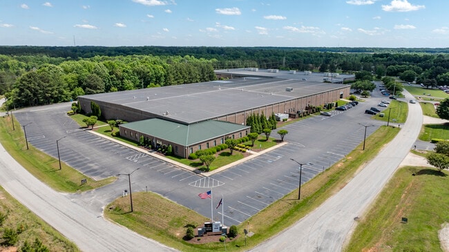
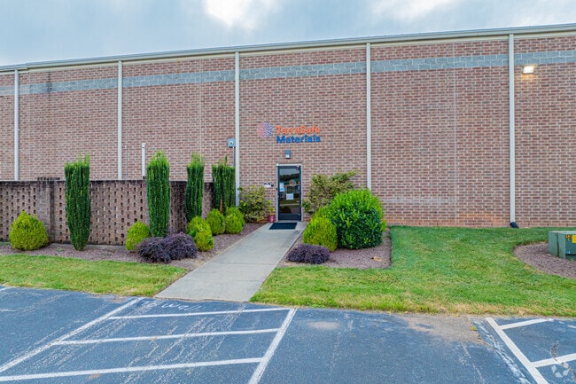
130 Mosswood Blvd
Raleigh, NC
Mosswood Lot
030698
MB 97/140
Lightindustrial
Franklin
X
North Carolina
3720184300K
2
2025
6.97 AC
2025
Franklin County
060501
Raleigh/Durham
119,496 SF
DEMOGRAPHICS near 130 Mosswood Blvd
1 Mile
3 Mile
5 Mile
2024 Total Population
2,069
22,399
58,301
2029 Population
2,534
26,663
67,325
Pop Growth 2024-2029
+ 22.47%
+ 19.04%
+ 15.48%
Average Age
39
39
40
2024 Total Households
749
8,160
21,311
HH Growth 2024-2029
+ 22.30%
+ 19.08%
+ 15.56%
Median Household Inc
$82,458
$91,983
$95,235
Avg Household Size
2.80
2.70
2.70
2024 Avg HH Vehicles
2.00
2.00
2.00
Median Home Value
$269,574
$309,540
$343,254
Median Year Built
2004
2003
2003
Nearby Places
Map Layers
Map Styles
 Street
 Aerial
- Restaurants
- Banks
- Shops
- Fitness
- Groceries
PUBLIC TRANSPORTATION
AIRPORT
Raleigh-Durham International
DRIVE
WALK
Distance
Raleigh-Durham International
38 min
25.3 mi
Nearby Properties
Address
Land Use
TOTAL SIZE
Lot Size
Zoning
Address
Land Use
TOTAL SIZE
Lot Size
Zoning
159,584 SF
67.12 AC
FCO GB
Address
Land Use
TOTAL SIZE
Lot Size
Zoning
97,878 SF
26.85 AC
GR5
Address
Land Use
TOTAL SIZE
Lot Size
Zoning
216,580 SF
14.99 AC
FCO GB
Address
Land Use
TOTAL SIZE
Lot Size
Zoning
170,100 SF
15.41 AC
FCO GB
Address
Land Use
TOTAL SIZE
Lot Size
Zoning
102,946 SF
43.23 AC
FCO GB
Address
Land Use
TOTAL SIZE
Lot Size
Zoning
20,981 SF
30.74 AC
FCO GB
Address
Land Use
TOTAL SIZE
Lot Size
Zoning
160,525 SF
20.02 AC
IND
Address
Land Use
TOTAL SIZE
Lot Size
Zoning
364,500 SF
30.25 AC
IND
Address
Land Use
TOTAL SIZE
Lot Size
Zoning
81,604 SF
17.53 AC
CIVIC
Address
Land Use
TOTAL SIZE
Lot Size
Zoning
65,837 SF
30 AC
M U
Address
Land Use
TOTAL SIZE
Lot Size
Zoning
68,189 SF
8.46 AC
HB
Address
Land Use
TOTAL SIZE
Lot Size
Zoning
148,249 SF
8.45 AC
L I
Address
Land Use
TOTAL SIZE
Lot Size
Zoning
28,756 SF
100.63 AC
FCO GB
Address
Land Use
TOTAL SIZE
Lot Size
Zoning
34,176 SF
12.93 AC
CU-1
Address
Land Use
TOTAL SIZE
Lot Size
Zoning
53,072 SF
20.91 AC
FCO GB
Address
Land Use
TOTAL SIZE
Lot Size
Zoning
112,694 SF
6.85 AC
M U
Address
Land Use
TOTAL SIZE
Lot Size
Zoning
73,722 SF
23.98 AC
IND
Address
Land Use
TOTAL SIZE
Lot Size
Zoning
880 SF
88.02 AC
MU-2
Address
Land Use
TOTAL SIZE
Lot Size
Zoning
63,930 SF
17.06 AC
CIVIC
Address
Land Use
TOTAL SIZE
Lot Size
Zoning
117,140 SF
8.62 AC
M U
Address
Land Use
TOTAL SIZE
Lot Size
Zoning
189,896 SF
10.01 AC
L I
Address
Land Use
TOTAL SIZE
Lot Size
Zoning
79,369 SF
4.62 AC
L I
Address
Land Use
TOTAL SIZE
Lot Size
Zoning
100,985 SF
10 AC
M U
Address
Land Use
TOTAL SIZE
Lot Size
Zoning
53.73 AC
IND
Address
Land Use
TOTAL SIZE
Lot Size
Zoning
79,560 SF
9.43 AC
IND
Address
Land Use
TOTAL SIZE
Lot Size
Zoning
35,519 SF
15.46 AC
CIVIC
Address
Land Use
TOTAL SIZE
Lot Size
Zoning
28,958 SF
4.64 AC
HB
Address
Land Use
TOTAL SIZE
Lot Size
Zoning
5,600 SF
8.66 AC
M U-2
Address
Land Use
TOTAL SIZE
Lot Size
Zoning
71,946 SF
8.05 AC
RMX
The World's #1 Commercial Real Estate Marketplace
Connect with us
© 2025 CoStar Group
The information above has been obtained from sources believed reliable. While we do not doubt its accuracy we have not verified it and make no guarantee, warranty or representation about it. It is your responsibility to independently confirm its accuracy and completeness. Any projections, opinions, assumptions, or estimates used are for example only and do not represent the current or future performance of the property. The value of this transaction to you depends on tax and other factors which should be evaluated by your tax, financial, and legal advisors. You and your advisors should conduct a careful, independent investigation of the property to determine to your satisfaction the suitability of the property for your needs.