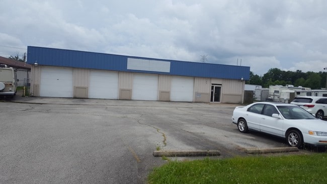
Property Record
130 Outer Loop, Louisville, KY 40214


NEARBY LISTINGS FOR SALE OR LEASE
Property Detail
130 Outer Loop
104907730000
TRACT 2 MINOR PLAT DB 5360 X 192, 1.9656 AC +/-
Autorepair
Jefferson
AE
Kentucky
21111C0090F
1.97 AC
2025
South Central
2025
Louisville
012005
Louisville/Jefferson County, KY-IN
5,760 SF
DEMOGRAPHICS near 130 Outer Loop
1 Mile
3 Mile
5 Mile
2024 Total Population
4,686
48,086
140,668
2029 Population
4,613
47,409
138,923
Pop Growth 2024-2029
(1.56%)
(1.41%)
(1.24%)
Average Age
37
39
39
2024 Total Households
1,678
18,875
56,243
HH Growth 2024-2029
(1.61%)
(1.46%)
(1.30%)
Median Household Inc
$49,777
$57,746
$50,419
Avg Household Size
2.70
2.50
2.40
2024 Avg HH Vehicles
2.00
2.00
2.00
Median Home Value
$183,746
$180,804
$160,214
Median Year Built
1977
1970
1964
Nearby Places
Map Layers
Map Styles
 Street
 Aerial
- Restaurants
- Banks
- Shops
- Fitness
- Groceries
PUBLIC TRANSPORTATION
AIRPORT
Louisville Muhammad Ali International
DRIVE
WALK
Distance
Louisville Muhammad Ali International
12 min
5.0 mi
SALE & LEASE HISTORY
LISTING DATE
SALE/LEASE

Jul 20, 2017
For Sale
Jan 15, 2018
For Sale
Nearby Properties
Address
Land Use
TOTAL SIZE
Lot Size
Zoning
Address
Land Use
TOTAL SIZE
Lot Size
Zoning
221,115 SF
97.92 AC
EZ1-ENTERP
Address
Land Use
TOTAL SIZE
Lot Size
Zoning
822,500 SF
44.75 AC
EZ1-ENTERP
Address
Land Use
TOTAL SIZE
Lot Size
Zoning
30.47 AC
R7-RESIDEN
Address
Land Use
TOTAL SIZE
Lot Size
Zoning
2,400 SF
42.61 AC
M2-INDUSTR
Address
Land Use
TOTAL SIZE
Lot Size
Zoning
679,250 SF
35.34 AC
Address
Land Use
TOTAL SIZE
Lot Size
Zoning
22.14 AC
EZ1-ENTERP
Address
Land Use
TOTAL SIZE
Lot Size
Zoning
1,800 SF
31.91 AC
Address
Land Use
TOTAL SIZE
Lot Size
Zoning
28.70 AC
C1-COMMERC
Address
Land Use
TOTAL SIZE
Lot Size
Zoning
22,113 SF
19.01 AC
R4-RESIDEN
Address
Land Use
TOTAL SIZE
Lot Size
Zoning
2,043 SF
60.14 AC
Address
Land Use
TOTAL SIZE
Lot Size
Zoning
256,872 SF
23.71 AC
C1-COMMERC
Address
Land Use
TOTAL SIZE
Lot Size
Zoning
2,507 SF
77.40 AC
R5-RESIDEN
Address
Land Use
TOTAL SIZE
Lot Size
Zoning
20,496 SF
18.38 AC
R6-RESIDEN
Address
Land Use
TOTAL SIZE
Lot Size
Zoning
5,560 SF
Address
Land Use
TOTAL SIZE
Lot Size
Zoning
201,600 SF
11.43 AC
EZ1-ENTERP
Address
Land Use
TOTAL SIZE
Lot Size
Zoning
321,501 SF
20 AC
M3-INDUSTR
Address
Land Use
TOTAL SIZE
Lot Size
Zoning
15.72 AC
R6-RESIDEN
Address
Land Use
TOTAL SIZE
Lot Size
Zoning
350,000 SF
20.55 AC
CM-COMMERC
Address
Land Use
TOTAL SIZE
Lot Size
Zoning
5.80 AC
EZ1-ENTERP
Address
Land Use
TOTAL SIZE
Lot Size
Zoning
17,270 SF
4.74 AC
R5-RESIDEN
Address
Land Use
TOTAL SIZE
Lot Size
Zoning
200 SF
57.08 AC
R4-RESIDEN
Address
Land Use
TOTAL SIZE
Lot Size
Zoning
5,568 SF
13.52 AC
C1-COMMERC
Address
Land Use
TOTAL SIZE
Lot Size
Zoning
12.98 AC
EZ1-ENTERP
Address
Land Use
TOTAL SIZE
Lot Size
Zoning
285,378 SF
16.79 AC
EZ1-ENTERP
Address
Land Use
TOTAL SIZE
Lot Size
Zoning
23.17 AC
R4-RESIDEN
Address
Land Use
TOTAL SIZE
Lot Size
Zoning
17.93 AC
Address
Land Use
TOTAL SIZE
Lot Size
Zoning
303,480 SF
14.20 AC
EZ1-ENTERP
Address
Land Use
TOTAL SIZE
Lot Size
Zoning
5,232 SF
8.34 AC
R7-RESIDEN
Address
Land Use
TOTAL SIZE
Lot Size
Zoning
273,000 SF
12.94 AC
EZ1-ENTERP
Address
Land Use
TOTAL SIZE
Lot Size
Zoning
217,081 SF
24.04 AC
C2-COMMERC
The World's #1 Commercial Real Estate Marketplace
Connect with us
© 2026 CoStar Group
The information above has been obtained from sources believed reliable. While we do not doubt its accuracy we have not verified it and make no guarantee, warranty or representation about it. It is your responsibility to independently confirm its accuracy and completeness. Any projections, opinions, assumptions, or estimates used are for example only and do not represent the current or future performance of the property. The value of this transaction to you depends on tax and other factors which should be evaluated by your tax, financial, and legal advisors. You and your advisors should conduct a careful, independent investigation of the property to determine to your satisfaction the suitability of the property for your needs.