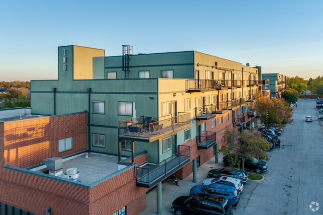
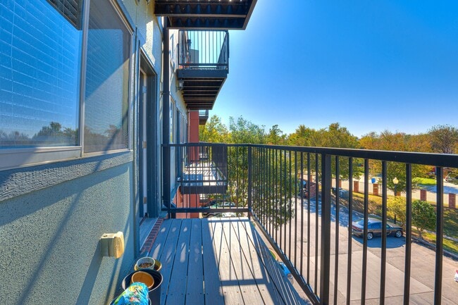
Property Record
1300 12Th Ave Se, Norman, OK 73071
Current Lease Availabilities
Property Detail
1300 12Th Ave Se
Oklahoma City, OK
East Village Replat Lts 29 30 31 Blk 1 B
R0156871
EAST VILLAGE PUD LT 2 & UND 1/2 INT OF COMMON AREA A EAST VILLAGE CONDOS UNIT 200 & 1.0404 UND INT IN C/E
Storebuilding
Cleveland
X
Oklahoma
40027C0285H
2
2025
0.03 AC
2025
Outer Norman
201302
Oklahoma City
1,287 SF
NEARBY LISTINGS FOR SALE OR LEASE
DEMOGRAPHICS near 1300 12Th Ave Se
1 mile
3 mile
5 mile
2024 Total Population
17,988
81,361
117,256
2029 Population
18,722
84,876
122,701
Pop Growth 2024-2029
+ 4.08%
+ 4.32%
+ 4.64%
Average Age
32
34
36
2024 Total Households
7,888
32,060
46,748
HH Growth 2024-2029
+ 4.41%
+ 4.71%
+ 4.95%
Median Household Inc
$38,772
$44,883
$54,574
Avg Household Size
2.20
2.20
2.30
2024 Avg HH Vehicles
2.00
2.00
2.00
Median Home Value
$167,452
$180,473
$198,003
Median Year Built
1983
1983
1986
Nearby Places
Map Layers
Map Styles
 Street
 Aerial
Transit
 Traffic
 Biking
Places
Listings with unknown addresses are not visible on the map
- Restaurants
- Banks
- Shops
- Fitness
- Groceries
PUBLIC TRANSPORTATION
COMMUTER RAIL
Norman Amtrak Station (Heartland Flyer - Amtrak)
Drive
Walk
Distance
Norman Amtrak Station (Heartland Flyer - Amtrak)
5 min
2.0 mi
AIRPORT
Will Rogers World
Drive
Walk
Distance
Will Rogers World
40 min
23.3 mi
Freight Ports
Tulsa Port Of Catoosa
Drive
Walk
Distance
Tulsa Port Of Catoosa
161 min
143.5 mi
Nearby Properties
Address
Land Use
TOTAL SIZE
Lot Size
Zoning
Address
Land Use
TOTAL SIZE
Lot Size
Zoning
18.60 AC
Address
Land Use
TOTAL SIZE
Lot Size
Zoning
4.36 AC
Address
Land Use
TOTAL SIZE
Lot Size
Zoning
100,000 SF
208.35 AC
Address
Land Use
TOTAL SIZE
Lot Size
Zoning
18,644 SF
2.16 AC
CO
Address
Land Use
TOTAL SIZE
Lot Size
Zoning
60,000 SF
4.39 AC
RM
Address
Land Use
TOTAL SIZE
Lot Size
Zoning
Address
Land Use
TOTAL SIZE
Lot Size
Zoning
345,756 SF
26.21 AC
Address
Land Use
TOTAL SIZE
Lot Size
Zoning
3.07 AC
Address
Land Use
TOTAL SIZE
Lot Size
Zoning
319,555 SF
6.86 AC
Address
Land Use
TOTAL SIZE
Lot Size
Zoning
21,641 SF
5.11 AC
Address
Land Use
TOTAL SIZE
Lot Size
Zoning
0.41 AC
R2
Address
Land Use
TOTAL SIZE
Lot Size
Zoning
Address
Land Use
TOTAL SIZE
Lot Size
Zoning
131,387 SF
9.55 AC
Address
Land Use
TOTAL SIZE
Lot Size
Zoning
10.83 AC
Address
Land Use
TOTAL SIZE
Lot Size
Zoning
102,331 SF
12.46 AC
Address
Land Use
TOTAL SIZE
Lot Size
Zoning
35,127 SF
2.34 AC
C2
Address
Land Use
TOTAL SIZE
Lot Size
Zoning
467,281 SF
33.50 AC
Address
Land Use
TOTAL SIZE
Lot Size
Zoning
3,188 SF
0.05 AC
R2
Address
Land Use
TOTAL SIZE
Lot Size
Zoning
13,005 SF
18.37 AC
Address
Land Use
TOTAL SIZE
Lot Size
Zoning
54,160 SF
8.26 AC
Address
Land Use
TOTAL SIZE
Lot Size
Zoning
351,466 SF
67.68 AC
I2
Address
Land Use
TOTAL SIZE
Lot Size
Zoning
Address
Land Use
TOTAL SIZE
Lot Size
Zoning
6.67 AC
Address
Land Use
TOTAL SIZE
Lot Size
Zoning
20,270 SF
1.17 AC
R1
Address
Land Use
TOTAL SIZE
Lot Size
Zoning
367,145 SF
22.97 AC
Address
Land Use
TOTAL SIZE
Lot Size
Zoning
17,142 SF
20.87 AC
Address
Land Use
TOTAL SIZE
Lot Size
Zoning
0.40 AC
R2
Address
Land Use
TOTAL SIZE
Lot Size
Zoning
11.76 AC
Address
Land Use
TOTAL SIZE
Lot Size
Zoning
298,423 SF
30.22 AC
Address
Land Use
TOTAL SIZE
Lot Size
Zoning
42,094 SF
18.75 AC
The World's #1 Commercial Real Estate Marketplace
Connect with us
© 2026 CoStar Group
The information above has been obtained from sources believed reliable. While we do not doubt its accuracy we have not verified it and make no guarantee, warranty or representation about it. It is your responsibility to independently confirm its accuracy and completeness. Any projections, opinions, assumptions, or estimates used are for example only and do not represent the current or future performance of the property. The value of this transaction to you depends on tax and other factors which should be evaluated by your tax, financial, and legal advisors. You and your advisors should conduct a careful, independent investigation of the property to determine to your satisfaction the suitability of the property for your needs.