No Photo
Property Record
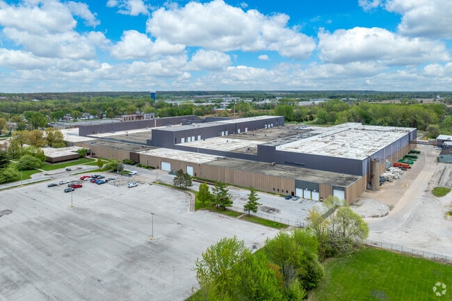
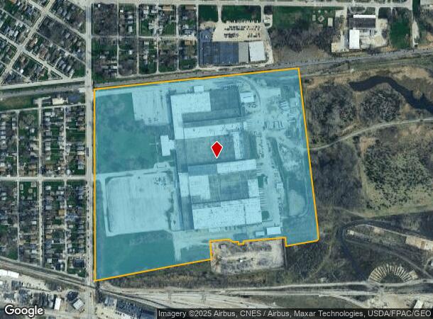
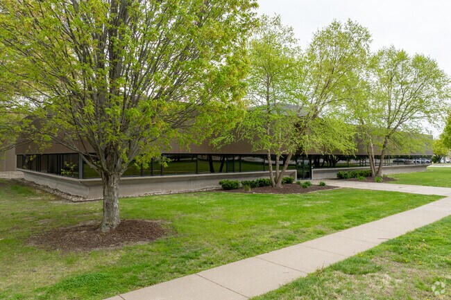
1300 19Th St, East Moline, IL 61244
NEARBY LISTINGS FOR SALE OR LEASE
Property Detail
1300 19Th St
09-30-400-006
SUPVR ASST MAP LOT 409 SHEET 63
Industrialgeneral
Rock Island
X
Illinois
19163C0395F
409
2024
61.10 AC
2024
Outlying Rock Island Cnty
020302
Davenport/Moline/Rock Island
720,645 SF
Davenport-Moline-Rock Island, IA-IL
DEMOGRAPHICS near 1300 19Th St
1 Mile
3 Mile
5 Mile
2024 Total Population
6,411
37,126
93,329
2029 Population
6,319
36,239
91,713
Pop Growth 2024-2029
(1.44%)
(2.39%)
(1.73%)
Average Age
39
41
41
2024 Total Households
2,594
15,432
39,016
HH Growth 2024-2029
(1.50%)
(2.48%)
(1.81%)
Median Household Inc
$46,973
$57,676
$65,647
Avg Household Size
2.40
2.30
2.30
2024 Avg HH Vehicles
2.00
2.00
2.00
Median Home Value
$107,183
$140,618
$170,363
Median Year Built
1954
1965
1968
Nearby Places
Map Layers
Map Styles
 Street
 Aerial
- Restaurants
- Banks
- Shops
- Fitness
- Groceries
PUBLIC TRANSPORTATION
AIRPORT
Quad Cities International
DRIVE
WALK
Distance
Quad Cities International
18 min
9.7 mi
SALE & LEASE HISTORY
LISTING DATE
SALE/LEASE

Sep 25, 2016
For Lease
Nearby Properties
Address
Land Use
TOTAL SIZE
Lot Size
Zoning
Address
Land Use
TOTAL SIZE
Lot Size
Zoning
9,000 SF
408.98 AC
Address
Land Use
TOTAL SIZE
Lot Size
Zoning
333.38 AC
B3
Address
Land Use
TOTAL SIZE
Lot Size
Zoning
250,504 SF
25.67 AC
Address
Land Use
TOTAL SIZE
Lot Size
Zoning
3,384,969 SF
128 AC
EM
Address
Land Use
TOTAL SIZE
Lot Size
Zoning
122,298 SF
65.13 AC
EM
Address
Land Use
TOTAL SIZE
Lot Size
Zoning
164,260 SF
13.81 AC
Address
Land Use
TOTAL SIZE
Lot Size
Zoning
197,382 SF
14.06 AC
EM
Address
Land Use
TOTAL SIZE
Lot Size
Zoning
75,000 SF
4.93 AC
Address
Land Use
TOTAL SIZE
Lot Size
Zoning
13,200 SF
15.82 AC
Address
Land Use
TOTAL SIZE
Lot Size
Zoning
112,000 SF
16.50 AC
EM
Address
Land Use
TOTAL SIZE
Lot Size
Zoning
3,360 SF
35.63 AC
Address
Land Use
TOTAL SIZE
Lot Size
Zoning
166,102 SF
4.36 AC
SIL
Address
Land Use
TOTAL SIZE
Lot Size
Zoning
138,436 SF
3.74 AC
Address
Land Use
TOTAL SIZE
Lot Size
Zoning
333,348 SF
30.81 AC
EM
Address
Land Use
TOTAL SIZE
Lot Size
Zoning
600 SF
25.17 AC
Address
Land Use
TOTAL SIZE
Lot Size
Zoning
196,305 SF
24.75 AC
SIL
Address
Land Use
TOTAL SIZE
Lot Size
Zoning
80,000 SF
5.47 AC
Address
Land Use
TOTAL SIZE
Lot Size
Zoning
50,000 SF
2.04 AC
Address
Land Use
TOTAL SIZE
Lot Size
Zoning
253.10 AC
SIL
Address
Land Use
TOTAL SIZE
Lot Size
Zoning
60,400 SF
4.29 AC
Address
Land Use
TOTAL SIZE
Lot Size
Zoning
Address
Land Use
TOTAL SIZE
Lot Size
Zoning
25,260 SF
10.20 AC
Address
Land Use
TOTAL SIZE
Lot Size
Zoning
6,820 SF
6.96 AC
Address
Land Use
TOTAL SIZE
Lot Size
Zoning
46,917 SF
4.57 AC
SIL
Address
Land Use
TOTAL SIZE
Lot Size
Zoning
18.46 AC
EM
Address
Land Use
TOTAL SIZE
Lot Size
Zoning
103,360 SF
14.66 AC
EM
Address
Land Use
TOTAL SIZE
Lot Size
Zoning
45,000 SF
2.52 AC
SIL
Address
Land Use
TOTAL SIZE
Lot Size
Zoning
73,981 SF
6.10 AC
Address
Land Use
TOTAL SIZE
Lot Size
Zoning
134,142 SF
13.31 AC
EM
The World's #1 Commercial Real Estate Marketplace
Connect with us
© 2025 CoStar Group
The information above has been obtained from sources believed reliable. While we do not doubt its accuracy we have not verified it and make no guarantee, warranty or representation about it. It is your responsibility to independently confirm its accuracy and completeness. Any projections, opinions, assumptions, or estimates used are for example only and do not represent the current or future performance of the property. The value of this transaction to you depends on tax and other factors which should be evaluated by your tax, financial, and legal advisors. You and your advisors should conduct a careful, independent investigation of the property to determine to your satisfaction the suitability of the property for your needs.