Property Record
1300 Allendale Rd, West Palm Beach, FL 33405


NEARBY LISTINGS FOR SALE OR LEASE
Property Detail
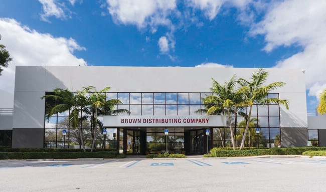
1300 Allendale Rd
74-43-43-33-16-000-2060
Mackle Park First Addition
Warehouse
MACKLE PARK FIRST ADDITION TR B & 33-43-43~ NW 1/4 LYG N OF & ADJ TO TR B OF PB23P91~ S OF &
AE
Palm Beach
12099C0587F
Florida
2024
7.39 AC
2025
DtwnPB to Tri-RailSta
003300
South Florida
118,135 SF
West Palm Beach-Boca Raton-Delray Beach, FL
DEMOGRAPHICS near 1300 Allendale Rd
1 Mile
3 Mile
5 Mile
2024 Total Population
9,163
87,444
278,720
2029 Population
9,542
90,943
289,582
Pop Growth 2024-2029
+ 4.14%
+ 4.00%
+ 3.90%
Average Age
38
40
40
2024 Total Households
3,222
34,978
109,937
HH Growth 2024-2029
+ 3.54%
+ 3.80%
+ 3.81%
Median Household Inc
$59,048
$64,239
$55,400
Avg Household Size
2.60
2.30
2.40
2024 Avg HH Vehicles
2.00
2.00
2.00
Median Home Value
$334,226
$375,920
$271,241
Median Year Built
1957
1979
1979
Nearby Places
Map Layers
Map Styles
 Street
 Aerial
- Restaurants
- Banks
- Shops
- Fitness
- Groceries
PUBLIC TRANSPORTATION
COMMUTER RAIL
West Palm Beach (Tri-County Commuter - South Florida Regional Transportation Authority (Tri-Rail))
DRIVE
WALK
Distance
West Palm Beach (Tri-County Commuter - South Florida Regional Transportation Authority (Tri-Rail))
6 min
2.3 mi
West Palm Beach (Mainline - Brightline)
DRIVE
WALK
Distance
West Palm Beach (Mainline - Brightline)
7 min
2.6 mi
AIRPORT
Palm Beach International
DRIVE
WALK
Distance
Palm Beach International
7 min
2.8 mi
Freight Ports
Port of Palm Beach
DRIVE
WALK
Distance
Port of Palm Beach
16 min
7.3 mi
SALE & LEASE HISTORY
LISTING DATE
SALE/LEASE

Nov 02, 2022
For Sale
Jun 27, 2022
For Sale
Dec 30, 2022
For Sale
Dec 30, 2022
For Lease
Nearby Properties
Address
Land Use
TOTAL SIZE
Lot Size
Zoning
Address
Land Use
TOTAL SIZE
Lot Size
Zoning
3,150,355 SF
616.71 AC
PO
Address
Land Use
TOTAL SIZE
Lot Size
Zoning
692,389 SF
10.70 AC
PUD-A
Address
Land Use
TOTAL SIZE
Lot Size
Zoning
9,111 SF
11.13 AC
R-AA
Address
Land Use
TOTAL SIZE
Lot Size
Zoning
305,838 SF
1.44 AC
QBD-8
Address
Land Use
TOTAL SIZE
Lot Size
Zoning
492,288 SF
58.55 AC
CPD
Address
Land Use
TOTAL SIZE
Lot Size
Zoning
656,724 SF
4.94 AC
DPD
Address
Land Use
TOTAL SIZE
Lot Size
Zoning
981,713 SF
77.89 AC
PO
Address
Land Use
TOTAL SIZE
Lot Size
Zoning
9,688 SF
8.20 AC
R-AA
Address
Land Use
TOTAL SIZE
Lot Size
Zoning
441,083 SF
425.95 AC
PO
Address
Land Use
TOTAL SIZE
Lot Size
Zoning
1,111,012 SF
19.48 AC
CPD
Address
Land Use
TOTAL SIZE
Lot Size
Zoning
484,252 SF
1.79 AC
CPD
Address
Land Use
TOTAL SIZE
Lot Size
Zoning
306,027 SF
1.25 AC
CPD
Address
Land Use
TOTAL SIZE
Lot Size
Zoning
128,779 SF
2.04 AC
C-WA
Address
Land Use
TOTAL SIZE
Lot Size
Zoning
596,079 SF
21.49 AC
RPD
Address
Land Use
TOTAL SIZE
Lot Size
Zoning
636,174 SF
1.39 AC
CLD-25
Address
Land Use
TOTAL SIZE
Lot Size
Zoning
460,394 SF
2.31 AC
DPD
Address
Land Use
TOTAL SIZE
Lot Size
Zoning
376,628 SF
1.22 AC
QBD-8
Address
Land Use
TOTAL SIZE
Lot Size
Zoning
363,411 SF
2.84 AC
CWD-10
Address
Land Use
TOTAL SIZE
Lot Size
Zoning
334,422 SF
2.60 AC
QGD-10
Address
Land Use
TOTAL SIZE
Lot Size
Zoning
226,711 SF
0.92 AC
DPD
Address
Land Use
TOTAL SIZE
Lot Size
Zoning
249,629 SF
2.09 AC
DPD
Address
Land Use
TOTAL SIZE
Lot Size
Zoning
303,776 SF
27.63 AC
CPD
Address
Land Use
TOTAL SIZE
Lot Size
Zoning
138,817 SF
1.90 AC
R-D(2)
Address
Land Use
TOTAL SIZE
Lot Size
Zoning
354,078 SF
9.36 AC
CPD
Address
Land Use
TOTAL SIZE
Lot Size
Zoning
311,142 SF
1.69 AC
FWD-5
Address
Land Use
TOTAL SIZE
Lot Size
Zoning
419,633 SF
5.13 AC
CPD
Address
Land Use
TOTAL SIZE
Lot Size
Zoning
492,002 SF
3.21 AC
FWD-5
Address
Land Use
TOTAL SIZE
Lot Size
Zoning
292,001 SF
1.15 AC
DPD
Address
Land Use
TOTAL SIZE
Lot Size
Zoning
434,580 SF
0.71 AC
QGD-10
Address
Land Use
TOTAL SIZE
Lot Size
Zoning
303,654 SF
6.93 AC
TOD-10
The World's #1 Commercial Real Estate Marketplace
Connect with us
© 2026 CoStar Group
The information above has been obtained from sources believed reliable. While we do not doubt its accuracy we have not verified it and make no guarantee, warranty or representation about it. It is your responsibility to independently confirm its accuracy and completeness. Any projections, opinions, assumptions, or estimates used are for example only and do not represent the current or future performance of the property. The value of this transaction to you depends on tax and other factors which should be evaluated by your tax, financial, and legal advisors. You and your advisors should conduct a careful, independent investigation of the property to determine to your satisfaction the suitability of the property for your needs.