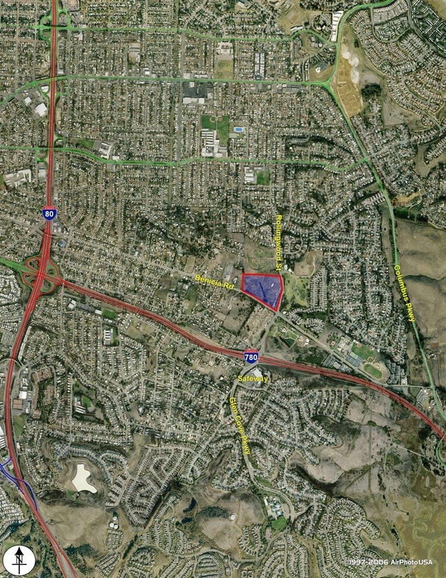
Property Record
1300 Benicia Rd, Vallejo, CA 94591

Current Lease Availabilities
Property Detail
1300 Benicia Rd
Vallejo, CA
BK-BG 00-00
0072-170-210
SOLANO
Commercialacreage
California
B and X Area of moderate flood hazard, usually the area between the limits of the 100-year and 500-year floods.
10.09 AC
2024
Benicia/Vallejo
2025
North Bay/Santa Rosa
250501
NEARBY LISTINGS FOR SALE OR LEASE
DEMOGRAPHICS near 1300 Benicia Rd
1 mile
3 mile
5 mile
2025 Total Population
16,122
100,671
159,215
2030 Population
16,217
101,353
160,259
Pop Growth 2025-2030
+ 0.59%
+ 0.68%
+ 0.66%
Average Age
42
42
42
2025 Total Households
5,570
36,740
57,286
HH Growth 2025-2030
+ 0.59%
+ 0.75%
+ 0.75%
Median Household Inc
$108,307
$94,957
$94,848
Avg Household Size
2.80
2.70
2.70
2025 Avg HH Vehicles
2.00
2.00
2.00
Median Home Value
$679,596
$693,549
$685,583
Median Year Built
1965
1973
1974
Nearby Places
Map Layers
Map Styles
 Street
 Aerial
Transit
 Traffic
 Biking
Places
Listings with unknown addresses are not visible on the map
- Restaurants
- Banks
- Shops
- Fitness
- Groceries
PUBLIC TRANSPORTATION
COMMUTER RAIL
Drive
Walk
Distance
13 min
9.6 mi
AIRPORT
Metro Oakland International
Drive
Walk
Distance
Metro Oakland International
47 min
35.6 mi
San Francisco International
Drive
Walk
Distance
San Francisco International
59 min
43.2 mi
Freight Ports
Port of Richmond
Drive
Walk
Distance
Port of Richmond
31 min
21.3 mi
Nearby Properties
Address
Land Use
TOTAL SIZE
Lot Size
Zoning
Address
Land Use
TOTAL SIZE
Lot Size
Zoning
1,053 SF
7.78 AC
HI
Address
Land Use
TOTAL SIZE
Lot Size
Zoning
197,656 SF
18.63 AC
Address
Land Use
TOTAL SIZE
Lot Size
Zoning
Address
Land Use
TOTAL SIZE
Lot Size
Zoning
266,792 SF
26.29 AC
Address
Land Use
TOTAL SIZE
Lot Size
Zoning
17.66 AC
Address
Land Use
TOTAL SIZE
Lot Size
Zoning
160,000 SF
13.67 AC
Address
Land Use
TOTAL SIZE
Lot Size
Zoning
43.81 AC
Address
Land Use
TOTAL SIZE
Lot Size
Zoning
7.86 AC
Address
Land Use
TOTAL SIZE
Lot Size
Zoning
128,544 SF
5.92 AC
Address
Land Use
TOTAL SIZE
Lot Size
Zoning
175,831 SF
8.63 AC
Address
Land Use
TOTAL SIZE
Lot Size
Zoning
200,888 SF
19.11 AC
MR25
Address
Land Use
TOTAL SIZE
Lot Size
Zoning
151,720 SF
8 AC
HDR
Address
Land Use
TOTAL SIZE
Lot Size
Zoning
73,819 SF
5.64 AC
Address
Land Use
TOTAL SIZE
Lot Size
Zoning
178,265 SF
10.87 AC
Address
Land Use
TOTAL SIZE
Lot Size
Zoning
266,792 SF
3.32 AC
Address
Land Use
TOTAL SIZE
Lot Size
Zoning
119,746 SF
0.64 AC
Address
Land Use
TOTAL SIZE
Lot Size
Zoning
83,768 SF
4.08 AC
Address
Land Use
TOTAL SIZE
Lot Size
Zoning
125,720 SF
11.72 AC
Address
Land Use
TOTAL SIZE
Lot Size
Zoning
140,712 SF
9.54 AC
Address
Land Use
TOTAL SIZE
Lot Size
Zoning
12.80 AC
Address
Land Use
TOTAL SIZE
Lot Size
Zoning
86,116 SF
4.64 AC
Address
Land Use
TOTAL SIZE
Lot Size
Zoning
82,058 SF
6.45 AC
Address
Land Use
TOTAL SIZE
Lot Size
Zoning
78,742 SF
0.67 AC
Address
Land Use
TOTAL SIZE
Lot Size
Zoning
113,152 SF
9.71 AC
Address
Land Use
TOTAL SIZE
Lot Size
Zoning
69,011 SF
3.67 AC
PUBLIC-PF
Address
Land Use
TOTAL SIZE
Lot Size
Zoning
65,856 SF
3.49 AC
Address
Land Use
TOTAL SIZE
Lot Size
Zoning
307,400 SF
5.52 AC
Address
Land Use
TOTAL SIZE
Lot Size
Zoning
29,773 SF
9.29 AC
Address
Land Use
TOTAL SIZE
Lot Size
Zoning
52,350 SF
3.88 AC
Address
Land Use
TOTAL SIZE
Lot Size
Zoning
26,881 SF
1.17 AC
The World's #1 Commercial Real Estate Marketplace
Connect with us
© 2026 CoStar Group
The information above has been obtained from sources believed reliable. While we do not doubt its accuracy we have not verified it and make no guarantee, warranty or representation about it. It is your responsibility to independently confirm its accuracy and completeness. Any projections, opinions, assumptions, or estimates used are for example only and do not represent the current or future performance of the property. The value of this transaction to you depends on tax and other factors which should be evaluated by your tax, financial, and legal advisors. You and your advisors should conduct a careful, independent investigation of the property to determine to your satisfaction the suitability of the property for your needs.