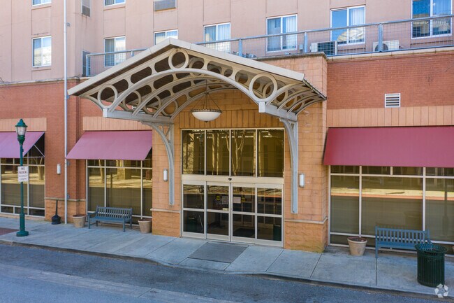
Property Record
1300 Carter St, Chattanooga, TN 37402


NEARBY LISTINGS FOR SALE OR LEASE
Property Detail
1300 Carter St
Chattanooga, TN-GA
Carter Fort & Whites
145F-E-001
LT 1 STAYBRIDGE SUB PB 68 PG 75 0100 13 11
Hotel
Hamilton
X
Tennessee
47065C0337G
1
2025
2.25 AC
2025
Chattanooga Downtown
003100
Chattanooga
8,020 SF
DEMOGRAPHICS near 1300 Carter St
1 Mile
3 Mile
5 Mile
2024 Total Population
13,068
55,885
123,259
2029 Population
14,424
60,788
132,557
Pop Growth 2024-2029
+ 10.38%
+ 8.77%
+ 7.54%
Average Age
36
37
38
2024 Total Households
6,866
24,392
52,895
HH Growth 2024-2029
+ 11.24%
+ 9.31%
+ 7.88%
Median Household Inc
$39,636
$47,787
$48,073
Avg Household Size
1.70
2.10
2.20
2024 Avg HH Vehicles
1.00
1.00
2.00
Median Home Value
$394,557
$304,011
$240,052
Median Year Built
2004
1976
1967
Nearby Places
Map Layers
Map Styles
 Street
 Aerial
- Restaurants
- Banks
- Shops
- Fitness
- Groceries
PUBLIC TRANSPORTATION
AIRPORT
Lovell Field
DRIVE
WALK
Distance
Lovell Field
19 min
10.1 mi
Freight Ports
Georgia Ports - Savannah
DRIVE
WALK
Distance
Georgia Ports - Savannah
409 min
365.3 mi
SALE & LEASE HISTORY
LISTING DATE
SALE/LEASE

Aug 02, 2019
For Lease
Nearby Properties
Address
Land Use
TOTAL SIZE
Lot Size
Zoning
Address
Land Use
TOTAL SIZE
Lot Size
Zoning
1,412,692 SF
1.74 AC
C3
Address
Land Use
TOTAL SIZE
Lot Size
Zoning
1,750,017 SF
31.32 AC
Address
Land Use
TOTAL SIZE
Lot Size
Zoning
603,035 SF
21.57 AC
C3
Address
Land Use
TOTAL SIZE
Lot Size
Zoning
728,901 SF
103.09 AC
Address
Land Use
TOTAL SIZE
Lot Size
Zoning
6.35 AC
Address
Land Use
TOTAL SIZE
Lot Size
Zoning
252,201 SF
1.60 AC
C3
Address
Land Use
TOTAL SIZE
Lot Size
Zoning
293,884 SF
4.40 AC
Address
Land Use
TOTAL SIZE
Lot Size
Zoning
192,000 SF
3.09 AC
R4
Address
Land Use
TOTAL SIZE
Lot Size
Zoning
409,451 SF
2.53 AC
C3
Address
Land Use
TOTAL SIZE
Lot Size
Zoning
298,706 SF
1.18 AC
Address
Land Use
TOTAL SIZE
Lot Size
Zoning
91,908 SF
2.64 AC
C3
Address
Land Use
TOTAL SIZE
Lot Size
Zoning
552,237 SF
1.87 AC
Address
Land Use
TOTAL SIZE
Lot Size
Zoning
170,000 SF
2.25 AC
C3
Address
Land Use
TOTAL SIZE
Lot Size
Zoning
182,932 SF
3.67 AC
M1
Address
Land Use
TOTAL SIZE
Lot Size
Zoning
134,974 SF
3.22 AC
Address
Land Use
TOTAL SIZE
Lot Size
Zoning
306,411 SF
6.96 AC
Address
Land Use
TOTAL SIZE
Lot Size
Zoning
19.38 AC
M1
Address
Land Use
TOTAL SIZE
Lot Size
Zoning
351,776 SF
17.70 AC
R4
Address
Land Use
TOTAL SIZE
Lot Size
Zoning
308,635 SF
2.24 AC
M1
Address
Land Use
TOTAL SIZE
Lot Size
Zoning
105,125 SF
3.38 AC
Address
Land Use
TOTAL SIZE
Lot Size
Zoning
275,364 SF
16.86 AC
C2
Address
Land Use
TOTAL SIZE
Lot Size
Zoning
357,029 SF
13.45 AC
C3
Address
Land Use
TOTAL SIZE
Lot Size
Zoning
293,516 SF
5.12 AC
M1
Address
Land Use
TOTAL SIZE
Lot Size
Zoning
194,019 SF
1.46 AC
C3
Address
Land Use
TOTAL SIZE
Lot Size
Zoning
288,371 SF
9.39 AC
Address
Land Use
TOTAL SIZE
Lot Size
Zoning
96,222 SF
0.57 AC
C3
Address
Land Use
TOTAL SIZE
Lot Size
Zoning
171,906 SF
2.10 AC
C2
Address
Land Use
TOTAL SIZE
Lot Size
Zoning
291,600 SF
1.32 AC
Address
Land Use
TOTAL SIZE
Lot Size
Zoning
175,260 SF
2.75 AC
C3
Address
Land Use
TOTAL SIZE
Lot Size
Zoning
75,697 SF
1.33 AC
The World's #1 Commercial Real Estate Marketplace
Connect with us
© 2026 CoStar Group
The information above has been obtained from sources believed reliable. While we do not doubt its accuracy we have not verified it and make no guarantee, warranty or representation about it. It is your responsibility to independently confirm its accuracy and completeness. Any projections, opinions, assumptions, or estimates used are for example only and do not represent the current or future performance of the property. The value of this transaction to you depends on tax and other factors which should be evaluated by your tax, financial, and legal advisors. You and your advisors should conduct a careful, independent investigation of the property to determine to your satisfaction the suitability of the property for your needs.