Property Record
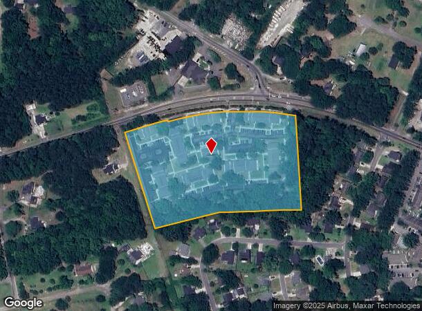
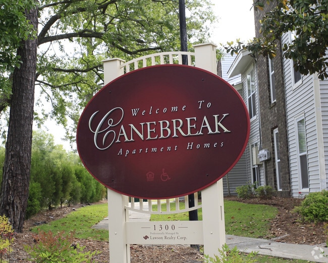
1300 Central Ave, Summerville, SC 29483


NEARBY LISTINGS FOR SALE OR LEASE
-
-
View all Summerville listings for sale on LoopNet.com
Property Detail
1300 Central Ave
136-00-00-118
Canebreak Apt
Officebuilding
SUBD: CANEBREAK APT PH 0
AE
Dorchester
45015C0565E
South Carolina
2025
8.30 AC
2025
Summerville
010607
Charleston/N Charleston
1,085 SF
Charleston-North Charleston, SC
DEMOGRAPHICS near 1300 Central Ave
1 Mile
3 Mile
5 Mile
2024 Total Population
7,924
48,781
100,324
2029 Population
8,671
53,118
109,789
Pop Growth 2024-2029
+ 9.43%
+ 8.89%
+ 9.43%
Average Age
39
39
39
2024 Total Households
2,992
18,040
37,629
HH Growth 2024-2029
+ 9.22%
+ 8.71%
+ 9.31%
Median Household Inc
$68,556
$71,808
$71,274
Avg Household Size
2.60
2.60
2.60
2024 Avg HH Vehicles
2.00
2.00
2.00
Median Home Value
$283,377
$281,468
$278,003
Median Year Built
1998
1997
2000
Nearby Places
Map Layers
Map Styles
 Street
 Aerial
- Restaurants
- Banks
- Shops
- Fitness
- Groceries
PUBLIC TRANSPORTATION
AIRPORT
Charleston AFB/International
DRIVE
WALK
Distance
Charleston AFB/International
25 min
16.3 mi
Freight Ports
North Charleston Terminal
DRIVE
WALK
Distance
North Charleston Terminal
31 min
19.6 mi
Nearby Properties
Address
Land Use
TOTAL SIZE
Lot Size
Zoning
Address
Land Use
TOTAL SIZE
Lot Size
Zoning
59.03 AC
PUD_SV
Address
Land Use
TOTAL SIZE
Lot Size
Zoning
212.62 AC
MUC_DC
Address
Land Use
TOTAL SIZE
Lot Size
Zoning
100.12 AC
MUC_DC
Address
Land Use
TOTAL SIZE
Lot Size
Zoning
2,772 SF
30.24 AC
I_DC
Address
Land Use
TOTAL SIZE
Lot Size
Zoning
621,920 SF
87.29 AC
I_DC
Address
Land Use
TOTAL SIZE
Lot Size
Zoning
528,320 SF
38.11 AC
I_DC
Address
Land Use
TOTAL SIZE
Lot Size
Zoning
31.05 AC
MUC_DC
Address
Land Use
TOTAL SIZE
Lot Size
Zoning
324,880 SF
50.65 AC
I_DC
Address
Land Use
TOTAL SIZE
Lot Size
Zoning
115,904 SF
6.42 AC
PUD_SV
Address
Land Use
TOTAL SIZE
Lot Size
Zoning
26,976 SF
16.22 AC
CG_DC
Address
Land Use
TOTAL SIZE
Lot Size
Zoning
231,400 SF
24.14 AC
I_DC
Address
Land Use
TOTAL SIZE
Lot Size
Zoning
80,465 SF
19.07 AC
I_DC
Address
Land Use
TOTAL SIZE
Lot Size
Zoning
51,900 SF
11.96 AC
G-B_SV
Address
Land Use
TOTAL SIZE
Lot Size
Zoning
161,548 SF
16.56 AC
I_DC
Address
Land Use
TOTAL SIZE
Lot Size
Zoning
121,500 SF
40.85 AC
I_DC
Address
Land Use
TOTAL SIZE
Lot Size
Zoning
154,880 SF
8.90 AC
MF-R_SV
Address
Land Use
TOTAL SIZE
Lot Size
Zoning
103,582 SF
11.02 AC
I_DC
Address
Land Use
TOTAL SIZE
Lot Size
Zoning
107,952 SF
8.30 AC
MF-R_SV
Address
Land Use
TOTAL SIZE
Lot Size
Zoning
128,000 SF
10.95 AC
I_DC
Address
Land Use
TOTAL SIZE
Lot Size
Zoning
62,777 SF
9.62 AC
CG_DC
Address
Land Use
TOTAL SIZE
Lot Size
Zoning
107,460 SF
13.76 AC
I_DC
Address
Land Use
TOTAL SIZE
Lot Size
Zoning
144,552 SF
55.27 AC
PL_SV
Address
Land Use
TOTAL SIZE
Lot Size
Zoning
281,313 SF
17.55 AC
I_DC
Address
Land Use
TOTAL SIZE
Lot Size
Zoning
4.15 AC
I_DC
Address
Land Use
TOTAL SIZE
Lot Size
Zoning
43,352 SF
7.14 AC
G-B_SV
Address
Land Use
TOTAL SIZE
Lot Size
Zoning
86,667 SF
11.92 AC
G-B_SV
Address
Land Use
TOTAL SIZE
Lot Size
Zoning
238.87 AC
I_DC
Address
Land Use
TOTAL SIZE
Lot Size
Zoning
1,685 SF
6.61 AC
R-4_DC
Address
Land Use
TOTAL SIZE
Lot Size
Zoning
69,616 SF
7.49 AC
MF-R_SV
Address
Land Use
TOTAL SIZE
Lot Size
Zoning
0.98 AC
D-MX_SV
The World's #1 Commercial Real Estate Marketplace
Connect with us
© 2025 CoStar Group
The information above has been obtained from sources believed reliable. While we do not doubt its accuracy we have not verified it and make no guarantee, warranty or representation about it. It is your responsibility to independently confirm its accuracy and completeness. Any projections, opinions, assumptions, or estimates used are for example only and do not represent the current or future performance of the property. The value of this transaction to you depends on tax and other factors which should be evaluated by your tax, financial, and legal advisors. You and your advisors should conduct a careful, independent investigation of the property to determine to your satisfaction the suitability of the property for your needs.