Property Record
1300 E 29Th St, Wilmington, DE 19802
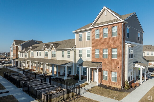
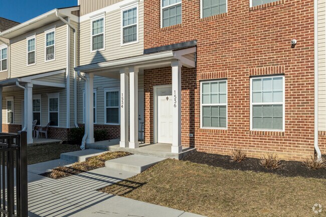
Property Detail
1300 E 29Th St
26-030.00-076
NEW CASTLE
Apartment
Delaware
26R-5A
b1
B and X Area of moderate flood hazard, usually the area between the limits of the 100-year and 500-year floods.
1.78 AC
0
Upper New Castle County
2025
Philadelphia
003002
Philadelphia-Camden-Wilmington, PA-NJ-DE-MD
31,536 SF
NEARBY LISTINGS FOR SALE OR LEASE
DEMOGRAPHICS near 1300 E 29Th St
1 mile
3 mile
5 mile
2025 Total Population
19,321
97,733
190,675
2030 Population
20,103
101,084
196,126
Pop Growth 2025-2030
+ 4.05%
+ 3.43%
+ 2.86%
Average Age
39
40
41
2025 Total Households
7,132
41,892
78,271
HH Growth 2025-2030
+ 4.21%
+ 3.53%
+ 2.99%
Median Household Inc
$53,746
$62,589
$73,766
Avg Household Size
2.40
2.20
2.30
2025 Avg HH Vehicles
1.00
1.00
2.00
Median Home Value
$153,527
$290,469
$305,134
Median Year Built
1951
1950
1955
Nearby Places
Map Layers
Map Styles
 Street
 Aerial
Layers
 Traffic
 Biking
Places
Listings with unknown addresses are not visible on the map
- Restaurants
- Banks
- Shops
- Fitness
- Groceries
PUBLIC TRANSPORTATION
COMMUTER RAIL
Wilmington (R2 - Southeastern Pennsylvania Transportation Authority Regional Rail (SEPTA Regional Rail))
Drive
Walk
Distance
Wilmington (R2 - Southeastern Pennsylvania Transportation Authority Regional Rail (SEPTA Regional Rail))
7 min
2.1 mi
Drive
Walk
Distance
13 min
7.2 mi
AIRPORT
Philadelphia International
Drive
Walk
Distance
Philadelphia International
30 min
19.7 mi
Freight Ports
Port of Wilmington, RI
Drive
Walk
Distance
Port of Wilmington, RI
11 min
4.1 mi
Nearby Properties
Address
Land Use
TOTAL SIZE
Lot Size
Zoning
Address
Land Use
TOTAL SIZE
Lot Size
Zoning
202,328 SF
10.98 AC
26R5-C
Address
Land Use
TOTAL SIZE
Lot Size
Zoning
1,924,803 SF
128.49 AC
OR
Address
Land Use
TOTAL SIZE
Lot Size
Zoning
696,387 SF
58.21 AC
OR
Address
Land Use
TOTAL SIZE
Lot Size
Zoning
14,810 SF
16.25 AC
26M-2
Address
Land Use
TOTAL SIZE
Lot Size
Zoning
7,840 SF
3.82 AC
26C-4
Address
Land Use
TOTAL SIZE
Lot Size
Zoning
20,000 SF
1.26 AC
26C-4
Address
Land Use
TOTAL SIZE
Lot Size
Zoning
593,288 SF
20.38 AC
OR
Address
Land Use
TOTAL SIZE
Lot Size
Zoning
679,619 SF
5.91 AC
26R-3
Address
Land Use
TOTAL SIZE
Lot Size
Zoning
410,310 SF
1.27 AC
26R-3
Address
Land Use
TOTAL SIZE
Lot Size
Zoning
160,931 SF
1.02 AC
26C-6
Address
Land Use
TOTAL SIZE
Lot Size
Zoning
2,864 SF
1.02 AC
26C-4
Address
Land Use
TOTAL SIZE
Lot Size
Zoning
8,025 SF
177.81 AC
26M-2
Address
Land Use
TOTAL SIZE
Lot Size
Zoning
371,733 SF
10.37 AC
OR
Address
Land Use
TOTAL SIZE
Lot Size
Zoning
406,158 SF
1.29 AC
26C-4
Address
Land Use
TOTAL SIZE
Lot Size
Zoning
105.88 AC
26M-2
Address
Land Use
TOTAL SIZE
Lot Size
Zoning
478,925 SF
59.10 AC
OR
Address
Land Use
TOTAL SIZE
Lot Size
Zoning
596,916 SF
5.97 AC
OR
Address
Land Use
TOTAL SIZE
Lot Size
Zoning
240,000 SF
0.79 AC
26R5-C
Address
Land Use
TOTAL SIZE
Lot Size
Zoning
43,918 SF
1.49 AC
26C-4
Address
Land Use
TOTAL SIZE
Lot Size
Zoning
332,844 SF
2.15 AC
26C-4
Address
Land Use
TOTAL SIZE
Lot Size
Zoning
258,984 SF
0.80 AC
26C-3
Address
Land Use
TOTAL SIZE
Lot Size
Zoning
38,140 SF
1.15 AC
26C-4
Address
Land Use
TOTAL SIZE
Lot Size
Zoning
27,330 SF
0.80 AC
26C-4
Address
Land Use
TOTAL SIZE
Lot Size
Zoning
43,325 SF
2.69 AC
26C-4
Address
Land Use
TOTAL SIZE
Lot Size
Zoning
12,500 SF
2.05 AC
26W4
Address
Land Use
TOTAL SIZE
Lot Size
Zoning
301,712 SF
0.92 AC
26C-4
Address
Land Use
TOTAL SIZE
Lot Size
Zoning
472,000 SF
1.05 AC
26C-4
Address
Land Use
TOTAL SIZE
Lot Size
Zoning
45,956 SF
1.05 AC
26C-4
Address
Land Use
TOTAL SIZE
Lot Size
Zoning
393,718 SF
42.16 AC
NCGA
Address
Land Use
TOTAL SIZE
Lot Size
Zoning
16,002 SF
16.91 AC
CR
The World's #1 Commercial Real Estate Marketplace
Connect with us
© 2026 CoStar Group
The information above has been obtained from sources believed reliable. While we do not doubt its accuracy we have not verified it and make no guarantee, warranty or representation about it. It is your responsibility to independently confirm its accuracy and completeness. Any projections, opinions, assumptions, or estimates used are for example only and do not represent the current or future performance of the property. The value of this transaction to you depends on tax and other factors which should be evaluated by your tax, financial, and legal advisors. You and your advisors should conduct a careful, independent investigation of the property to determine to your satisfaction the suitability of the property for your needs.