Property Record
1300 Sw Gould Dr, Gainesville, GA 30504

NEARBY LISTINGS FOR SALE OR LEASE
Property Detail
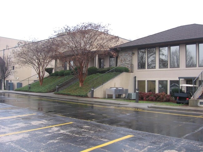
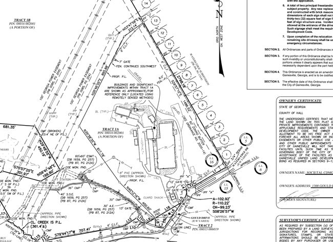
1300 Sw Gould Dr
08-00016-02-001
TRACT 1A @ 27.312 AC - 1300 GOULD DRIVE
Manufacturinglight
Hall
X
Georgia
13139C0170G
27.31 AC
2025
I-985/Gainesville
2025
Atlanta
001005
Gainesville, GA
67,718 SF
DEMOGRAPHICS near 1300 Sw Gould Dr
1 Mile
3 Mile
5 Mile
2024 Total Population
6,420
40,290
82,233
2029 Population
7,092
44,632
91,465
Pop Growth 2024-2029
+ 10.47%
+ 10.78%
+ 11.23%
Average Age
35
36
37
2024 Total Households
2,204
13,667
29,094
HH Growth 2024-2029
+ 10.39%
+ 10.77%
+ 11.23%
Median Household Inc
$46,264
$58,075
$57,852
Avg Household Size
2.80
2.80
2.70
2024 Avg HH Vehicles
2.00
2.00
2.00
Median Home Value
$275,823
$271,191
$274,151
Median Year Built
1993
1991
1990
Nearby Places
Map Layers
Map Styles
 Street
 Aerial
- Restaurants
- Banks
- Shops
- Fitness
- Groceries
PUBLIC TRANSPORTATION
COMMUTER RAIL
DRIVE
WALK
Distance
10 min
5.0 mi
Nearby Properties
Address
Land Use
TOTAL SIZE
Lot Size
Zoning
Address
Land Use
TOTAL SIZE
Lot Size
Zoning
66,720 SF
27.49 AC
PUD
Address
Land Use
TOTAL SIZE
Lot Size
Zoning
157,050 SF
144.96 AC
N-B
Address
Land Use
TOTAL SIZE
Lot Size
Zoning
27,221 SF
2.23 AC
G-B
Address
Land Use
TOTAL SIZE
Lot Size
Zoning
2,160 SF
5.60 AC
PUD
Address
Land Use
TOTAL SIZE
Lot Size
Zoning
760,440 SF
53.33 AC
L-I
Address
Land Use
TOTAL SIZE
Lot Size
Zoning
58,020 SF
3.15 AC
PUD
Address
Land Use
TOTAL SIZE
Lot Size
Zoning
3,620 SF
20.20 AC
PUD
Address
Land Use
TOTAL SIZE
Lot Size
Zoning
100,864 SF
4.10 AC
PUD
Address
Land Use
TOTAL SIZE
Lot Size
Zoning
41,471 SF
27.60 AC
G-B/R-1
Address
Land Use
TOTAL SIZE
Lot Size
Zoning
19,875 SF
19.76 AC
R-B
Address
Land Use
TOTAL SIZE
Lot Size
Zoning
277,684 SF
23.06 AC
L-I
Address
Land Use
TOTAL SIZE
Lot Size
Zoning
76,726 SF
0.42 AC
C-B
Address
Land Use
TOTAL SIZE
Lot Size
Zoning
132,557 SF
32.85 AC
O-I
Address
Land Use
TOTAL SIZE
Lot Size
Zoning
469,180 SF
25.56 AC
H-I
Address
Land Use
TOTAL SIZE
Lot Size
Zoning
11,430 SF
38 AC
R-I
Address
Land Use
TOTAL SIZE
Lot Size
Zoning
258,372 SF
24.38 AC
L-I
Address
Land Use
TOTAL SIZE
Lot Size
Zoning
308,672 SF
41.22 AC
L-I
Address
Land Use
TOTAL SIZE
Lot Size
Zoning
308,672 SF
41.22 AC
L-I
Address
Land Use
TOTAL SIZE
Lot Size
Zoning
1,191 SF
262.63 AC
H-I
Address
Land Use
TOTAL SIZE
Lot Size
Zoning
172,114 SF
43.32 AC
M-2
Address
Land Use
TOTAL SIZE
Lot Size
Zoning
1,441 SF
10.46 AC
PUD
Address
Land Use
TOTAL SIZE
Lot Size
Zoning
304,088 SF
17.45 AC
H-I
Address
Land Use
TOTAL SIZE
Lot Size
Zoning
123,944 SF
13.21 AC
G-B
Address
Land Use
TOTAL SIZE
Lot Size
Zoning
60,062 SF
0.51 AC
C-B
Address
Land Use
TOTAL SIZE
Lot Size
Zoning
67,383 SF
1.68 AC
C-B
Address
Land Use
TOTAL SIZE
Lot Size
Zoning
301,380 SF
16.76 AC
I-1
Address
Land Use
TOTAL SIZE
Lot Size
Zoning
231,966 SF
0.95 AC
C-B
Address
Land Use
TOTAL SIZE
Lot Size
Zoning
199,610 SF
14.66 AC
L-I
Address
Land Use
TOTAL SIZE
Lot Size
Zoning
12,200 SF
0.30 AC
C-B
Address
Land Use
TOTAL SIZE
Lot Size
Zoning
24,097 SF
1.85 AC
C-B
The World's #1 Commercial Real Estate Marketplace
Connect with us
© 2026 CoStar Group
The information above has been obtained from sources believed reliable. While we do not doubt its accuracy we have not verified it and make no guarantee, warranty or representation about it. It is your responsibility to independently confirm its accuracy and completeness. Any projections, opinions, assumptions, or estimates used are for example only and do not represent the current or future performance of the property. The value of this transaction to you depends on tax and other factors which should be evaluated by your tax, financial, and legal advisors. You and your advisors should conduct a careful, independent investigation of the property to determine to your satisfaction the suitability of the property for your needs.