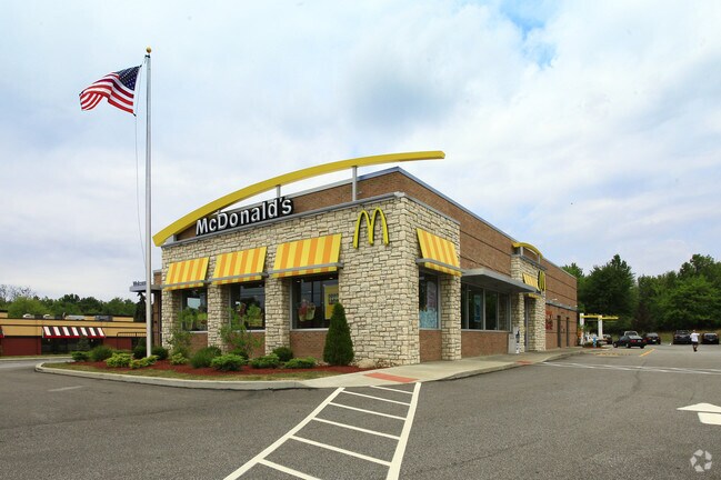
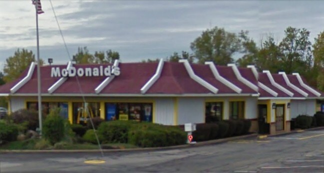
Property Record
1300 W Pleasant Valley Rd, Cleveland, OH 44134
NEARBY LISTINGS FOR SALE OR LEASE
Property Detail
1300 W Pleasant Valley Rd
Cleveland
Descript
Cleveland-Elyria, OH
Cuyahoga
452-34-008
Ohio
Restaurantdrivein
1.05 AC
4,614 SF
Southwest
DEMOGRAPHICS near 1300 W Pleasant Valley Rd
1 Mile
3 Mile
5 Mile
2024 Total Population
6,936
60,092
166,590
2029 Population
6,662
58,223
161,461
Pop Growth 2024-2029
(3.95%)
(3.11%)
(3.08%)
Average Age
48
44
43
2024 Total Households
3,003
25,015
71,524
HH Growth 2024-2029
(4.20%)
(3.31%)
(3.25%)
Median Household Inc
$77,184
$79,092
$69,391
Avg Household Size
2.20
2.30
2.30
2024 Avg HH Vehicles
2.00
2.00
2.00
Median Home Value
$182,759
$195,219
$176,033
Median Year Built
1966
1965
1961
Nearby Places
Map Layers
Map Styles
 Street
 Aerial
- Restaurants
- Banks
- Shops
- Fitness
- Groceries
PUBLIC TRANSPORTATION
COMMUTER RAIL
Canal Exploration Center (National Park Scenic Railway - Cuyahoga Valley Scenic Railroad)
DRIVE
WALK
Distance
Canal Exploration Center (National Park Scenic Railway - Cuyahoga Valley Scenic Railroad)
10 min
4.6 mi
Rockside (National Park Scenic Railway - Cuyahoga Valley Scenic Railroad)
DRIVE
WALK
Distance
Rockside (National Park Scenic Railway - Cuyahoga Valley Scenic Railroad)
13 min
6.3 mi
AIRPORT
Cleveland-Hopkins International
DRIVE
WALK
Distance
Cleveland-Hopkins International
27 min
12.8 mi
Freight Ports
Port of Toledo
DRIVE
WALK
Distance
Port of Toledo
141 min
111.4 mi
Nearby Properties
Address
Land Use
TOTAL SIZE
Lot Size
Zoning
Address
Land Use
TOTAL SIZE
Lot Size
Zoning
477,641 SF
14.07 AC
MF-1
Address
Land Use
TOTAL SIZE
Lot Size
Zoning
202,152 SF
21.04 AC
U-1
Address
Land Use
TOTAL SIZE
Lot Size
Zoning
436,164 SF
20.01 AC
U-5
Address
Land Use
TOTAL SIZE
Lot Size
Zoning
245,255 SF
14 AC
Address
Land Use
TOTAL SIZE
Lot Size
Zoning
307,703 SF
47.05 AC
U-5
Address
Land Use
TOTAL SIZE
Lot Size
Zoning
238,500 SF
20.31 AC
SC
Address
Land Use
TOTAL SIZE
Lot Size
Zoning
632,686 SF
16.44 AC
MF-3
Address
Land Use
TOTAL SIZE
Lot Size
Zoning
102,219 SF
14.01 AC
RB
Address
Land Use
TOTAL SIZE
Lot Size
Zoning
162,134 SF
12.24 AC
CG
Address
Land Use
TOTAL SIZE
Lot Size
Zoning
281,600 SF
18.73 AC
SF-A
Address
Land Use
TOTAL SIZE
Lot Size
Zoning
168,322 SF
14.44 AC
Address
Land Use
TOTAL SIZE
Lot Size
Zoning
440,765 SF
44.35 AC
2F
Address
Land Use
TOTAL SIZE
Lot Size
Zoning
28,189 SF
15.33 AC
B-1OR2
Address
Land Use
TOTAL SIZE
Lot Size
Zoning
245,255 SF
13.34 AC
Address
Land Use
TOTAL SIZE
Lot Size
Zoning
83,375 SF
9.29 AC
MF-1
Address
Land Use
TOTAL SIZE
Lot Size
Zoning
162,134 SF
13.35 AC
CG
Address
Land Use
TOTAL SIZE
Lot Size
Zoning
124,224 SF
25.99 AC
U-1
Address
Land Use
TOTAL SIZE
Lot Size
Zoning
258,669 SF
12.80 AC
U-5
Address
Land Use
TOTAL SIZE
Lot Size
Zoning
114,101 SF
4.40 AC
SF-AA
Address
Land Use
TOTAL SIZE
Lot Size
Zoning
238,500 SF
20.89 AC
SC
Address
Land Use
TOTAL SIZE
Lot Size
Zoning
56,002 SF
6.76 AC
U-5
Address
Land Use
TOTAL SIZE
Lot Size
Zoning
180,095 SF
26.26 AC
SF-AA
Address
Land Use
TOTAL SIZE
Lot Size
Zoning
126,224 SF
5.31 AC
RB
Address
Land Use
TOTAL SIZE
Lot Size
Zoning
99,916 SF
4.72 AC
U-3
Address
Land Use
TOTAL SIZE
Lot Size
Zoning
100,047 SF
5.34 AC
SF-A
Address
Land Use
TOTAL SIZE
Lot Size
Zoning
92,553 SF
11.61 AC
CB
Address
Land Use
TOTAL SIZE
Lot Size
Zoning
251,780 SF
5.54 AC
U-5
Address
Land Use
TOTAL SIZE
Lot Size
Zoning
98,905 SF
12.92 AC
RB
Address
Land Use
TOTAL SIZE
Lot Size
Zoning
128,782 SF
9.98 AC
RB
Address
Land Use
TOTAL SIZE
Lot Size
Zoning
72,957 SF
11.48 AC
1F-3
The World's #1 Commercial Real Estate Marketplace
Connect with us
© 2025 CoStar Group
The information above has been obtained from sources believed reliable. While we do not doubt its accuracy we have not verified it and make no guarantee, warranty or representation about it. It is your responsibility to independently confirm its accuracy and completeness. Any projections, opinions, assumptions, or estimates used are for example only and do not represent the current or future performance of the property. The value of this transaction to you depends on tax and other factors which should be evaluated by your tax, financial, and legal advisors. You and your advisors should conduct a careful, independent investigation of the property to determine to your satisfaction the suitability of the property for your needs.