Property Record
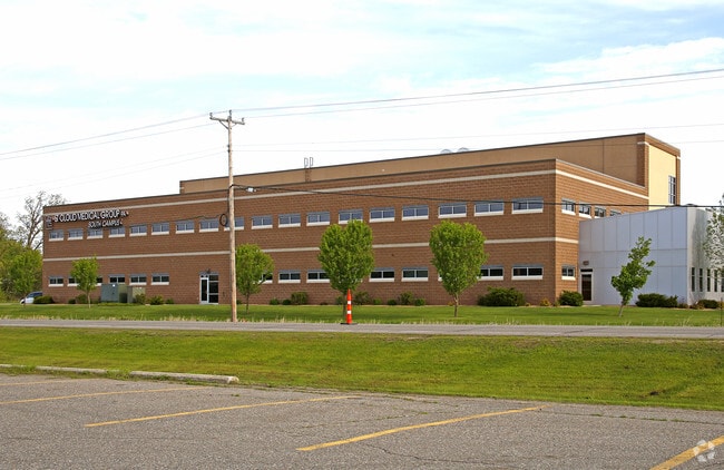
1301 33Rd St S, Saint Cloud, MN 56301


Property Detail
1301 33Rd St S
82.51256.0200
LOT 001 BLK 001 SUNCREST PARK PLAT 4 SECTION 26 TOWNSHIP 124 RANGE 028 SECTION 26 TOWNSHIP 124 RANGE 028
Multifamilydwelling
Stearns
I1
Minnesota
B and X Area of moderate flood hazard, usually the area between the limits of the 100-year and 500-year floods.
1
2026
4.60 AC
2025
Stearns County
000402
Minneapolis/St Paul
55,736 SF
St. Cloud, MN
NEARBY LISTINGS FOR SALE OR LEASE
DEMOGRAPHICS near 1301 33Rd St S
1 mile
3 mile
5 mile
2025 Total Population
4,553
39,164
79,829
2030 Population
4,724
40,772
82,785
Pop Growth 2025-2030
+ 3.76%
+ 4.11%
+ 3.70%
Average Age
40
35
37
2025 Total Households
1,785
14,275
31,630
HH Growth 2025-2030
+ 3.75%
+ 4.28%
+ 3.75%
Median Household Inc
$97,398
$65,825
$61,159
Avg Household Size
2.50
2.40
2.30
2025 Avg HH Vehicles
2.00
2.00
2.00
Median Home Value
$323,875
$271,741
$233,517
Median Year Built
1995
1985
1980
Nearby Places
Map Layers
Map Styles
 Street
 Aerial
Layers
 Traffic
 Biking
Places
Listings with unknown addresses are not visible on the map
- Restaurants
- Banks
- Shops
- Fitness
- Groceries
PUBLIC TRANSPORTATION
COMMUTER RAIL
Drive
Walk
Distance
11 min
4.8 mi
SALE & LEASE HISTORY
LISTING DATE
SALE/LEASE

Apr 19, 2017
For Lease
Nearby Properties
Address
Land Use
TOTAL SIZE
Lot Size
Zoning
Address
Land Use
TOTAL SIZE
Lot Size
Zoning
307,404 SF
105.31 AC
Address
Land Use
TOTAL SIZE
Lot Size
Zoning
154.73 AC
I
Address
Land Use
TOTAL SIZE
Lot Size
Zoning
105,833 SF
4.61 AC
C4
Address
Land Use
TOTAL SIZE
Lot Size
Zoning
238,920 SF
5.40 AC
R3
Address
Land Use
TOTAL SIZE
Lot Size
Zoning
281,127 SF
3.10 AC
PUD95
Address
Land Use
TOTAL SIZE
Lot Size
Zoning
278,850 SF
20.83 AC
Address
Land Use
TOTAL SIZE
Lot Size
Zoning
15.77 AC
Address
Land Use
TOTAL SIZE
Lot Size
Zoning
177,951 SF
8.26 AC
R3
Address
Land Use
TOTAL SIZE
Lot Size
Zoning
152,055 SF
2.33 AC
R3
Address
Land Use
TOTAL SIZE
Lot Size
Zoning
165,758 SF
3 AC
R3
Address
Land Use
TOTAL SIZE
Lot Size
Zoning
115,298 SF
8.50 AC
R5
Address
Land Use
TOTAL SIZE
Lot Size
Zoning
233,354 SF
7.30 AC
R5
Address
Land Use
TOTAL SIZE
Lot Size
Zoning
158,809 SF
2.67 AC
R3
Address
Land Use
TOTAL SIZE
Lot Size
Zoning
19.83 AC
Address
Land Use
TOTAL SIZE
Lot Size
Zoning
24.47 AC
Address
Land Use
TOTAL SIZE
Lot Size
Zoning
Address
Land Use
TOTAL SIZE
Lot Size
Zoning
183,627 SF
3 AC
R3
Address
Land Use
TOTAL SIZE
Lot Size
Zoning
0.28 AC
I2
Address
Land Use
TOTAL SIZE
Lot Size
Zoning
72,200 SF
3 AC
R3
Address
Land Use
TOTAL SIZE
Lot Size
Zoning
112,300 SF
2.27 AC
R3
Address
Land Use
TOTAL SIZE
Lot Size
Zoning
165,878 SF
11.17 AC
PUD56
Address
Land Use
TOTAL SIZE
Lot Size
Zoning
Address
Land Use
TOTAL SIZE
Lot Size
Zoning
158,758 SF
18.58 AC
C5
Address
Land Use
TOTAL SIZE
Lot Size
Zoning
157,351 SF
14.16 AC
C5
Address
Land Use
TOTAL SIZE
Lot Size
Zoning
32,074 SF
7.20 AC
PUD50
Address
Land Use
TOTAL SIZE
Lot Size
Zoning
90,427 SF
9.40 AC
Address
Land Use
TOTAL SIZE
Lot Size
Zoning
13.37 AC
Address
Land Use
TOTAL SIZE
Lot Size
Zoning
136,500 SF
6.02 AC
R5
Address
Land Use
TOTAL SIZE
Lot Size
Zoning
109,352 SF
77.47 AC
R1
Address
Land Use
TOTAL SIZE
Lot Size
Zoning
121,968 SF
6.49 AC
PUD84
The World's #1 Commercial Real Estate Marketplace
Connect with us
© 2026 CoStar Group
The information above has been obtained from sources believed reliable. While we do not doubt its accuracy we have not verified it and make no guarantee, warranty or representation about it. It is your responsibility to independently confirm its accuracy and completeness. Any projections, opinions, assumptions, or estimates used are for example only and do not represent the current or future performance of the property. The value of this transaction to you depends on tax and other factors which should be evaluated by your tax, financial, and legal advisors. You and your advisors should conduct a careful, independent investigation of the property to determine to your satisfaction the suitability of the property for your needs.